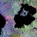
Category:Satellite pictures of Taal Volcano
Jump to navigation
Jump to search
Media in category "Satellite pictures of Taal Volcano"
The following 12 files are in this category, out of 12 total.
-
Lac Taal.png 807 × 743; 1.34 MB
-
Lake Taal Philippines.gif 450 × 900; 359 KB
-
Smoke and Vog from Taal Volcano (MODIS 2022-04-02).jpg 2,501 × 2,058; 492 KB
-
STS045-152-274 Manila and Taal Volcano.jpg 4,457 × 5,572; 4.51 MB
-
Taal Before 2020 Eruption.jpeg 2,069 × 2,069; 1.18 MB
-
Taal Continues to Rumble (MODIS 2024-03-07).jpg 3,488 × 2,699; 1.02 MB
-
Taal Main Crater Lake satellite image.gif 134 × 141; 9 KB
-
Taal Volcano in the Philippines (Copernicus).jpg 4,000 × 2,540; 6.19 MB
-
Taal Volcano satellite image.gif 450 × 472; 214 KB
-
Taal Volcano-Pansipit River satellite image.gif 252 × 252; 54 KB
-
Taal, Philippines (2023-11-09-13-01-30 UMBRA-05).tiff 18,757 × 29,227, 7 pages; 726.05 MB
-
Taal, Philippines (2023-11-11-01-53-24 UMBRA-04).tiff 23,431 × 32,309, 7 pages; 984.31 MB


