File:Svatobor COSK 1842 Sauerbrun.jpg
Jump to navigation
Jump to search
Size of this preview: 800 × 467 pixels. Other resolutions: 320 × 187 pixels | 640 × 374 pixels | 1,024 × 598 pixels | 1,280 × 748 pixels | 2,543 × 1,486 pixels.
Original file (2,543 × 1,486 pixels, file size: 759 KB, MIME type: image/jpeg)
Captions
Captions
Add a one-line explanation of what this file represents
Summary
[edit]
| Description |
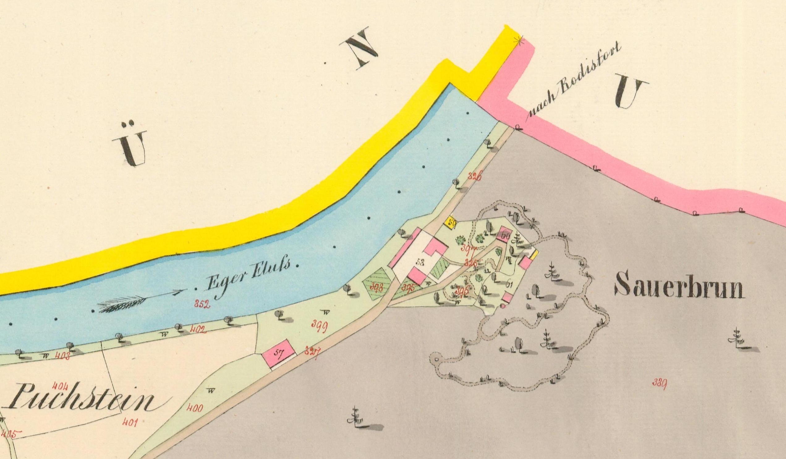
Čeština: Sauerbrun, katastrální území Svatobor u Hradiště - dříve Zwetbau, Císařské povinné otisky stabilního katastru 1 : 2 880 - Čechy, mapový list 7592-1. Prostor, kde byla později postaven Ottův pavilon. Dnes toto území patří do katastrálního území Kyselka. |
| Date | |
| Source | Ústřední archiv zeměměřictví a katastru |
| Author | Anonymous |

|
This file was created on the basis of data provided by the Central Archives of Surveying and Land Register (State Administration of Land Surveying and Cadastre).
|
Licensing
[edit]
This image (or other media file) is in the public domain because its copyright has expired and its author is anonymous.
This applies to the European Union and those countries with a copyright term of 70 years after the work was made available to the public and the author never disclosed their identity. Important: Always mention where the image comes from, as far as possible, and make sure the author never claimed authorship. Note: In Germany and possibly other countries, certain anonymous works published before July 1, 1995 are copyrighted until 70 years after the death of the author. See Übergangsrecht. Please use this template only if the author never claimed authorship or their authorship never became public in any other way. If the work is anonymous or pseudonymous (e.g., published only under a corporate or organization's name), use this template for images published more than 70 years ago.
For a work made available to the public in the United Kingdom, please use Template:PD-UK-unknown instead.
|
File history
Click on a date/time to view the file as it appeared at that time.
| Date/Time | Thumbnail | Dimensions | User | Comment | |
|---|---|---|---|---|---|
| current | 10:45, 19 April 2021 | | 2,543 × 1,486 (759 KB) | Gampe (talk | contribs) | Uploaded a work by {{Anonymous}} from [https://ags.cuzk.cz/archiv/ Ústřední archiv zeměměřictví a katastru] with UploadWizard |
You cannot overwrite this file.
File usage on Commons
There are no pages that use this file.
File usage on other wikis
The following other wikis use this file:
- Usage on cs.wikipedia.org