File:Sumpfwald am Hellsee im Biesenthaler Becken 69247365.tif
Jump to navigation
Jump to search

Size of this JPG preview of this TIF file: 800 × 534 pixels. Other resolutions: 320 × 214 pixels | 640 × 427 pixels | 1,024 × 684 pixels | 1,280 × 855 pixels | 2,560 × 1,710 pixels | 4,011 × 2,679 pixels.
Original file (4,011 × 2,679 pixels, file size: 30.78 MB, MIME type: image/tiff)
Captions
Captions
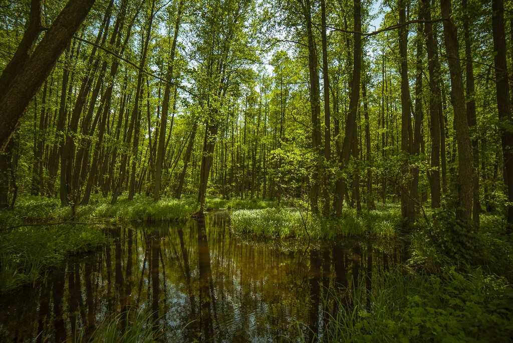
Marsh forest at Hellsee in the Biesenthaler Becken nature reserve from 19 May 2019
Summary
[edit]| Description |
Deutsch: Das Foto zeigt einen sumpfigen Wald am Hellsee im Naturschutzgebiet Biesenthaler Becken WDPA ID 162411 . Das Gebiet ist Teil des Naturparks Barnim und umfasst eine glazial geprägte Landschaft, erkennbar an der Hügellandschaft mit Kames und Zungenbeckenseen. Das Bild wurde am 19. Mai 2019 aufgenommen.
English: The photo shows a swampy forest at the Hellsee in the nature reserve Biesenthaler Becken. The area is part of the Barnim Nature Park and comprises a glacial landscape, recognisable by the hilly landscape with kames and tongue-shaped basins. The picture was taken on 19 May 2019.
|
||
| Date | Taken on 19 May 2019 | ||
| Source | Own work | ||
| Author | fba.accountants |
| Camera location | | View this and other nearby images on: OpenStreetMap |
|---|
Picture was taken bei Thomas Hück on a company retreat of FBA.ACCOUNTANTS
Licensing
[edit]I, the copyright holder of this work, hereby publish it under the following license:
This file is licensed under the Creative Commons Attribution-Share Alike 4.0 International license.
- You are free:
- to share – to copy, distribute and transmit the work
- to remix – to adapt the work
- Under the following conditions:
- attribution – You must give appropriate credit, provide a link to the license, and indicate if changes were made. You may do so in any reasonable manner, but not in any way that suggests the licensor endorses you or your use.
- share alike – If you remix, transform, or build upon the material, you must distribute your contributions under the same or compatible license as the original.
This image was uploaded as part of Wiki Loves Earth 2019.
|
 |
File history
Click on a date/time to view the file as it appeared at that time.
| Date/Time | Thumbnail | Dimensions | User | Comment | |
|---|---|---|---|---|---|
| current | 19:25, 27 May 2019 |  | 4,011 × 2,679 (30.78 MB) | Thomas.hueck (talk | contribs) | User created page with UploadWizard |
You cannot overwrite this file.
File usage on Commons
The following page uses this file: