File:Sulci Gordii topography ESA290801.tiff
Jump to navigation
Jump to search

Size of this JPG preview of this TIF file: 800 × 358 pixels. Other resolutions: 320 × 143 pixels | 640 × 286 pixels | 1,024 × 458 pixels | 1,280 × 572 pixels | 4,000 × 1,788 pixels.
Original file (4,000 × 1,788 pixels, file size: 16.65 MB, MIME type: image/tiff)
Captions
Captions
Add a one-line explanation of what this file represents
Summary
[edit]| Description |
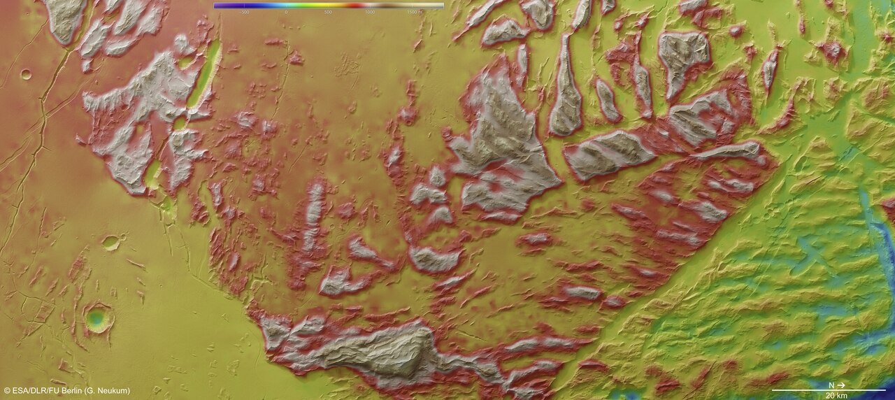
English: This colour-coded overhead view is based on an ESA’s Mars Express High Resolution Stereo Camera digital terrain model of the Sulci Gordii region of Mars, which lies about 200 km east of Olympus Mons. Sulci Gordii was imaged on 23 January 2013 (orbit 11531), with a ground resolution of approximately 31 m per pixel. |
| Date | |
| Source | http://www.esa.int/spaceinimages/Images/2013/05/Sulci_Gordii_topography |
| Author | European Space Agency |
| Permission (Reusing this file) |
ESA/DLR/FU Berlin (G. Neukum),CC BY-SA 3.0 IGO |
| Other versions |
|
| Title | Sulci Gordii topography |
| Mission | Mars Express |
| Activity | Space Science |

Licensing
[edit]This file is licensed under the Creative Commons Attribution-ShareAlike 3.0 IGO license.
Attribution: ESA/DLR/FU Berlin (G. Neukum)
- You are free:
- to share – to copy, distribute and transmit the work
- to remix – to adapt the work
- Under the following conditions:
- attribution – You must give appropriate credit, provide a link to the license, and indicate if changes were made. You may do so in any reasonable manner, but not in any way that suggests the licensor endorses you or your use.
- share alike – If you remix, transform, or build upon the material, you must distribute your contributions under the same or compatible license as the original.
File history
Click on a date/time to view the file as it appeared at that time.
| Date/Time | Thumbnail | Dimensions | User | Comment | |
|---|---|---|---|---|---|
| current | 10:30, 24 May 2017 |  | 4,000 × 1,788 (16.65 MB) | Fæ (talk | contribs) | European Space Agency, Id 290801, http://www.esa.int/spaceinimages/Images/2013/05/Sulci_Gordii_topography, User:Fæ/Project_list/ESA |
You cannot overwrite this file.
File usage on Commons
The following page uses this file: