File:Stone circles on the northern bank of Lethe Vallis.png
Jump to navigation
Jump to search
Size of this preview: 600 × 600 pixels. Other resolutions: 240 × 240 pixels | 480 × 480 pixels | 768 × 768 pixels | 1,024 × 1,024 pixels | 1,700 × 1,700 pixels.
Original file (1,700 × 1,700 pixels, file size: 2.03 MB, MIME type: image/png)
Captions
Captions
Add a one-line explanation of what this file represents
Summary
[edit]
| Description |
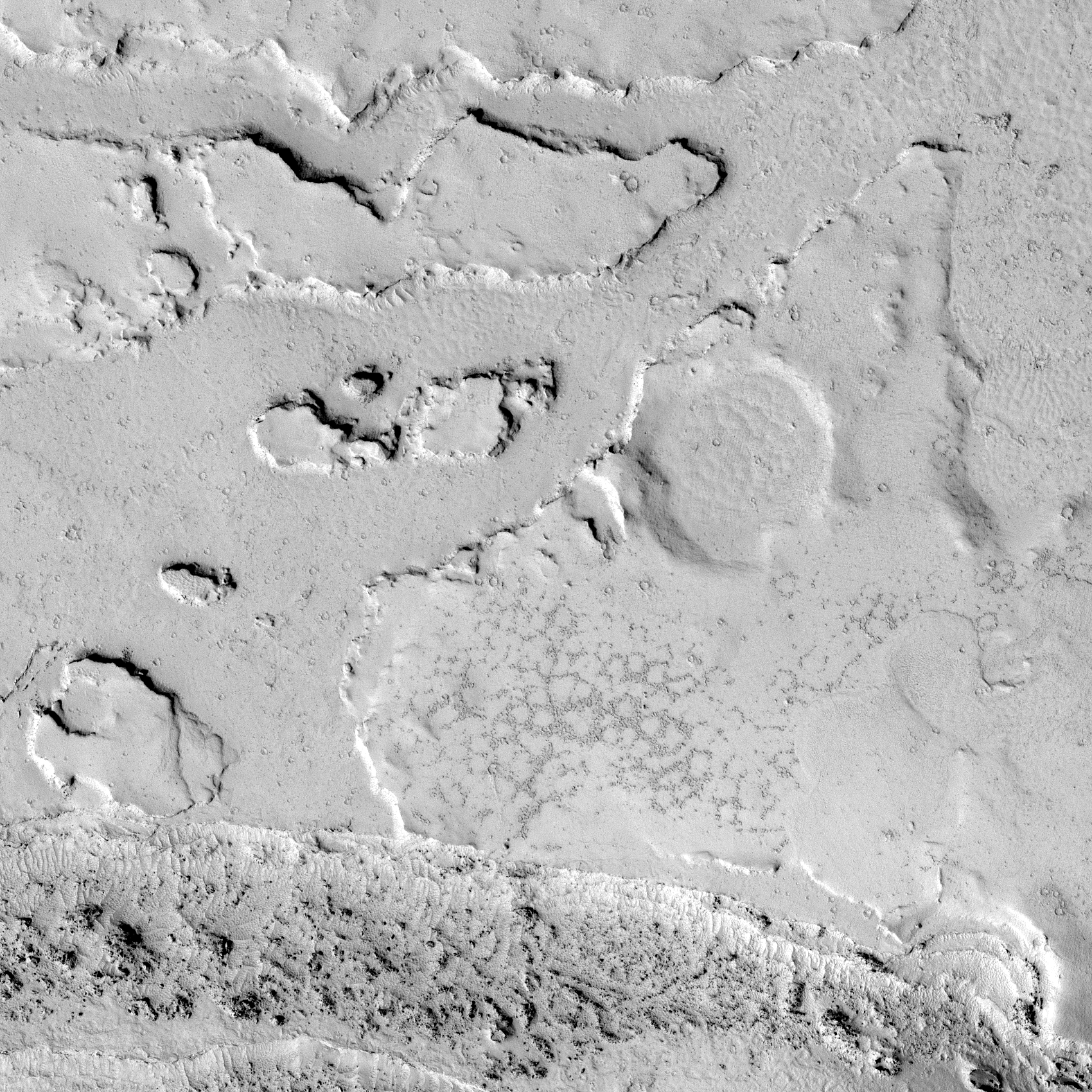
Українська: Ділянка рівнини Елізій на Марсі. Внизу видно частину долини Лета (Lethe Vallis). Координати центру — 4,493°N, 155,934°E. Розмір зображення — близько 850×850 м, північ угорі. Знімок камери HiRISE на супутнику Mars Reconnaissance Orbiter, контраст збільшено. Висота Сонця — 37°; висота супутника — 282,5 км.
Нижче центру видно скупчення кам'яних багатокутників. Такі об'єкти утворюються при регулярному замерзанні й відтаюванні ґрунту, багатого на лід (Balme et al., 2010, New Scientist, 2008).
English: Part of Elysium Planitia on Mars. Part of Lethe Vallis is seen below. Centered at 4.493°N, 155.934°E. Size of the image is 850×850 m, north is up. Photo by Mars Reconnaissance Orbiter's camera HiRISE, contrast is increased. Sun elevation is 37°; spacecraft altitude is 282.5 km.
A cluster of stone circles is seen below the center. Such objects form on ice-rich substrate if it regularly melts and freezes (Balme et al., 2010, New Scientist, 2008). |
| Date | |
| Source | Part of HiRISE image PSP_004072_1845 with increased contrast |
| Author | NASA/JPL/University of Arizona |
Licensing
[edit]
| This file is in the public domain in the United States because it was solely created by NASA. NASA copyright policy states that "NASA material is not protected by copyright unless noted". (See Template:PD-USGov, NASA copyright policy page or JPL Image Use Policy.) | ||
 |
Warnings:
|
File history
Click on a date/time to view the file as it appeared at that time.
| Date/Time | Thumbnail | Dimensions | User | Comment | |
|---|---|---|---|---|---|
| current | 20:18, 8 December 2018 | | 1,700 × 1,700 (2.03 MB) | Sneeuwschaap (talk | contribs) | User created page with UploadWizard |
You cannot overwrite this file.
File usage on Commons
There are no pages that use this file.
File usage on other wikis
The following other wikis use this file:
- Usage on es.wikipedia.org
- Usage on ru.wikipedia.org
- Usage on uk.wikipedia.org