File:Stikine Territory.png

Original file (554 × 618 pixels, file size: 769 KB, MIME type: image/png)
Captions
Captions
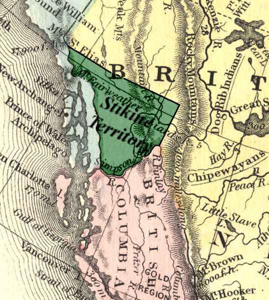
Map of Stikine Territory, 1862
Source: http://encycl.opentopia.com/term/Stikine_Territory (originally uploaded to enwiki by User:SimonP)
|
This work is in the public domain in its country of origin and other countries and areas where the copyright term is the author's life plus 70 years or fewer.
| |
| This file has been identified as being free of known restrictions under copyright law, including all related and neighboring rights. | |
File history
Click on a date/time to view the file as it appeared at that time.
| Date/Time | Thumbnail | Dimensions | User | Comment | |
|---|---|---|---|---|---|
| current | 20:21, 7 January 2008 | | 554 × 618 (769 KB) | Voyager (talk | contribs) | Map of Stikine Territory, 1862 Source: http://encycl.opentopia.com/term/Stikine_Territory {{PD-old}} Category:Maps of British Columbia |
You cannot overwrite this file.
File usage on Commons
There are no pages that use this file.
File usage on other wikis
The following other wikis use this file:
- Usage on de.wikipedia.org
- Usage on en.wikipedia.org
- Usage on es.wikipedia.org
- Usage on fr.wikipedia.org
- Usage on id.wikipedia.org
- Usage on it.wikipedia.org
- Usage on pl.wikipedia.org
- Usage on ru.wikipedia.org
- Usage on sr.wikipedia.org
- Usage on uk.wikipedia.org