File:State of New York - in Senate Jany. 7th, 1836. NYPL434743.tiff
Jump to navigation
Jump to search

Size of this JPG preview of this TIF file: 799 × 600 pixels. Other resolutions: 320 × 240 pixels | 640 × 480 pixels | 1,023 × 768 pixels | 1,280 × 961 pixels | 2,560 × 1,922 pixels | 7,230 × 5,428 pixels.
Original file (7,230 × 5,428 pixels, file size: 112.28 MB, MIME type: image/tiff)
Captions
Captions
Add a one-line explanation of what this file represents
Summary
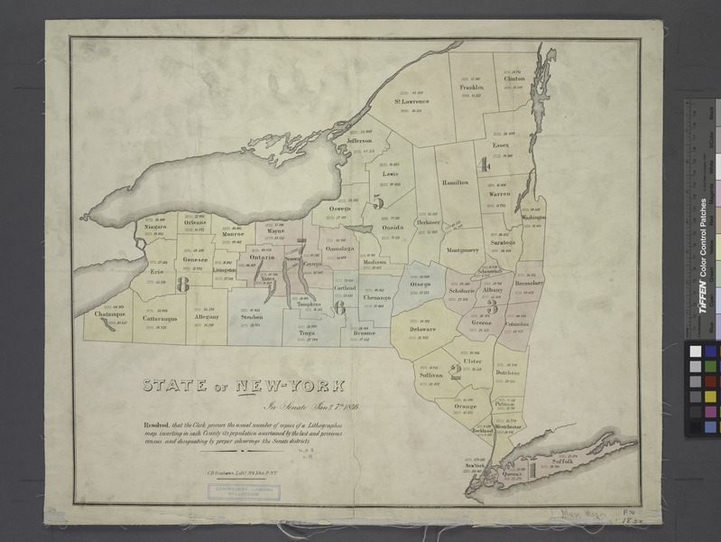
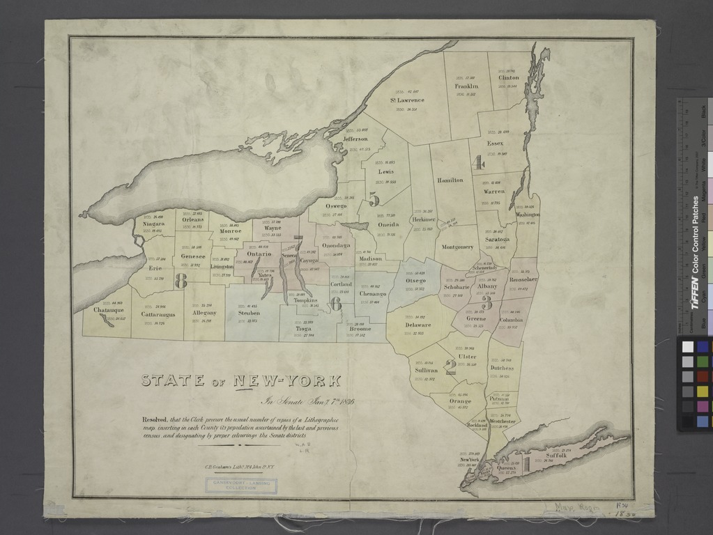
[edit]| Description | State of New York : in Senate Jany. 7th, 1836.; Maps of New York City and State / Whole | |||||||||||||||||||||||
| Notes | "Resolved, that the Clerk procure the usual number of copies of a lithographic map, inserting in each county its population ascertained by the last and previous census, and designating by proper colorings the Senate districts." ''Note 2.'') "Resolved, that the Clerk procure the usual number of copies of a lithographic map, inserting in each county its population ascertained by the last and previous census, and designating by proper colorings the Senate districts." ''Note 3.'') "Resolved, that the Clerk procure the usual number of copies of a lithographic map, inserting in each county its population ascertained by the last and previous census, and designating by proper colorings the Senate districts." ''Note 4.'') "Resolved, that the Clerk procure the usual number of copies of a lithographic map, inserting in each county its population ascertained by the last and previous census, and designating by proper colorings the Senate districts." ''Note 5.'') Gansevoort-Lansing Collection. ''Note 6.'') National Endowment for the Humanities Grant for Access to Early Maps of the Middle Atlantic Seaboard. ''Note 7.'') Shows county boundaries and senate districts, as well as the population figures for each county according to the 1830 and 1835 censuses. | |||||||||||||||||||||||
| Item physical description | 1 map : hand col.; 39 x 48 cm. | |||||||||||||||||||||||
| Catalogue call number | Map Div. 01-1869 | |||||||||||||||||||||||
| Date | ||||||||||||||||||||||||
| Source |
http://digitalgallery.nypl.org/nypldigital/dgkeysearchdetail.cfm?imageID=434743
|
|||||||||||||||||||||||
| Author | New York (State). Legislature. Senate - Publisher | |||||||||||||||||||||||
| Permission (Reusing this file) |
From The Lionel Pincus and Princess Firyal Map Division. http://maps.nypl.org
|
|||||||||||||||||||||||
| Location | Stephen A. Schwarzman Building / The Lionel Pincus and Princess Firyal Map Division | |||||||||||||||||||||||
| Digital item published | 12-6-2008; updated 3-25-2011 | |||||||||||||||||||||||
| Digital ID | 434743 | |||||||||||||||||||||||

The making of this file was supported by Wikimedia UK.
To see other files made with the support of Wikimedia UK, please see the category Supported by Wikimedia UK.
|
File history
Click on a date/time to view the file as it appeared at that time.
| Date/Time | Thumbnail | Dimensions | User | Comment | |
|---|---|---|---|---|---|
| current | 09:30, 5 May 2014 |  | 7,230 × 5,428 (112.28 MB) | Fæ (talk | contribs) | GWToolset: Creating mediafile for Fæ. Tranche 3 17512-20314 @ 11:54, 3 March 2014 |
You cannot overwrite this file.
File usage on Commons
There are no pages that use this file.