File:St.Wilfrid's church, Honington, Lincs. - geograph.org.uk - 70559.jpg
Jump to navigation
Jump to search
No higher resolution available.
St.Wilfrid's_church,_Honington,_Lincs._-_geograph.org.uk_-_70559.jpg (640 × 427 pixels, file size: 101 KB, MIME type: image/jpeg)
Captions
Captions
Add a one-line explanation of what this file represents
This is a photo of listed building number 1062413. |
Summary
[edit]
| Description |
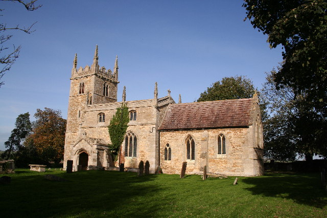
English: St.Wilfrid's church, Honington, Lincs. A hidden gem tucked away behind the former vicarage and approached through the garden. A fine Norman nave and Early English chancel and tower, fine furnishings and Monuments to the Hussey family.
Deutsch: Die anglikanische St.-Wilfrid-Kirche (Church of St Wilfrid) in Honington, Lincolnshire, England, Vereinigtes Königreich. Hier die Ansicht von Südosten mit einem Teil des Kirchhofs.
|
|
| Date | ||
| Source | From geograph.org.uk | |
| Author | Richard Croft | |
| Attribution (required by the license) | Richard Croft / St.Wilfrid's church, Honington, Lincs. / | |
| Object location | | View this and other nearby images on: OpenStreetMap |
|---|
_&language=en)
Licensing
[edit]

|
This image was taken from the Geograph project collection. See this photograph's page on the Geograph website for the photographer's contact details. The copyright on this image is owned by Richard Croft and is licensed for reuse under the Creative Commons Attribution-ShareAlike 2.0 license.
|
This file is licensed under the Creative Commons Attribution-Share Alike 2.0 Generic license.
Attribution: Richard Croft
- You are free:
- to share – to copy, distribute and transmit the work
- to remix – to adapt the work
- Under the following conditions:
- attribution – You must give appropriate credit, provide a link to the license, and indicate if changes were made. You may do so in any reasonable manner, but not in any way that suggests the licensor endorses you or your use.
- share alike – If you remix, transform, or build upon the material, you must distribute your contributions under the same or compatible license as the original.
File history
Click on a date/time to view the file as it appeared at that time.
| Date/Time | Thumbnail | Dimensions | User | Comment | |
|---|---|---|---|---|---|
| current | 19:19, 30 January 2010 | | 640 × 427 (101 KB) | GeographBot (talk | contribs) | == {{int:filedesc}} == {{Information |description={{en|1=St.Wilfrid's church, Honington, Lincs. A hidden gem tucked away behind the former vicarage and approached through the garden. A fine Norman nave and Early English chancel and tower, fine furnishings |
You cannot overwrite this file.
File usage on Commons
There are no pages that use this file.
File usage on other wikis
The following other wikis use this file:
- Usage on en.wikipedia.org