Category:Honington, Lincolnshire
Jump to navigation
Jump to search
village in Lincolnshire, UK  Eglwys Sant Wilfrid, Honington, tu ôl i'r ficerdy | |||||
| Upload media | |||||
| Instance of | |||||
|---|---|---|---|---|---|
| Location | Honington, South Kesteven, Lincolnshire, East Midlands, England | ||||
 | |||||
Subcategories
This category has the following 10 subcategories, out of 10 total.
Media in category "Honington, Lincolnshire"
The following 125 files are in this category, out of 125 total.
-
 A hedgerow in Honington, Lincolnshire, England, on Main Street oposite church 01.jpg 2,560 × 1,920; 2.49 MB
-
 A hedgerow in Honington, Lincolnshire, England, on Main Street oposite church 02.jpg 2,560 × 1,920; 2.53 MB
-
 A south-west view over Honington vicarage garden, Lincolnshire, England 01.jpg 2,560 × 1,920; 2.07 MB
-
 A south-west view over Honington vicarage garden, Lincolnshire, England 02.jpg 2,560 × 1,920; 2.14 MB
-
 A view from West Willoughby towards Honington, Lincolnshire, England.jpg 2,560 × 1,920; 2.57 MB
-
 A153 heading west towards Barkston - geograph.org.uk - 3076217.jpg 640 × 480; 75 KB
-
 A153 Sleaford Road - geograph.org.uk - 2974092.jpg 640 × 429; 52 KB
-
 A153 Sleaford road - geograph.org.uk - 4786831.jpg 1,024 × 813; 91 KB
-
 A153 towards Barkston - geograph.org.uk - 3076222.jpg 640 × 480; 73 KB
-
 A607, Lincoln Road - geograph.org.uk - 4208465.jpg 640 × 480; 295 KB
-

-
 Arable, Pasture ^ Old Dead Tree - geograph.org.uk - 2955001.jpg 429 × 640; 94 KB
-
 Autumn hedgerow - geograph.org.uk - 281522.jpg 640 × 427; 108 KB
-
 Been some changes made on Heath Lane - geograph.org.uk - 4081943.jpg 640 × 427; 127 KB
-
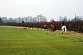 Belvoir Hunt and hounds - geograph.org.uk - 1141820.jpg 640 × 428; 58 KB
-

-
 Bridleway gate - geograph.org.uk - 6384404.jpg 1,024 × 768; 142 KB
-
 Bridleway Heath Lane - geograph.org.uk - 2955034.jpg 429 × 640; 70 KB
-
 Bus shelter on A607 outside Honington - geograph.org.uk - 5989382.jpg 1,600 × 894; 720 KB
-
 Carlton Ashes hill - geograph.org.uk - 1624458.jpg 640 × 426; 71 KB
-
 Carlton Scroop from the south - geograph.org.uk - 1141892.jpg 640 × 428; 59 KB
-
 Collapsing dry-stone wall, Honington Heath - geograph.org.uk - 6384384.jpg 1,024 × 768; 229 KB
-
 Ditch at Iron Age camp, Honington Heath - geograph.org.uk - 6384485.jpg 1,024 × 768; 169 KB
-
 Ditch at Iron Age camp, Honington Heath - geograph.org.uk - 6384489.jpg 1,024 × 768; 177 KB
-
 Drystone Wall ^ Heath Lane - geograph.org.uk - 2955065.jpg 428 × 640; 85 KB
-
 Early summer with a touch of snow^ - geograph.org.uk - 3392384.jpg 800 × 600; 114 KB
-
 Entrance road to Honington Camp - geograph.org.uk - 4081941.jpg 640 × 427; 80 KB
-
 Farm track, Honington Heath - geograph.org.uk - 6384375.jpg 1,024 × 768; 138 KB
-
 Farm track, Honington Heath - geograph.org.uk - 6384378.jpg 1,024 × 768; 132 KB
-
 Farming ^ Honington Camp - geograph.org.uk - 2955052.jpg 640 × 429; 78 KB
-
 Farmland at Honington - geograph.org.uk - 1141835.jpg 640 × 428; 71 KB
-
 Farmland near Honigton - geograph.org.uk - 3076221.jpg 640 × 480; 84 KB
-
 Farmland near The Red House - geograph.org.uk - 2906765.jpg 640 × 480; 40 KB
-
 Farmland near West Willoughby - geograph.org.uk - 3076216.jpg 640 × 480; 56 KB
-
 Farmland towards Ash Plantation - geograph.org.uk - 3076218.jpg 640 × 480; 99 KB
-
 Farmland, Honington - geograph.org.uk - 3076223.jpg 640 × 480; 74 KB
-
 Field by Frinkley Lane - geograph.org.uk - 4644963.jpg 640 × 480; 116 KB
-
 Field entrance off Hough Road - geograph.org.uk - 2906684.jpg 640 × 480; 92 KB
-
 Fields near Twelve Acre Plantation - geograph.org.uk - 2386461.jpg 1,024 × 681; 392 KB
-
 Footpath at Honington - geograph.org.uk - 6372216.jpg 1,024 × 768; 186 KB
-
 Footpath Dilema - geograph.org.uk - 2974106.jpg 429 × 640; 76 KB
-
 Footpath to the A607 - geograph.org.uk - 4081782.jpg 427 × 640; 91 KB
-
 Former course of the A153 at Honington - geograph.org.uk - 6384344.jpg 1,024 × 768; 158 KB
-

-
 Frinkley Lane heading west - geograph.org.uk - 2906762.jpg 640 × 480; 54 KB
-
 Frinkley Lane level crossing - geograph.org.uk - 1131760.jpg 640 × 428; 98 KB
-
 Frinkley Lane level crossing - geograph.org.uk - 166805.jpg 640 × 427; 96 KB
-
 Frinkley Lane Level Crossing - geograph.org.uk - 3368252.jpg 2,256 × 1,504; 1.77 MB
-
 Frinkley Lane, off Hough Road - geograph.org.uk - 3367279.jpg 2,256 × 1,504; 3.96 MB
-

-
 Going round the bend - geograph.org.uk - 6384416.jpg 1,024 × 768; 180 KB
-
 Grantham Road at the Frinkley Lane junction - geograph.org.uk - 3969135.jpg 3,776 × 2,520; 4.04 MB
-

-
 Heath Lane (bridleway) - geograph.org.uk - 3076219.jpg 640 × 480; 92 KB
-
 Heath Lane - geograph.org.uk - 2954983.jpg 640 × 429; 49 KB
-
 Heath Lane Bridleway - geograph.org.uk - 2955022.jpg 429 × 640; 127 KB
-
 Heath Lane, Honington - geograph.org.uk - 4081797.jpg 640 × 427; 63 KB
-
 Heath Lane, Honington - geograph.org.uk - 6384340.jpg 1,024 × 768; 137 KB
-
 Heath Lane, Honington - geograph.org.uk - 6384350.jpg 1,024 × 768; 166 KB
-
 Heath Lane, Honington - geograph.org.uk - 6384362.jpg 1,024 × 768; 169 KB
-
 Heath Lane, Honington - geograph.org.uk - 6384373.jpg 1,024 × 768; 215 KB
-
 Hedgerow beside Hough Road - geograph.org.uk - 2906771.jpg 640 × 480; 56 KB
-
 Hedgerow by Lincoln Road, Honington - geograph.org.uk - 6246219.jpg 1,857 × 1,237; 1.14 MB
-
 Honington Beck in a snowstorm - geograph.org.uk - 3368249.jpg 2,256 × 1,504; 1.99 MB
-
 Honington Camp, aerial 2018 - geograph.org.uk - 5846359.jpg 1,024 × 683; 200 KB
-
 Honington Grange from the village - geograph.org.uk - 1141800.jpg 640 × 428; 66 KB
-
 Honington Heath - geograph.org.uk - 1131783.jpg 640 × 428; 74 KB
-
 Honington House - geograph.org.uk - 1141827.jpg 640 × 428; 65 KB
-

-
 Hough Road entering Grove Plantation - geograph.org.uk - 3952705.jpg 4,000 × 3,000; 3.66 MB
-
 Hough Road heading north - geograph.org.uk - 2906682.jpg 640 × 480; 122 KB
-

-

-
 Inland Beach^ - geograph.org.uk - 2974089.jpg 429 × 640; 58 KB
-

-
 Level crossing on Lincoln Road - geograph.org.uk - 3076225.jpg 640 × 480; 66 KB
-
 Level crossing, Honington - geograph.org.uk - 1131741.jpg 640 × 428; 62 KB
-
 Lincoln Road, Honington - geograph.org.uk - 4208470.jpg 640 × 480; 290 KB
-
 Main Street Honington - geograph.org.uk - 2974094.jpg 640 × 429; 95 KB
-
 Main Street Honington - geograph.org.uk - 3127882.jpg 1,024 × 713; 178 KB
-
 Main Street leaving Honington - geograph.org.uk - 3076224.jpg 640 × 480; 78 KB
-
 Main Street, Honington - geograph.org.uk - 2954967.jpg 640 × 429; 74 KB
-
 Manege, Honington Grange - geograph.org.uk - 5271430.jpg 2,816 × 2,112; 2.26 MB
-
 Nottingham to Sleaford railway - geograph.org.uk - 1131747.jpg 640 × 428; 92 KB
-
 Nottingham to Sleaford railway - geograph.org.uk - 1141895.jpg 640 × 428; 80 KB
-
 Path to the Church - geograph.org.uk - 475805.jpg 572 × 640; 93 KB
-
 Rail crossing on Frinkley Lane - geograph.org.uk - 3127875.jpg 1,024 × 571; 109 KB
-
 Railway line near Honington - geograph.org.uk - 1751514.jpg 1,024 × 683; 330 KB
-
 Railway towards Sleaford - geograph.org.uk - 3076228.jpg 640 × 480; 84 KB
-

-
 Sheep grazing below Spellar Wood, Honington - geograph.org.uk - 2410449.jpg 1,024 × 681; 344 KB
-
 Sheep grazing on Honington Heath - geograph.org.uk - 1131790.jpg 640 × 428; 79 KB
-
 Sheep grazing on Honington Heath - geograph.org.uk - 1141851.jpg 640 × 428; 80 KB
-
 Sheep grazing on the edge of the village - geograph.org.uk - 1751525.jpg 956 × 639; 275 KB
-
 Site of Honington Hall - geograph.org.uk - 1751620.jpg 1,024 × 683; 438 KB
-
 Slightland Plantation - geograph.org.uk - 6222251.jpg 1,024 × 768; 121 KB
-
 Small plantation of the parish boundary - geograph.org.uk - 6384390.jpg 1,024 × 768; 189 KB
-
 St Wilfrid, Honington - geograph.org.uk - 5659069.jpg 900 × 610; 256 KB
-
 St Wilfrid, Honington - Porch - geograph.org.uk - 5659070.jpg 640 × 900; 327 KB
-
 St Wilfrid, Honington - Tower - geograph.org.uk - 5659071.jpg 692 × 900; 257 KB
-
 Stile Towards Honington - geograph.org.uk - 2974082.jpg 429 × 640; 88 KB
-
 Stubble field off Heath Lane - geograph.org.uk - 6384360.jpg 1,024 × 768; 174 KB
-

-
 The Ancaster Gap - geograph.org.uk - 5182701.jpg 1,024 × 768; 254 KB
-
 The road to Hough, and the Red House - geograph.org.uk - 2123200.jpg 2,048 × 1,536; 846 KB
-
 The top of Heath Lane, Honington - geograph.org.uk - 6384369.jpg 1,024 × 768; 271 KB
-
 Towards Honington - geograph.org.uk - 2955011.jpg 429 × 640; 62 KB
-
 Towards Lincoln Road - geograph.org.uk - 2954960.jpg 640 × 428; 54 KB
-
 Turn left to Honington from Hough Road - geograph.org.uk - 3127868.jpg 1,024 × 768; 151 KB
-
 View from the churchyard, Honington - geograph.org.uk - 6222245.jpg 1,024 × 768; 181 KB
-
 View north from the A153 - West Willoughby - geograph.org.uk - 1883703.jpg 1,500 × 996; 1.36 MB
-
 View south from the A153 - West Willoughby - geograph.org.uk - 1883725.jpg 1,500 × 996; 1.15 MB
-
 View towards Honington Station - geograph.org.uk - 5182707.jpg 1,024 × 768; 299 KB
-
 View towards the Red House near Honington - geograph.org.uk - 6363568.jpg 1,024 × 768; 155 KB
-
 Winter farmland at Honington - geograph.org.uk - 1141811.jpg 640 × 428; 80 KB
-
 Winter farmland at Honington - geograph.org.uk - 1141858.jpg 640 × 428; 68 KB
-
 Winter farmland at Honington - geograph.org.uk - 1141868.jpg 640 × 428; 70 KB
-
 Barkston Heath - geograph.org.uk - 208762.jpg 640 × 427; 87 KB
-
 Carlton Ashes - geograph.org.uk - 166819.jpg 640 × 427; 83 KB
-
 Farmland off Hough Road - geograph.org.uk - 281538.jpg 640 × 427; 119 KB
-
 Frinkley Lane - geograph.org.uk - 760030.jpg 640 × 427; 53 KB
-
 Frinkley Lane near Honington Grange - geograph.org.uk - 256919.jpg 640 × 427; 80 KB
-
 Heath Lane - geograph.org.uk - 549948.jpg 640 × 427; 74 KB
-
 Heath Lane, Barkston Heath - geograph.org.uk - 208715.jpg 640 × 480; 98 KB
-
 Spellar Wood - geograph.org.uk - 256922.jpg 640 × 480; 97 KB


_-_geograph.org.uk_-_3076219.jpg)


.jpg)


