File:Sopka Baklan 2003.jpg
Jump to navigation
Jump to search

Size of this preview: 800 × 400 pixels. Other resolutions: 320 × 160 pixels | 640 × 320 pixels | 1,024 × 512 pixels | 1,280 × 640 pixels | 2,400 × 1,200 pixels.
Original file (2,400 × 1,200 pixels, file size: 583 KB, MIME type: image/jpeg)
Captions
Captions
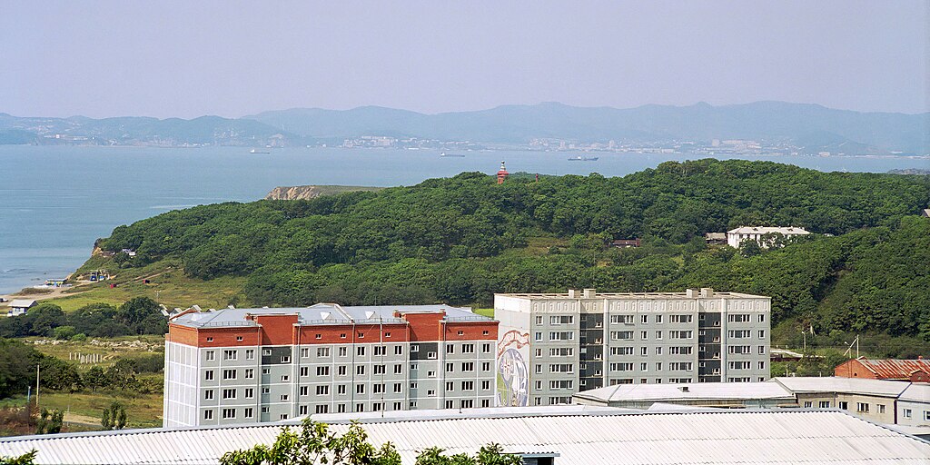
Sopka Baklan in the Beregovoy settlement
Summary
[edit]
| Description |
English: View of the Nakhodka bay from the "seven winds" district. In the center is the Baklan hill, on top of which there was battery No. 905 of the Suchan defense sector.
Русский: Вид на залив Находка с района "семи ветров". В центре - сопка Баклан, на вершине которой была батарея №905 Сучанского сектора обороны. |
| Date | |
| Source | Own work |
| Author | Vrangel Bay (aka Alex Wild) |
| Camera location | | View this and other nearby images on: OpenStreetMap |
|---|
"Береговой строится" - примерно тот же ракурс, но вид с вертолета (примерно 1980 год): https://pastvu.com/p/1552937
Licensing
[edit]
I, the copyright holder of this work, hereby publish it under the following license:
This file is licensed under the Creative Commons Attribution-Share Alike 4.0 International license.
- You are free:
- to share – to copy, distribute and transmit the work
- to remix – to adapt the work
- Under the following conditions:
- attribution – You must give appropriate credit, provide a link to the license, and indicate if changes were made. You may do so in any reasonable manner, but not in any way that suggests the licensor endorses you or your use.
- share alike – If you remix, transform, or build upon the material, you must distribute your contributions under the same or compatible license as the original.
| Annotations | This image is annotated: View the annotations at Commons |
File history
Click on a date/time to view the file as it appeared at that time.
| Date/Time | Thumbnail | Dimensions | User | Comment | |
|---|---|---|---|---|---|
| current | 19:23, 20 January 2023 | | 2,400 × 1,200 (583 KB) | Vrangel Bay (talk | contribs) | Uploaded own work with UploadWizard |
You cannot overwrite this file.
File usage on Commons
There are no pages that use this file.