File:Sketch showing the route (in red) from Red River to the Pacific Ocean. (IA bp 2726).pdf

Original file (2,633 × 2,060 pixels, file size: 751 KB, MIME type: application/pdf)
Captions
Captions
Summary
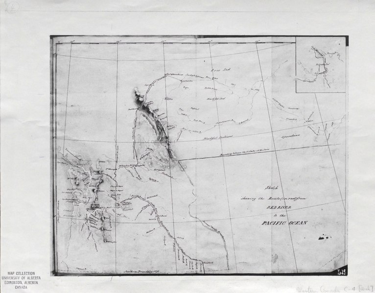
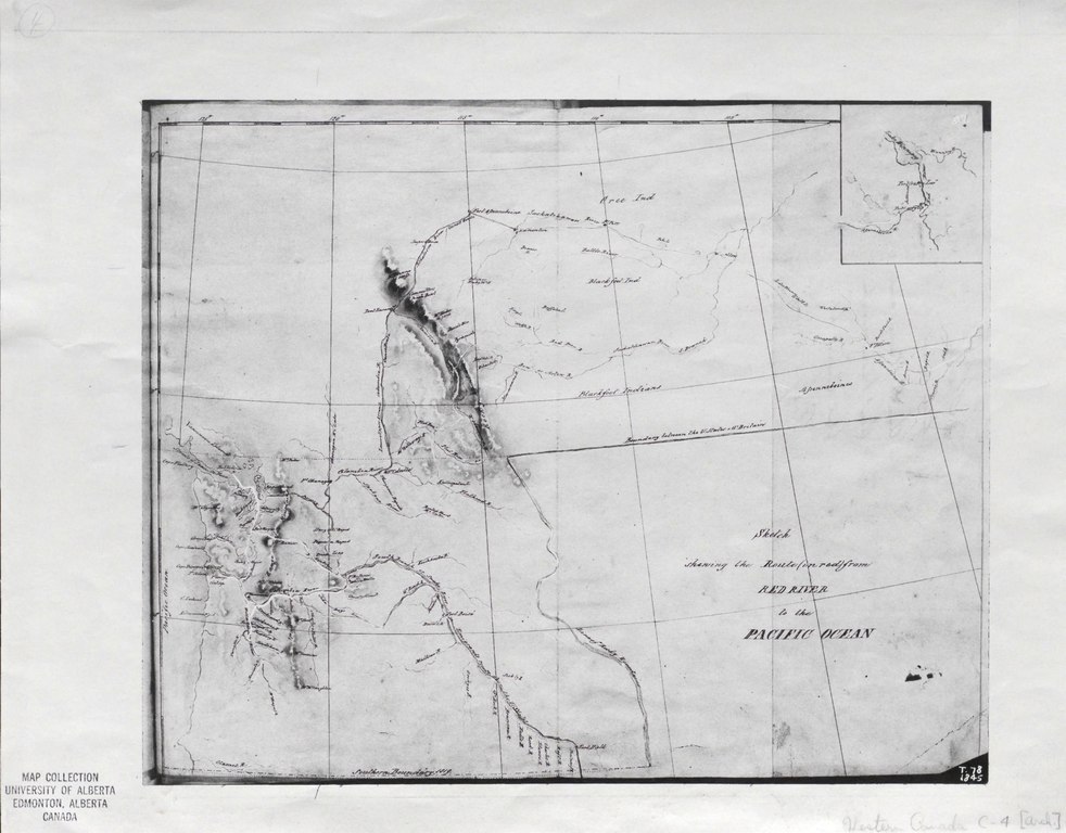
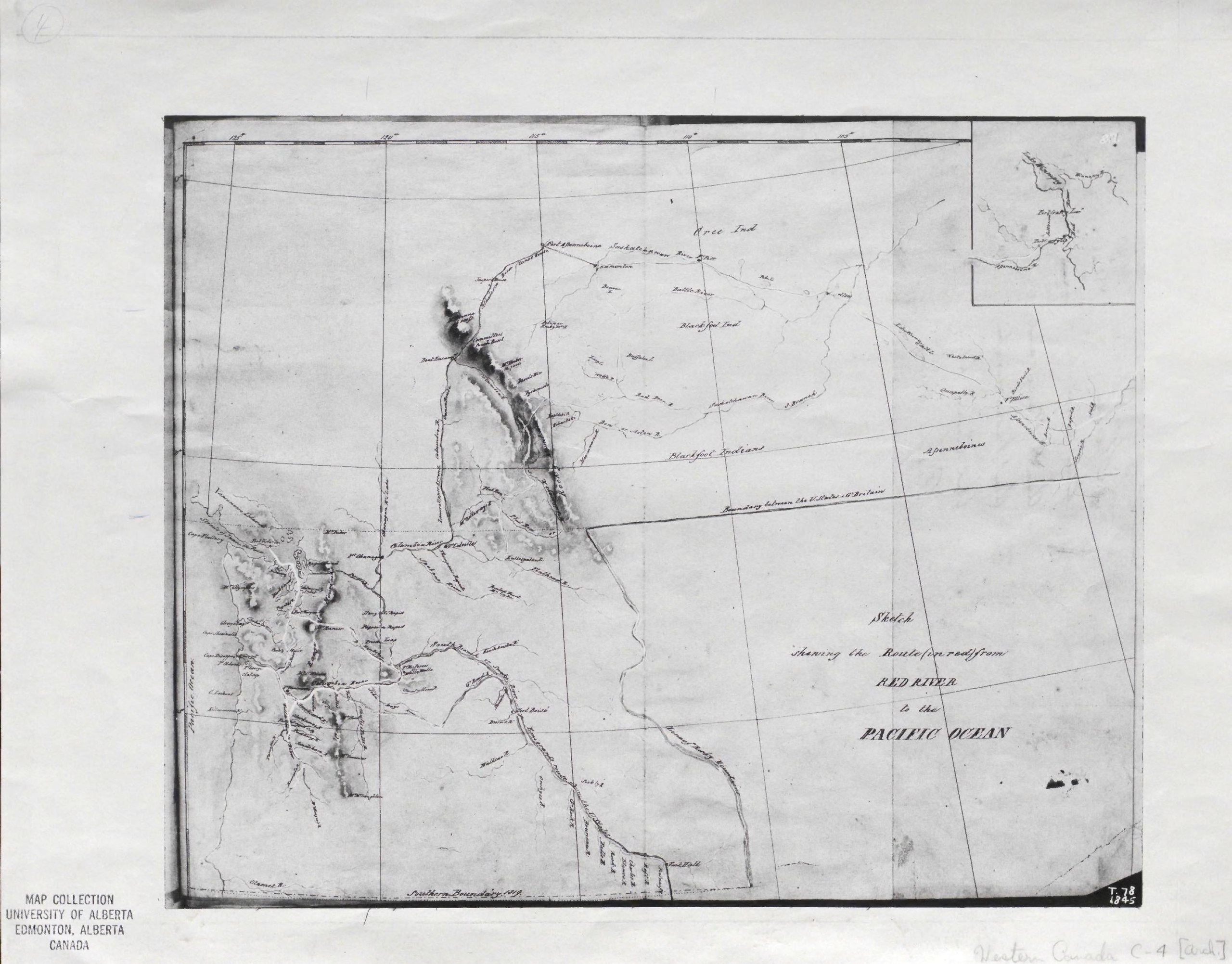
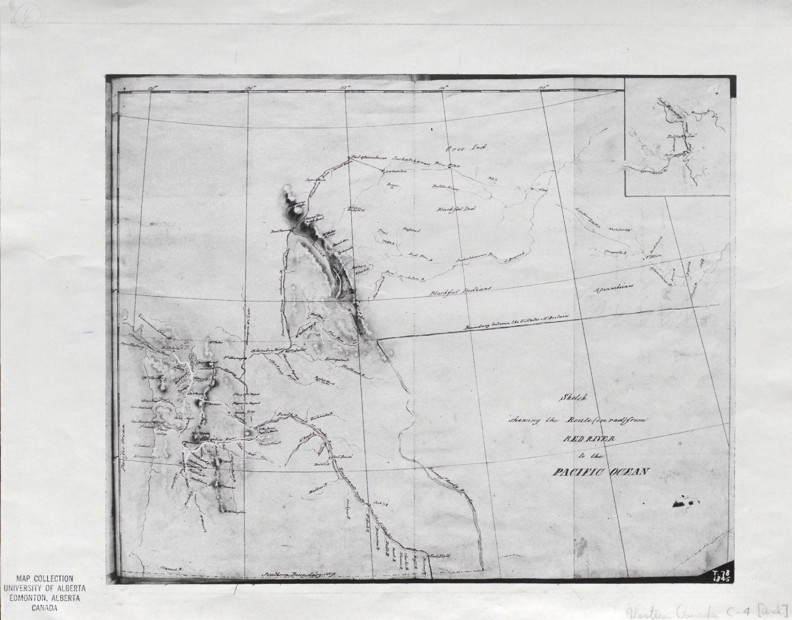
[edit]| Sketch showing the route (in red) from Red River to the Pacific Ocean.
( |
|
|---|---|
| Title |
Sketch showing the route (in red) from Red River to the Pacific Ocean. |
| Publisher |
Dept. of the Interior, Dominion Lands Office, [Canada] |
| Description |
Sketch of the route of Lt. Ubarre and Lt. Vavasour, 1845.;Scanned in Peel's Prairie Provinces database: Map 227: http://peel.library.ualberta.ca/maps/M000227.html;Photocopy of a map in the National Map Collection.;Map showing forts, place names, rivers and the route of American emigrants along the Snake River from Idaho and Oregon. Inset: eastern section of route. Shows Lieutenants Warre and Vavasour's route from Fort Garry Upper Red River, south of Lake Winnipeg to the mouth of the Columbia River (Washington State) and then northwards to Victoria, Vancouver Island.;1 map : photocopy ; 28.6 x 35.3 cm. on sheet 35.7 x 44.7 cm. Subjects: Western Canada--Physical sciences |
| Language | English |
| Publication date | [1845?] |
| Current location |
IA Collections: wcw_gale; wcw; university_of_alberta_libraries; toronto |
| Accession number |
bp_2726 |
| Notes | Scale: [1:5 258 880] |
| Source | |
Licensing
[edit]|
This work is in the public domain in its country of origin and other countries and areas where the copyright term is the author's life plus 70 years or fewer.
| |
| This file has been identified as being free of known restrictions under copyright law, including all related and neighboring rights. | |
File history
Click on a date/time to view the file as it appeared at that time.
| Date/Time | Thumbnail | Dimensions | User | Comment | |
|---|---|---|---|---|---|
| current | 12:34, 27 August 2021 |  | 2,633 × 2,060 (751 KB) | Fæ (talk | contribs) | IA Query "collection:(wcw) date:[1000 TO 1899]" bp_2726 Category:William C. Wonders Map Collection (COM:IA books#query) (1845 #213) |
You cannot overwrite this file.
File usage on Commons
The following page uses this file: