File:Sivas Belediyesi sınırları.pdf
Jump to navigation
Jump to search

Size of this JPG preview of this PDF file: 519 × 599 pixels. Other resolutions: 208 × 240 pixels | 416 × 480 pixels | 666 × 768 pixels | 887 × 1,024 pixels | 1,775 × 2,048 pixels | 7,675 × 8,856 pixels.
Original file (7,675 × 8,856 pixels, file size: 243 KB, MIME type: application/pdf)
Captions
Captions
Add a one-line explanation of what this file represents
Summary
[edit]| Description |
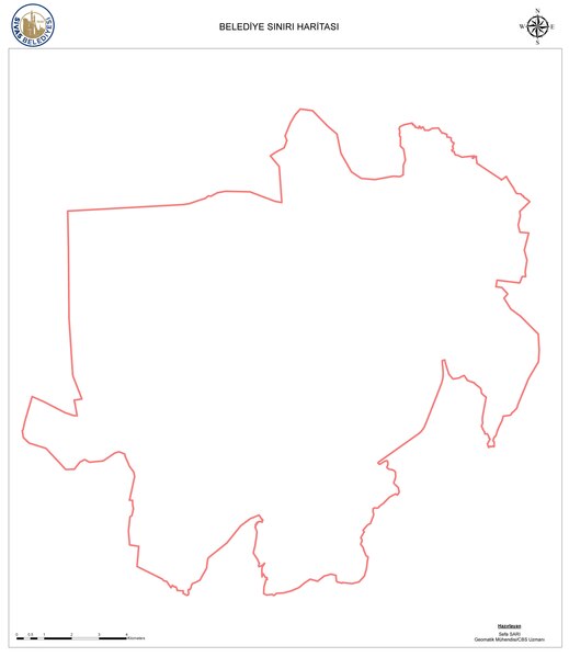
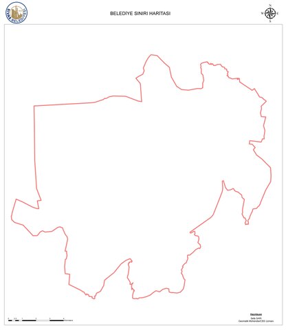
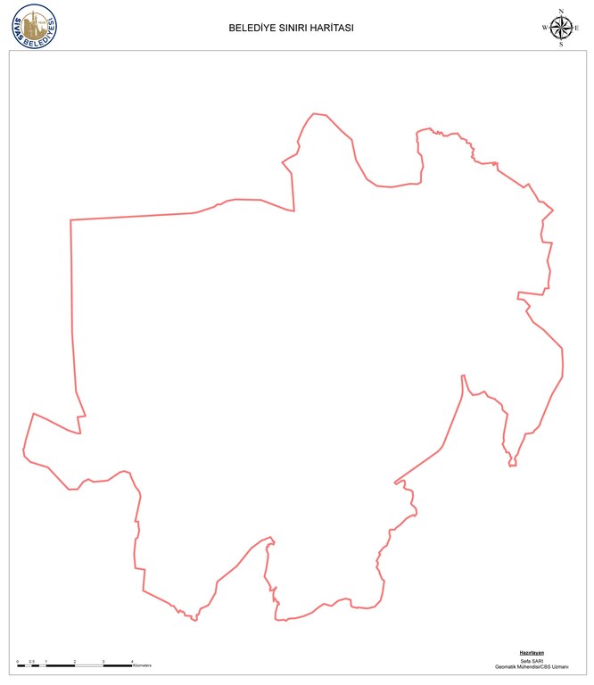
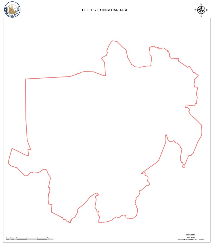
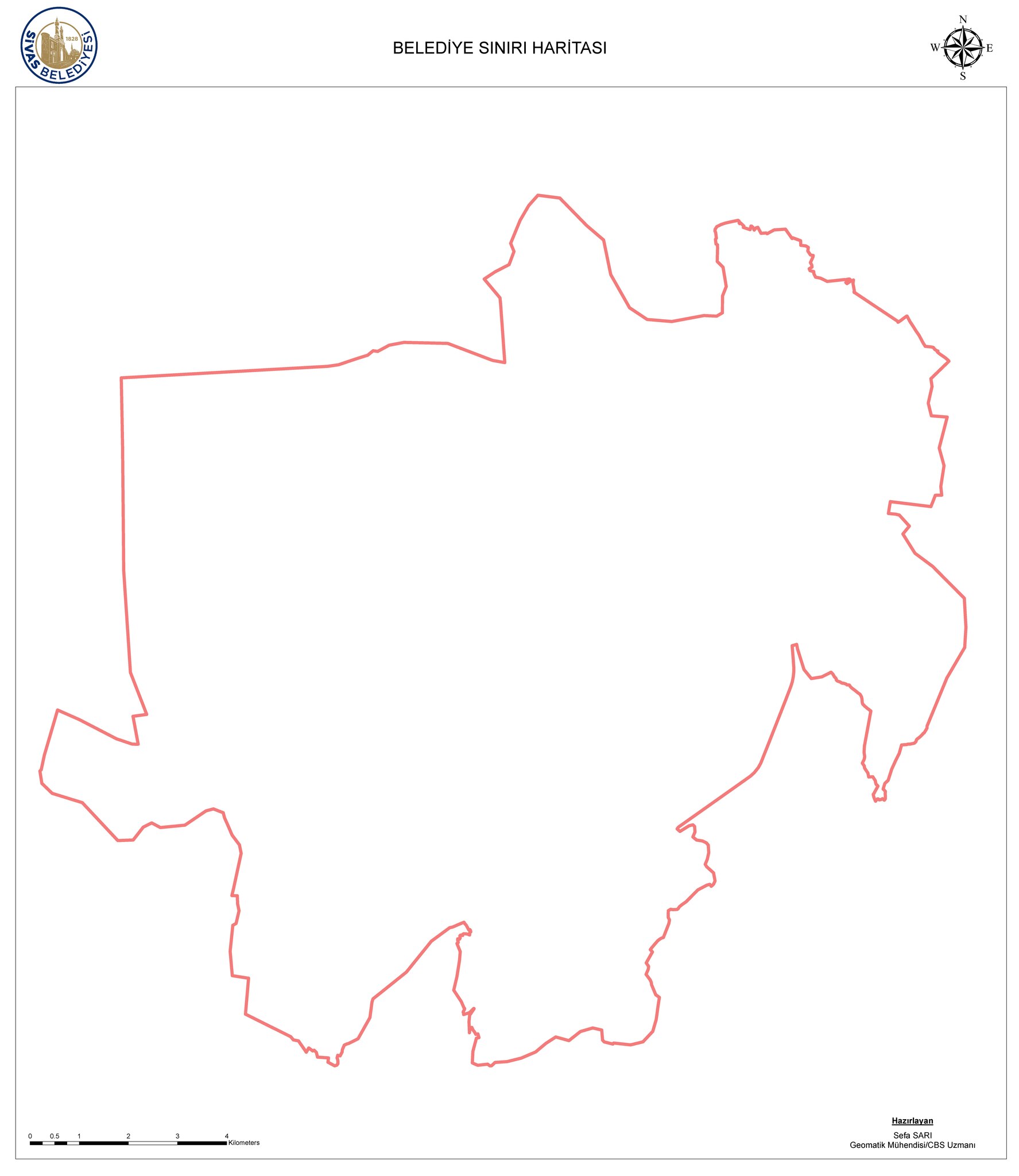
Türkçe: Sivas Belediyesi sınırları |
| Date | |
| Source | https://ulasav.csb.gov.tr/dataset/sivas-belediye-siniri-haritasi |
| Author | Sefa Sarı |
Licensing
[edit]| This file is licensed under Turkish National Smart City Open Data Platform Open Data License 1.0 (Açık Veri Lisansı 1.0). | |
|
File history
Click on a date/time to view the file as it appeared at that time.
| Date/Time | Thumbnail | Dimensions | User | Comment | |
|---|---|---|---|---|---|
| current | 11:14, 17 August 2024 |  | 7,675 × 8,856 (243 KB) | ToprakM (talk | contribs) | Uploaded a work by Sefa Sarı from https://ulasav.csb.gov.tr/dataset/sivas-belediye-siniri-haritasi with UploadWizard |
You cannot overwrite this file.
File usage on Commons
There are no pages that use this file.