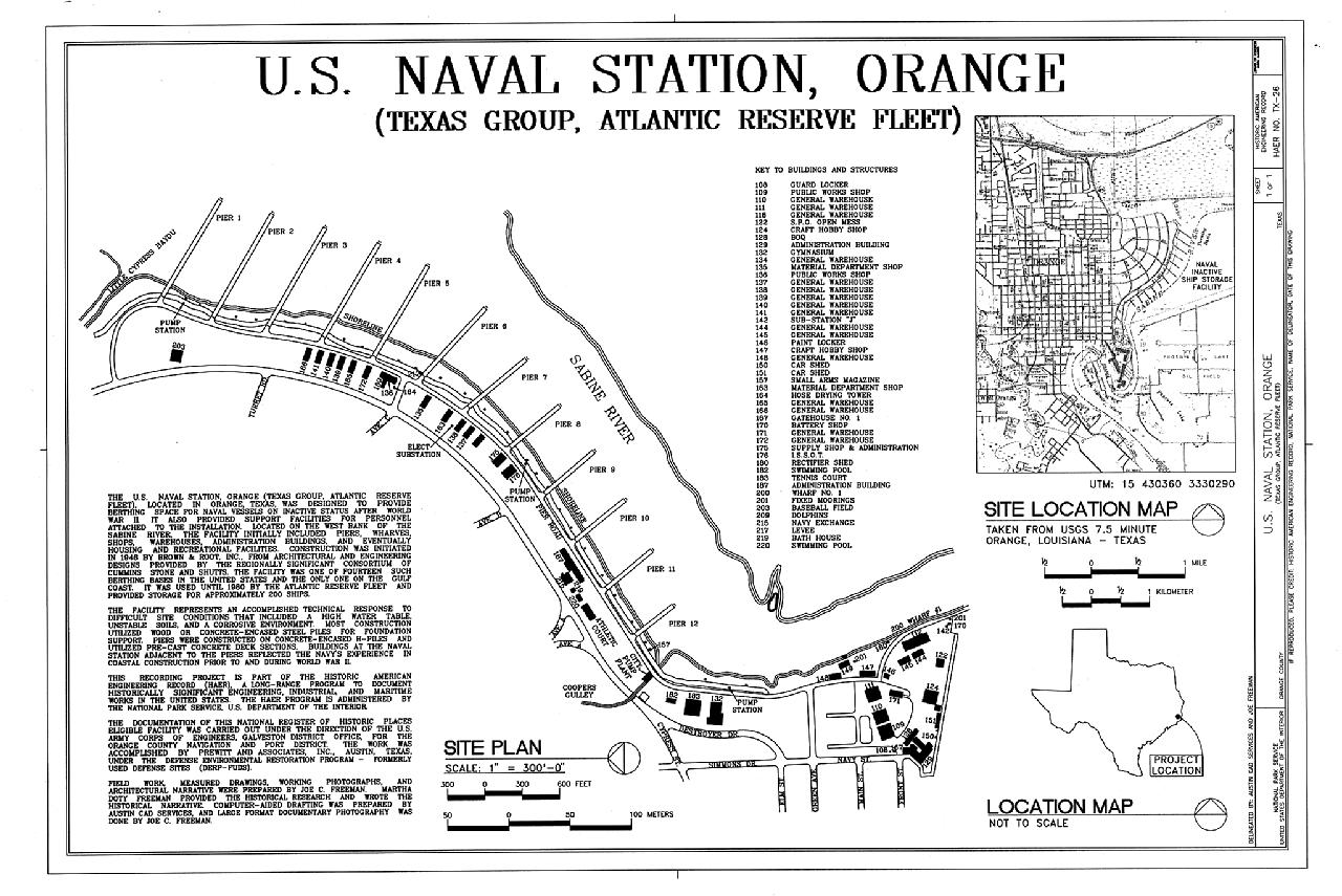
File:Site Plan - U.S. Naval Station, Orange, West bank of Sabine River, Orange, Orange County, TX HAER TX-26 (sheet 1 of 1).tif
Jump to navigation
Jump to search

Size of this JPG preview of this TIF file: 800 × 535 pixels. Other resolutions: 320 × 214 pixels | 640 × 428 pixels | 1,024 × 684 pixels | 1,280 × 855 pixels | 2,560 × 1,711 pixels | 14,364 × 9,600 pixels.
Original file (14,364 × 9,600 pixels, file size: 2.6 MB, MIME type: image/tiff)
Captions
Captions
Add a one-line explanation of what this file represents
Summary
[edit]| Warning | The original file is very high-resolution. It might not load properly or could cause your browser to freeze when opened at full size. |
|---|
| Site Plan - U.S. Naval Station, Orange, West bank of Sabine River, Orange, Orange County, TX | ||||
|---|---|---|---|---|
| Photographer |
Freeman, Joe, creator |
|||
| Title |
Site Plan - U.S. Naval Station, Orange, West bank of Sabine River, Orange, Orange County, TX |
|||
| Depicted place | Texas; Orange County; Orange | |||
| Date | Documentation compiled after 1968 | |||
| Dimensions | 24 x 36 in. (D size) | |||
| Current location |
Library of Congress Prints and Photographs Division Washington, D.C. 20540 USA http://hdl.loc.gov/loc.pnp/pp.print |
|||
| Accession number |
HAER TX-26 (sheet 1 of 1) |
|||
| Credit line |
|
|||
| Notes |
|
|||
| Source | https://www.loc.gov/pictures/item/tx0741.sheet.00001a | |||
| Permission (Reusing this file) |
|
|||

File history
Click on a date/time to view the file as it appeared at that time.
| Date/Time | Thumbnail | Dimensions | User | Comment | |
|---|---|---|---|---|---|
| current | 08:53, 2 August 2014 |  | 14,364 × 9,600 (2.6 MB) | Fæ (talk | contribs) | GWToolset: Creating mediafile for Fæ. HABS 2014-08-01 (3201:3400) |
You cannot overwrite this file.
File usage on Commons
The following page uses this file: