File:Seelstrang1886.jpg
Jump to navigation
Jump to search
Size of this preview: 800 × 544 pixels. Other resolutions: 320 × 218 pixels | 640 × 435 pixels | 1,024 × 696 pixels | 1,280 × 870 pixels | 2,560 × 1,740 pixels | 4,954 × 3,368 pixels.
Original file (4,954 × 3,368 pixels, file size: 10.6 MB, MIME type: image/jpeg)
Captions
Captions
Add a one-line explanation of what this file represents
Summary
[edit]
| Description |
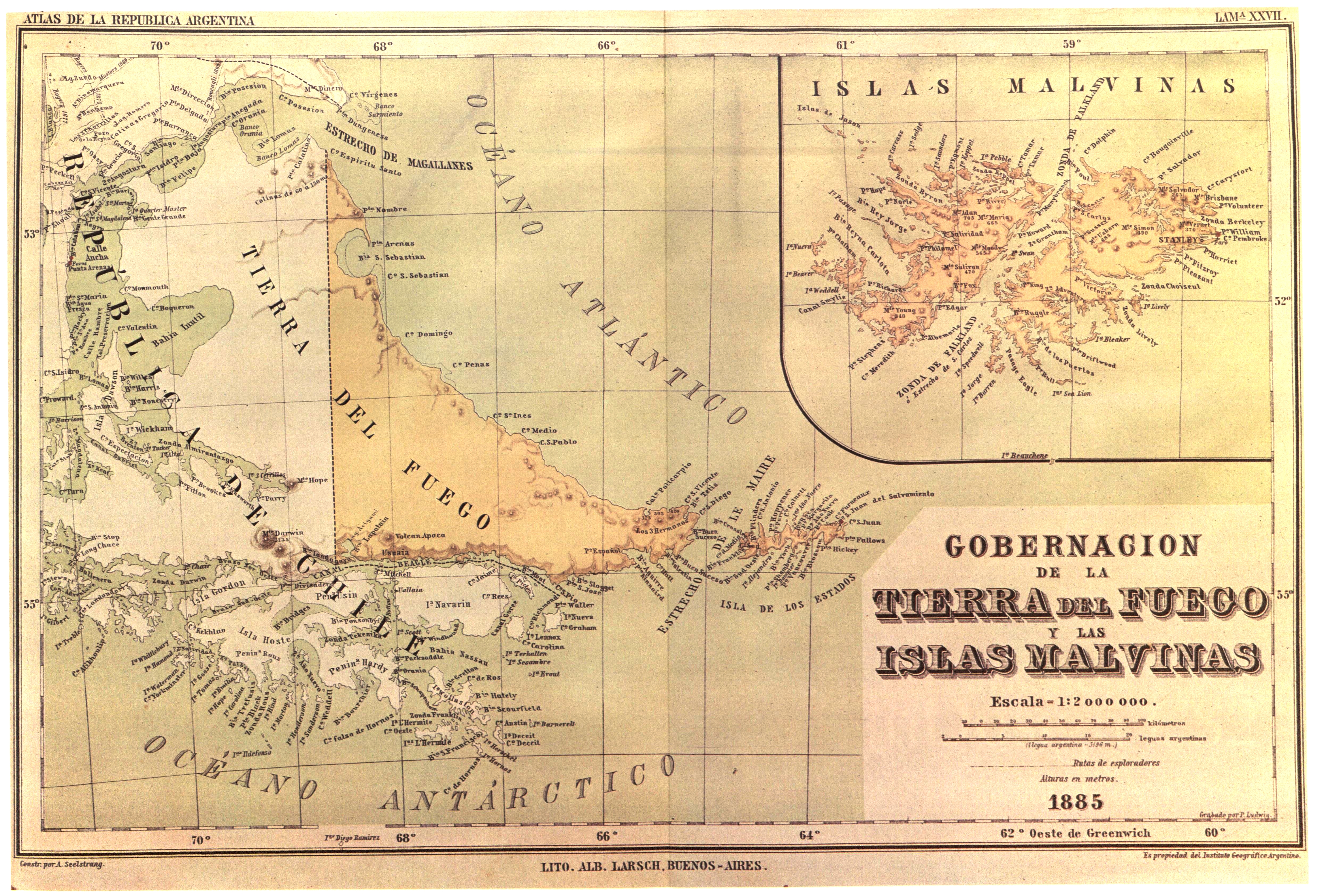
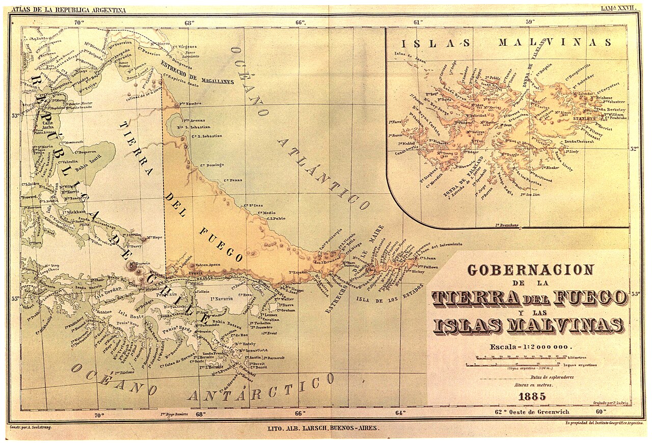
English: "In 1882 the Argentine Geographic Institut decided to issue a general map and a atlas of the Argentine Republic. The task was put in the hands of the well known Profesor of the University of Cordoba, Arturo Seelstrang, who had already brought out a map of the Republic in 1875.
The Atlas was 'constructed and published' by the institute 'under the auspices of the National Government'. Plate XXVII of the Atlas, reproduced here, was headed 'Governoship of Tierra del Fuego and the Malvinas Islands' and were drawn up in 1885 and published the following year. As may be observed, said map shows the boundary line running through the centre of the Beagle Channel, indicating Picton, Nueva and Lennox Islands an all the other islands and islets extending southwards as far as Cape Horn as being under Chilean sovereignty."Español: Mapa oficial del Instituto Geográfico Argentino del año 1885 mostrando el «Canal Beagle» y sus límites. En este mapa se ve expresamente el Océano Antártico. |
||||
| Date | |||||
| Source | El Conflicto del Beagle, edited by the chilean Foreign Affairs Office, 1978, Switzerland. | ||||
| Author | Arturo Seelstrang | ||||
| Permission (Reusing this file) |
|
||||
File history
Click on a date/time to view the file as it appeared at that time.
| Date/Time | Thumbnail | Dimensions | User | Comment | |
|---|---|---|---|---|---|
| current | 01:16, 19 May 2018 | | 4,954 × 3,368 (10.6 MB) | Janitoalevic (talk | contribs) | . |
| 13:22, 19 August 2007 |  | 4,954 × 3,368 (1.93 MB) | Keysanger (talk | contribs) | {{Information |Description="In 1882 the Argentine Geographic Institut decided to issue a general map and a atlas of the Argentine Republic. The task was put in the hands of the well known Profesor of the University of Cordoba, Arturo Seelstrang, who had a |
You cannot overwrite this file.
File usage on Commons
The following page uses this file:
- File:Mapa oficial.jpg (file redirect)
File usage on other wikis
The following other wikis use this file:
- Usage on de.wikipedia.org
- Usage on en.wikipedia.org
- Usage on es.wikipedia.org
- Usage on fr.wikipedia.org