File:Schobuell in NF.PNG
Jump to navigation
Jump to search
No higher resolution available.
Schobuell_in_NF.PNG (353 × 340 pixels, file size: 7 KB, MIME type: image/png)
Captions
Captions
Add a one-line explanation of what this file represents
| Description |
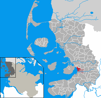
English: This map shows the area of the town Husum in the district Nordfriesland, Schleswig-Holstein, Germany.
Deutsch: Diese Karte zeigt das Gebiet des Stadtteils Schobüll von Husum, Kreis Nordfriesland, Schleswig-Holstein, Deutschland. |
||||||||
| Date | |||||||||
| Source |
English: The map was created by de:Benutzer:Rauenstein.
Deutsch: Die Karte wurde von de:Benutzer:Rauenstein erstellt.
English: Location marked by de:Benutzer:Begw.
Deutsch: Position durch de:Benutzer:Begw markiert. |
||||||||
| Author | |||||||||
| Permission (Reusing this file) |
|

File history
Click on a date/time to view the file as it appeared at that time.
| Date/Time | Thumbnail | Dimensions | User | Comment | |
|---|---|---|---|---|---|
| current | 14:14, 21 January 2007 | | 353 × 340 (7 KB) | ClausG (talk | contribs) | Corrections in Klanxbüll and Rodenäs, Reußenköge and Ockholm |
| 21:29, 12 January 2007 |  | 353 × 340 (7 KB) | Ditschi (talk | contribs) | Ortsteil von Husum | |
| 04:57, 2 January 2006 |  | 353 × 340 (7 KB) | Begw (talk | contribs) | {{GFDL}} == Beschreibung == * en: This map shows the area of the Gemeinde (municipality) de:Schobüll in the Kreis (district) Nordfriesland, Schleswig-Holstein, Germany. * de: Diese Karte zeigt das Gebiet der Gemeinde de:Schobüll im Amt Hatt |
You cannot overwrite this file.
File usage on Commons
The following page uses this file:
File usage on other wikis
The following other wikis use this file: