File:Scarboroughs new county and post office map of Louisiana and Mississippi with complete index giving population and location ; compiled from the latest government surveys and other authentic sources (9138828500).jpg
Jump to navigation
Jump to search
Size of this preview: 651 × 600 pixels. Other resolutions: 261 × 240 pixels | 521 × 480 pixels.
Original file (800 × 737 pixels, file size: 162 KB, MIME type: image/jpeg)
Captions
Captions
Add a one-line explanation of what this file represents
Summary
[edit].jpg&action=edit§ion=1)
| Description |
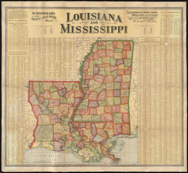
Zoom into this map at maps.bpl.org. Author: Scarborough Company Publisher: Scarborough Company Date: 1904 Location: Louisiana, Mississippi Dimensions: 69 x 61 cm. Scale: [ca. 1:990,000] Call Number: G4010 1904 .S23 |
| Date | |
| Source |
|
| Author | http://maps.bpl.org |
Licensing
[edit].jpg&action=edit§ion=2)
This file is licensed under the Creative Commons Attribution 2.0 Generic license.
- You are free:
- to share – to copy, distribute and transmit the work
- to remix – to adapt the work
- Under the following conditions:
- attribution – You must give appropriate credit, provide a link to the license, and indicate if changes were made. You may do so in any reasonable manner, but not in any way that suggests the licensor endorses you or your use.
| This image, originally posted to Flickr, was reviewed on 21 August 2013 by the administrator or reviewer File Upload Bot (Magnus Manske), who confirmed that it was available on Flickr under the stated license on that date. |
File history
Click on a date/time to view the file as it appeared at that time.
| Date/Time | Thumbnail | Dimensions | User | Comment | |
|---|---|---|---|---|---|
| current | 03:30, 21 August 2013 | | 800 × 737 (162 KB) | File Upload Bot (Magnus Manske) (talk | contribs) | Transferred from Flickr by User:tm |
You cannot overwrite this file.
File usage on Commons
There are no pages that use this file.
.jpg&oldid=894488954)