File:Sanborn map of Northside, Cincinnati.pdf
Jump to navigation
Jump to search

Size of this JPG preview of this PDF file: 463 × 599 pixels. Other resolutions: 185 × 240 pixels | 371 × 480 pixels | 593 × 768 pixels | 1,275 × 1,650 pixels.
Original file (1,275 × 1,650 pixels, file size: 438 KB, MIME type: application/pdf)
Captions
Captions
Add a one-line explanation of what this file represents
| Object location | | View this and other nearby images on: OpenStreetMap |
|---|
| Description |
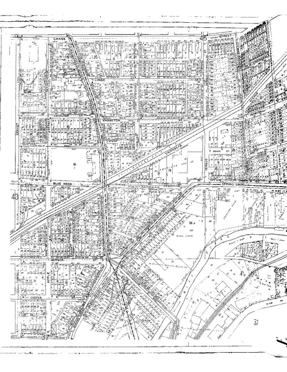
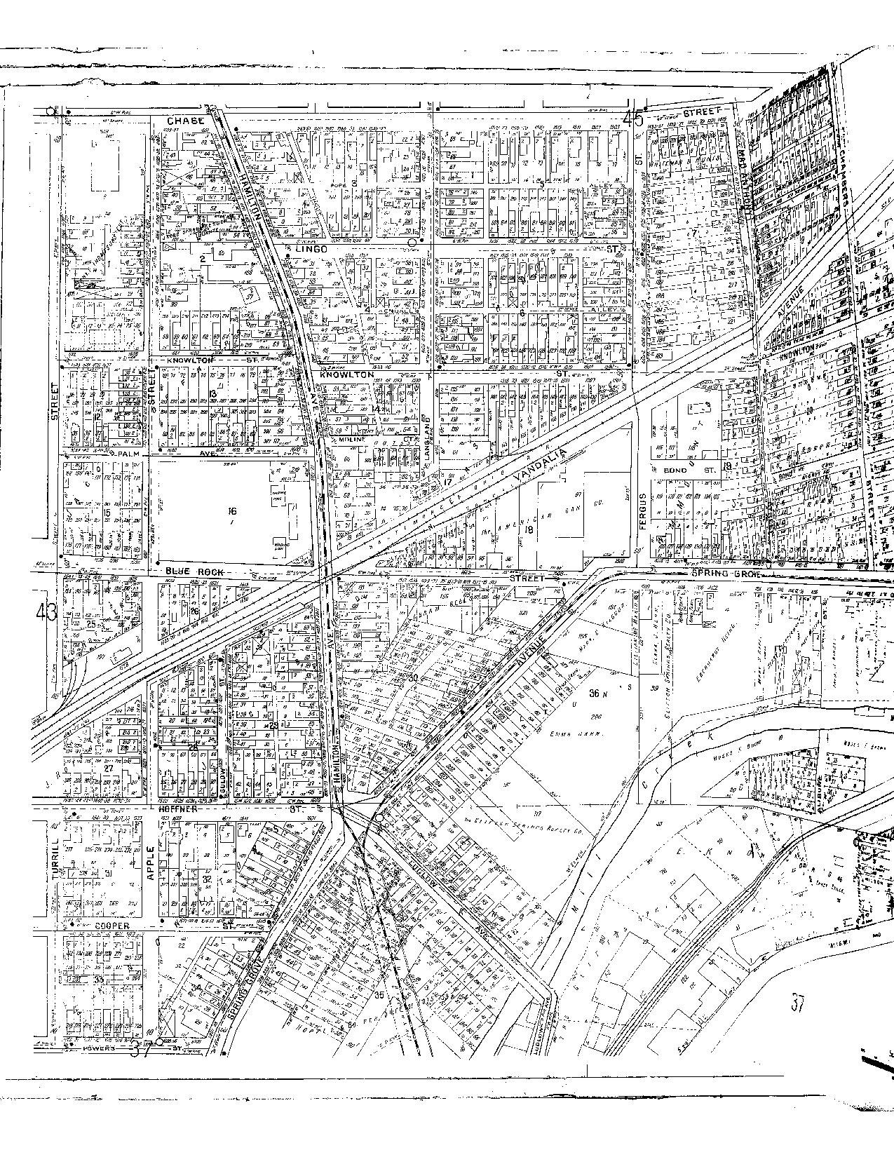
English: Sanborn map of the present-day Northside neighborhood of Cincinnati, Ohio, United States. The intersection of Blue Rock, Vandalia, and Hamilton Avenues with the B&O railroad line is located at approximately 39°9'36"N, 84°32'22"W. |
||
| Date | |||
| Source | Black-and-white scan of sheet 44 of volume I of the 1922 Sanborn Fire Insurance Maps | ||
| Author | Sanborn Maps | ||
| Permission (Reusing this file) |
|
File history
Click on a date/time to view the file as it appeared at that time.
| Date/Time | Thumbnail | Dimensions | User | Comment | |
|---|---|---|---|---|---|
| current | 06:19, 15 December 2013 |  | 1,275 × 1,650 (438 KB) | Nyttend (talk | contribs) | {{Object location|39|9|36|N|84|32|22|W}} {{Information |Description={{en|Sanborn Maps|Sanborn map}} of the present-day {{w|Northside, Cincinnati|Northside}} neighborhood of {{w|Cincinnati}}, {{w|Ohio}}, {{w|United States}}. The intersection of Blue Ro... |
You cannot overwrite this file.
File usage on Commons
There are no pages that use this file.