File:Sanborn Fire Insurance Map from Sugar Mill and Cannery, Hawaii County, Hawaii. LOC sanborn01553 001-11.tif
Jump to navigation
Jump to search

Size of this JPG preview of this TIF file: 500 × 599 pixels. Other resolutions: 200 × 240 pixels | 400 × 480 pixels | 641 × 768 pixels | 854 × 1,024 pixels | 1,709 × 2,048 pixels | 6,408 × 7,680 pixels.
Original file (6,408 × 7,680 pixels, file size: 140.8 MB, MIME type: image/tiff)
Captions
Captions
Add a one-line explanation of what this file represents
Summary
[edit]| Description |
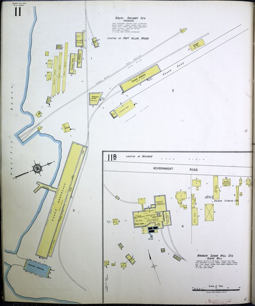
English: 1919. 38 Sheet(s). Includes Map of the Territory of Hawaii. Bound. |
||
| Title | Sanborn Fire Insurance Map from Sugar Mill and Cannery, Hawaii County, Hawaii. | ||
| Shelf ID | https://www.loc.gov/item/sanborn01553_001/ | ||
| Parent | https://www.loc.gov/resource/g4380m.g015531919/ | ||
| Sheet title | Image 11 of Sanborn Fire Insurance Map from Sugar Mill and Cannery, Hawaii County, Hawaii. | ||
| Date | |||
| Source | https://www.loc.gov/item/sanborn01553_001/ | ||
| Author | Unknown author | ||
| Permission (Reusing this file) |
|
||
| Other versions |
|
||
| Location | Hawaii County · Map Of The Territory Of Hawaii · Hawaii · Sugar Mill · Cannery | ||
| Part of | American Memory · Sanborn Maps · Geography And Maps Division · Sanborn Fire Insurance Maps |


Licensing
[edit]|
This is a faithful photographic reproduction of a two-dimensional, public domain work of art. The work of art itself is in the public domain for the following reason:
The official position taken by the Wikimedia Foundation is that "faithful reproductions of two-dimensional public domain works of art are public domain".
This photographic reproduction is therefore also considered to be in the public domain in the United States. In other jurisdictions, re-use of this content may be restricted; see Reuse of PD-Art photographs for details. | ||||
File history
Click on a date/time to view the file as it appeared at that time.
| Date/Time | Thumbnail | Dimensions | User | Comment | |
|---|---|---|---|---|---|
| current | 05:23, 12 July 2018 |  | 6,408 × 7,680 (140.8 MB) | Fæ (talk | contribs) | LOC Maps multisheet https://www.loc.gov/item/sanborn01553_001/ sheet 11 of 38 #21771 |
You cannot overwrite this file.
File usage on Commons
The following 3 pages use this file:
- User:Holly Cheng/Recent uploads/Hawaii/2018 July 12
- File:Kauai Railway Company's terminal located at Port Allen in 1919, from- Sanborn Fire Insurance Map from Sugar Mill and Cannery, Hawaii County, Hawaii. LOC sanborn01553 001-11 (cropped).tif
- File:Sanborn Fire Insurance Map from Sugar Mill and Cannery, Hawaii County, Hawaii. LOC sanborn01553 001-11.jpg