File:SCS administrative division and offices, Area 3, Texas LOC 89695104.tif
Jump to navigation
Jump to search

Size of this JPG preview of this TIF file: 789 × 600 pixels. Other resolutions: 316 × 240 pixels | 632 × 480 pixels | 1,011 × 768 pixels | 1,280 × 973 pixels | 2,560 × 1,946 pixels | 7,483 × 5,687 pixels.
Original file (7,483 × 5,687 pixels, file size: 121.75 MB, MIME type: image/tiff)
Captions
Captions
Add a one-line explanation of what this file represents
Summary
[edit]| Description |
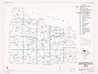
English: "Base compiled from USGS National atlas, 1970 edition." In lower right corner: October 1987 1002932." "Source: Data compiled by SCS field personnel." Includes index to soil and water conservation districts and location map. Available also through the Library of Congress Web site as a raster image. |
||
| Title | SCS administrative division and offices, Area 3, Texas | ||
| Shelf ID | G4031.J1 1988 .U5 | ||
| Date | |||
| Source | https://www.loc.gov/item/89695104/ | ||
| Author | National Cartographic Center (U.S.); United States. Soil Conservation Service | ||
| Permission (Reusing this file) |
|
||
| Other versions |
|
||
| Location | United States · Texas. · Texas | ||
| Part of | American Memory · Catalog · Geography And Map Division · Additional Conservation And Environment Cartographic Items | ||
| Subject | Soil Conservation Service · United States · Maps · Soil Conservation Districts · Water Districts · Texas |


Licensing
[edit]| This work is from the Library of Congress. According to the library, there are no known copyright restrictions on the use of this work. |  |
File history
Click on a date/time to view the file as it appeared at that time.
| Date/Time | Thumbnail | Dimensions | User | Comment | |
|---|---|---|---|---|---|
| current | 10:29, 8 November 2019 |  | 7,483 × 5,687 (121.75 MB) | Fæ (talk | contribs) | LOC Maps https://www.loc.gov/item/89695104/ #23992 |
You cannot overwrite this file.
File usage on Commons
The following page uses this file: