File:Südliche Ostalpen.png
Jump to navigation
Jump to search

Size of this preview: 800 × 311 pixels. Other resolutions: 320 × 124 pixels | 640 × 249 pixels | 1,024 × 398 pixels | 1,280 × 497 pixels | 2,560 × 995 pixels | 5,978 × 2,323 pixels.
Original file (5,978 × 2,323 pixels, file size: 5.13 MB, MIME type: image/png)
Captions
Captions
Add a one-line explanation of what this file represents
| Description |
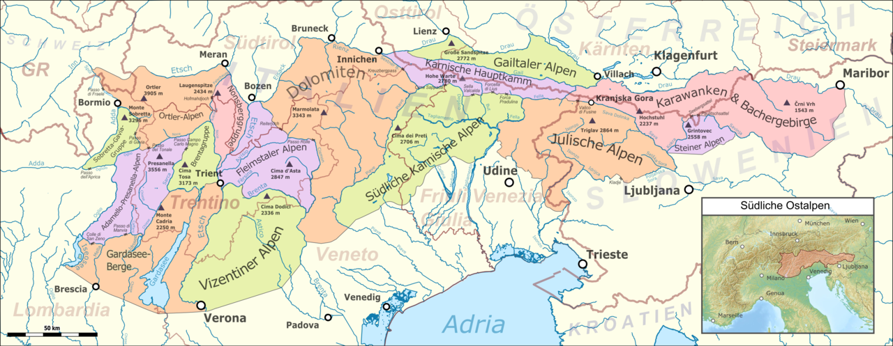
Deutsch: Lagekarte der südlichen Ostalpen |
|||||||||
| Date | ||||||||||
| Source |
Map was created using:
|
|||||||||
| Creator |
|
|||||||||
| Permission (Reusing this file) |
Map data (c) OpenStreetMap (and) contributors, CC-BY-SA | |||||||||
| Geotemporal data | ||||||||||
| Bounding box |
|
|||||||||
| Georeferencing | ||||||||||
I, the copyright holder of this work, hereby publish it under the following licenses:

|
Permission is granted to copy, distribute and/or modify this document under the terms of the GNU Free Documentation License, Version 1.2 or any later version published by the Free Software Foundation; with no Invariant Sections, no Front-Cover Texts, and no Back-Cover Texts. A copy of the license is included in the section entitled GNU Free Documentation License. |
This file is licensed under the Creative Commons Attribution-Share Alike 3.0 Unported license.
- You are free:
- to share – to copy, distribute and transmit the work
- to remix – to adapt the work
- Under the following conditions:
- attribution – You must give appropriate credit, provide a link to the license, and indicate if changes were made. You may do so in any reasonable manner, but not in any way that suggests the licensor endorses you or your use.
- share alike – If you remix, transform, or build upon the material, you must distribute your contributions under the same or compatible license as the original.
You may select the license of your choice.
File history
Click on a date/time to view the file as it appeared at that time.
| Date/Time | Thumbnail | Dimensions | User | Comment | |
|---|---|---|---|---|---|
| current | 03:56, 17 January 2019 | 5,978 × 2,323 (5.13 MB) | Pechristener (talk | contribs) | improved color scheme | |
| 21:40, 8 January 2019 | 5,978 × 2,323 (5.14 MB) | Pechristener (talk | contribs) | typo Adria fixed | ||
| 12:01, 6 May 2018 | 5,978 × 2,323 (5.14 MB) | Pechristener (talk | contribs) | Korrekturen: Trentino eingetragen, Ortler und Grenze bei Marmolata | ||
| 22:55, 26 August 2017 | 5,978 × 2,323 (5.11 MB) | Pechristener (talk | contribs) | Karnischer Hauptkamm beschriftet / Grenze zwischen Fleimstaler Alpen und Dolomiten korr / Grappastock hinzu | ||
| 06:57, 12 August 2017 | 5,978 × 2,323 (5.1 MB) | Pechristener (talk | contribs) | {{Map |Description={{de|1=Lagekarte der südlichen Ostalpen}} |Source = Map was created using: *[http://www.openstreetmap.org/ Open Street Map] Data *Alps location map.png for location... |
You cannot overwrite this file.
File usage on Commons
The following 3 pages use this file:
File usage on other wikis
The following other wikis use this file:
- Usage on als.wikipedia.org
- Usage on de.wikipedia.org
- Dolomiten
- Karnische Alpen
- Ostalpen
- Südalpen
- Julische Alpen
- Steiner Alpen
- Gailtaler Alpen
- Brenta (Gebirge)
- Vorlage:Navigationsleiste Südliche Ostalpen nach AVE
- Karawanken und Bachergebirge
- Gardaseeberge
- Nonsberggruppe
- Ortler-Alpen
- Adamello-Presanella-Alpen
- Sobretta-Gavia-Gruppe
- Fleimstaler Alpen
- Vizentiner Alpen
- Südliche Karnische Alpen
- Benutzer:FkMohr/Baustelle/Alpen-Einteilung
- Benutzer Diskussion:Pechristener/Alpenkarten
- Karnischer Hauptkamm
- Usage on es.wikipedia.org
- Usage on hu.wikipedia.org
- Usage on sk.wikipedia.org