Category:Files by User:FkMohr/Karte
Jump to navigation
Jump to search

Karten, insbesondere die von Pechristener gezeichneten; siehe auch Alpen-Karten & Liste der Positionskarten (d).
Ziffern am Beginn des Namens (ein- bis dreistellig) entsprechen der Nummerierung von SchweizMobil; vierstellige sind Höhen in Metern über Meeresspiegel.
Media in category "Files by User:FkMohr/Karte"
The following 180 files are in this category, out of 180 total.
-
 1812-Malojapass.jpg 1,268 × 894; 362 KB
-
 20 grüne Hauptwege.jpg 962 × 759; 188 KB
-
 27-S.T.M.Rosa.jpg 494 × 513; 198 KB
-
 45-Karte.jpg 691 × 641; 285 KB
-
 Aare.svg 800 × 450; 407 KB
-
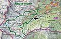
 Albula-Alpen.png 2,846 × 2,820; 2.1 MB
-
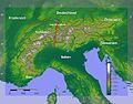
 Alpen zwischen Allgäu und Gardasee.png 3,999 × 4,331; 6.71 MB
-
 Alpen zwischen Chiemsee und Dolomiten.png 6,412 × 6,380; 10.01 MB
-
 Alpen zwischen Salzkammergut und Neusiedler See.png 5,204 × 4,260; 6.38 MB
-
 Alpenkarte.svg 3,178 × 1,871; 2.42 MB
-
 Alps-WestEast.jpg 1,200 × 937; 491 KB
-
 Ampezzaner Dolomiten.png 4,311 × 5,006; 5.5 MB
-
 Appenzeller Alpen.png 2,265 × 2,004; 1.98 MB
-
 AV-Karte-4-2.png 500 × 464; 497 KB
-
 AV-Karte-BY16.jpg 533 × 368; 416 KB
-
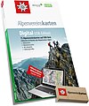 AV-Karte-Digital.jpg 2,111 × 2,523; 2.87 MB
-
 AV-Karten.jpg 600 × 600; 309 KB
-
 Berchtesgadener Alpen.png 3,493 × 3,413; 2.52 MB
-
 Berner Alpen.png 2,999 × 2,007; 2.35 MB
-
 Bernina-Alpen.png 4,917 × 3,633; 3.2 MB
-
 Bregenzerwaldgebirge.png 3,366 × 3,238; 2.77 MB
-
 Civettagruppe.png 4,311 × 5,006; 5.48 MB
-
 E1 route map.png 616 × 645; 320 KB
-
 E101Höhenprofil.jpg 799 × 378; 75 KB
-
 E3 route map.png 616 × 644; 325 KB
-
 Emmentaler Alpen.png 3,758 × 3,784; 3.26 MB
-
 Euro-Map-all.png 1,918 × 2,012; 329 KB
-
 Fanesgruppe ohne Parseispitze.png 4,311 × 5,006; 5.49 MB
-
 Fanesgruppe.png 4,311 × 5,006; 5.49 MB
-
 Geislergruppe Karte.png 4,311 × 5,006; 5.49 MB
-
 Glarner Alpen Map.png 4,984 × 3,979; 4.82 MB
-
 Gotthard-Gruppe.png 1,995 × 1,307; 1.08 MB
-
 GsponerHwKarte.jpg 525 × 690; 304 KB
-
 Karte Adamello-Presanella-Alpen.png 3,165 × 3,750; 3.3 MB
-
 Karte Adula-Alpen.png 3,295 × 3,757; 2.98 MB
-
 Karte Allgäuer Alpen.png 3,488 × 2,013; 2.61 MB
-
 Karte Ammergauer Alpen.png 3,721 × 3,458; 2.54 MB
-
 Karte Ankogelgruppe.png 4,202 × 4,601; 3.48 MB
-
 Karte Bayerische Voralpen2.png 5,632 × 3,096; 3.8 MB
-
 Karte Belledonne-Gruppe.png 3,131 × 3,534; 3.06 MB
-
 Karte Bergamasker Alpen.png 3,705 × 2,426; 3.27 MB
-
 Karte Brandenberger Alpen.png 5,298 × 3,366; 2.89 MB
-
 Karte Brentagruppe.png 2,988 × 3,084; 1.99 MB
-
 Karte Dachsteingebirge.png 3,744 × 2,075; 1.64 MB
-
 Karte der Gebirgsgruppen in den Alpen.png 9,930 × 5,848; 9.32 MB
-
 Karte der Nonsberggruppe.png 674 × 690; 263 KB
-
 Karte Dolomiten Bosconero.png 4,311 × 5,006; 5.48 MB
-
 Karte Dolomiten mit Cimonegagruppe.png 4,311 × 5,006; 5.5 MB
-
 Karte Dolomiten mit Grappastock.png 4,311 × 5,006; 5.47 MB
-
 Karte Dolomiten.png 4,311 × 5,006; 5.46 MB
-
 Karte Fleimstaler Alpen.png 5,204 × 4,861; 5.48 MB
-
 Karte Freiburger Alpen.png 4,742 × 3,670; 4.52 MB
-
 Karte Gardaseeberge.png 2,287 × 1,961; 1.8 MB
-
 Karte Glocknergruppe.png 3,311 × 3,011; 1.99 MB
-
 Karte Goldberggruppe.png 4,271 × 5,164; 3.09 MB
-
 Karte Kaisergebirge.png 2,649 × 1,862; 1.22 MB
-
 Karte Kitzbüheler Alpen.png 3,937 × 2,344; 2.34 MB
-
 Karte Kreuzeckgruppe.png 4,348 × 2,426; 1.85 MB
-
 Karte Lechquellengebirge.png 4,167 × 3,372; 2.83 MB
-
 Karte Lechtaler Alpen.png 3,407 × 2,481; 2.59 MB
-
 Karte Livigno-Alpen.png 1,500 × 1,603; 1.04 MB
-
 Karte Loferer und Leoganger Steinberge.png 2,481 × 1,537; 1.11 MB
-
 Karte Mont-Blanc-Gruppe.png 1,884 × 1,981; 1.8 MB
-
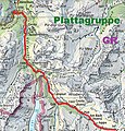
 Karte Plattagruppe.png 744 × 801; 387 KB
-
 Karte Plessur-Alpen.png 2,940 × 2,508; 1.62 MB
-
 Karte Rieserfernergruppe.png 3,049 × 2,804; 1.58 MB
-
 Karte Salzburger Schieferalpen.png 3,813 × 1,717; 1.6 MB
-
 Karte Schobergruppe.png 2,983 × 2,675; 1.68 MB
-
 Karte Sesvennagruppe.png 4,644 × 3,800; 2.97 MB
-
 Karte Stubaier Alpen.png 3,354 × 3,366; 3.21 MB
-
 Karte Tennengebirge.png 2,259 × 1,685; 1.04 MB
-
 Karte Tessiner Alpen.png 2,855 × 3,041; 3.21 MB
-
 Karte Turtmanntal.jpg 425 × 642; 222 KB
-
 Karte Venedigergruppe.png 5,130 × 3,976; 3.49 MB
-
 Karte ViaJacobi.jpg 1,121 × 720; 583 KB
-
 Karte Villgratner Berge.png 5,325 × 2,546; 2.51 MB
-
 Karte Vizentiner Alpen.png 5,255 × 4,783; 7.19 MB
-
 Karte Zillertaler Alpen.png 4,014 × 3,603; 3.51 MB
-
 Karte-1.jpg 747 × 490; 173 KB
-
 Karte-159.jpg 479 × 607; 255 KB
-
 Karte-180.jpg 420 × 602; 223 KB
-
 Karte-182.jpg 1,113 × 622; 541 KB
-
 Karte-186.jpg 561 × 363; 168 KB
-
 Karte-193.jpg 905 × 672; 408 KB
-
 Karte-2.jpg 719 × 469; 163 KB
-
 Karte-221.jpg 512 × 719; 298 KB
-
 Karte-25.jpg 630 × 514; 231 KB
-
 Karte-3.jpg 747 × 492; 177 KB
-
 Karte-33.jpg 746 × 583; 223 KB
-
 Karte-35.jpg 674 × 805; 287 KB
-
 Karte-353.jpg 1,039 × 684; 562 KB
-
 Karte-39.jpg 829 × 552; 367 KB
-
 Karte-40.jpg 374 × 756; 170 KB
-
 Karte-43.jpg 1,459 × 431; 327 KB
-
 Karte-49.jpg 746 × 533; 312 KB
-
 Karte-50.jpg 437 × 470; 110 KB
-
 Karte-53.jpg 748 × 446; 246 KB
-
 Karte-56.jpg 449 × 474; 177 KB
-
 Karte-564.jpg 546 × 551; 234 KB
-
 Karte-566.jpg 1,198 × 603; 396 KB
-
 Karte-569.jpg 465 × 652; 250 KB
-
 Karte-57.jpg 523 × 550; 203 KB
-
 Karte-570.jpg 791 × 642; 389 KB
-
 Karte-573.jpg 453 × 547; 211 KB
-
 Karte-574.jpg 1,056 × 362; 308 KB
-
 Karte-587.jpg 719 × 711; 391 KB
-
 Karte-59.jpg 378 × 501; 151 KB
-
 Karte-590.jpg 1,658 × 708; 906 KB
-
 Karte-595.jpg 1,078 × 350; 307 KB
-
 Karte-599.jpg 1,106 × 562; 465 KB
-
 Karte-6.jpg 1,152 × 571; 458 KB
-
 Karte-60.jpg 1,453 × 375; 367 KB
-
 Karte-64.jpg 550 × 696; 199 KB
-
 Karte-676.jpg 416 × 748; 250 KB
-
 Karte-7.jpg 716 × 463; 161 KB
-
 Karte-702.jpg 511 × 510; 211 KB
-
 Karte-72.jpg 658 × 437; 187 KB
-
 Karte-726.jpg 1,127 × 724; 573 KB
-
 Karte-757.jpg 774 × 809; 466 KB
-
 Karte-787.jpg 1,097 × 551; 481 KB
-
 Karte-796.jpg 847 × 621; 432 KB
-
 Karte-806.jpg 397 × 560; 188 KB
-
 Karte-827.jpg 946 × 412; 293 KB
-
 Karte-829.jpg 951 × 722; 440 KB
-
 Karte-831.jpg 804 × 548; 305 KB
-
 Karte-85.jpg 1,584 × 605; 630 KB
-
 Karte-87.jpg 639 × 690; 242 KB
-
 Karte-88.jpg 577 × 529; 226 KB
-
 Karte-893.jpg 347 × 717; 191 KB
-
 Karte-931.jpg 675 × 729; 396 KB
-
 Karte-988.jpg 595 × 639; 291 KB
-
 Karwendel map.png 5,425 × 4,541; 3.94 MB
-
 Lagekarte Chiemgauer Alpen.png 7,550 × 4,408; 5.64 MB
-
 Lagekarte der Langkofelgruppe.png 4,311 × 5,006; 5.52 MB
-
 Lagekarte Granatspitzgruppe.png 2,854 × 4,735; 2.24 MB
-
 Lagekarte Latemar.png 4,311 × 5,006; 5.37 MB
-
 Lagekarte Marmarole.png 4,311 × 5,006; 5.38 MB
-
 Lagekarte Sella.png 4,311 × 5,006; 5.48 MB
-
 Langkofelgruppe nach Bergalbum.png 4,311 × 5,006; 5.52 MB
-
 Leone-Gruppe.png 2,571 × 2,819; 2.48 MB
-
 Lüsner Berge.png 4,311 × 5,006; 5.5 MB
-
 Marmolatagruppe.png 4,311 × 5,006; 5.49 MB
-
 Mieminger Kette map2.png 3,731 × 2,062; 1.34 MB
-
 Mieminger Kette.svg 1,343 × 742; 790 KB
-
 Mittlere Ostalpen.png 6,406 × 4,119; 7.87 MB
-
 Oestliche Westalpen.svg 2,341 × 2,252; 3.29 MB
-
 Ortler-Alpen (nach Ernst Höhne).png 1,447 × 1,057; 804 KB
-
 Ortler-Alpen.png 1,447 × 1,057; 788 KB
-
 Ortlergruppe (nach Moriggl 1924).png 1,447 × 1,057; 809 KB
-
 Palagruppe.png 4,311 × 5,006; 5.5 MB
-
 Peitlerkofel-Plose-Gruppe.png 4,311 × 5,006; 5.5 MB
-
 Peitlerkofelgruppe.png 4,311 × 5,006; 5.5 MB
-
 Pelmostock.png 4,311 × 5,006; 5.49 MB
-
 Pragser Dolomiten.png 4,311 × 5,006; 5.49 MB
-
 Puez-Geisler-Gruppe nach Bergalbum.png 4,311 × 5,006; 5.47 MB
-
 Puez-Geisler-Gruppe nach Höhne.png 4,311 × 5,006; 5.5 MB
-
 Puezgruppe.png 4,311 × 5,006; 5.5 MB
-
 Rosengarten Map.png 4,311 × 5,006; 5.49 MB
-
 Rätikon map.png 3,154 × 3,857; 2.71 MB
-
 Samnaungruppe.png 4,144 × 3,936; 2.22 MB
-
 Schiaragruppe.png 4,311 × 5,006; 5.5 MB
-
 Schlerngruppe.png 4,311 × 5,006; 5.58 MB
-
 Schwyzer Alpen.png 3,749 × 2,666; 2.98 MB
-
 SchwyzerAlpen.png 1,920 × 1,080; 4.24 MB
-
 Sextner Dolomiten.png 4,311 × 5,006; 5.5 MB
-
 Silvretta map.png 1,925 × 1,378; 851 KB
-
 Sobretta-Gavia-Gruppe.png 768 × 669; 271 KB
-
 Südliche Ostalpen.png 5,978 × 2,323; 5.13 MB
-
 Tambogruppe.png 1,732 × 2,457; 2.22 MB
-
 Tuxer Alpen Karte.png 4,847 × 4,398; 3.51 MB
-
 Urner Alpen.png 2,626 × 3,512; 2.65 MB
-
 Verwall Karte.png 2,863 × 1,387; 1.13 MB
-
 Verwall-Lage.png 683 × 485; 816 KB
-
 ViaAltaValleM.jpg 800 × 796; 110 KB
-
 Walliser Alpen.png 2,412 × 1,733; 2.28 MB
-
 Westliche Ostalpen.png 4,000 × 3,889; 6.72 MB
-
 Westliche Westalpen.png 5,137 × 6,677; 7.98 MB
-
 Wettersteingebirge map.png 3,731 × 1,630; 1.07 MB
-
 Wettersteingebirge und Mieminger Kette.png 3,731 × 3,009; 1.98 MB
-
 Ötztaler Alpen Map.png 4,710 × 4,941; 5.42 MB


.png)

.png)


