File:Søre Harildstad site plan 2012.jpg
Jump to navigation
Jump to search
Size of this preview: 439 × 600 pixels. Other resolutions: 176 × 240 pixels | 351 × 480 pixels | 562 × 768 pixels | 750 × 1,024 pixels | 1,331 × 1,818 pixels.
Original file (1,331 × 1,818 pixels, file size: 506 KB, MIME type: image/jpeg)
Captions
Captions
Add a one-line explanation of what this file represents
Summary
[edit]
| Description |
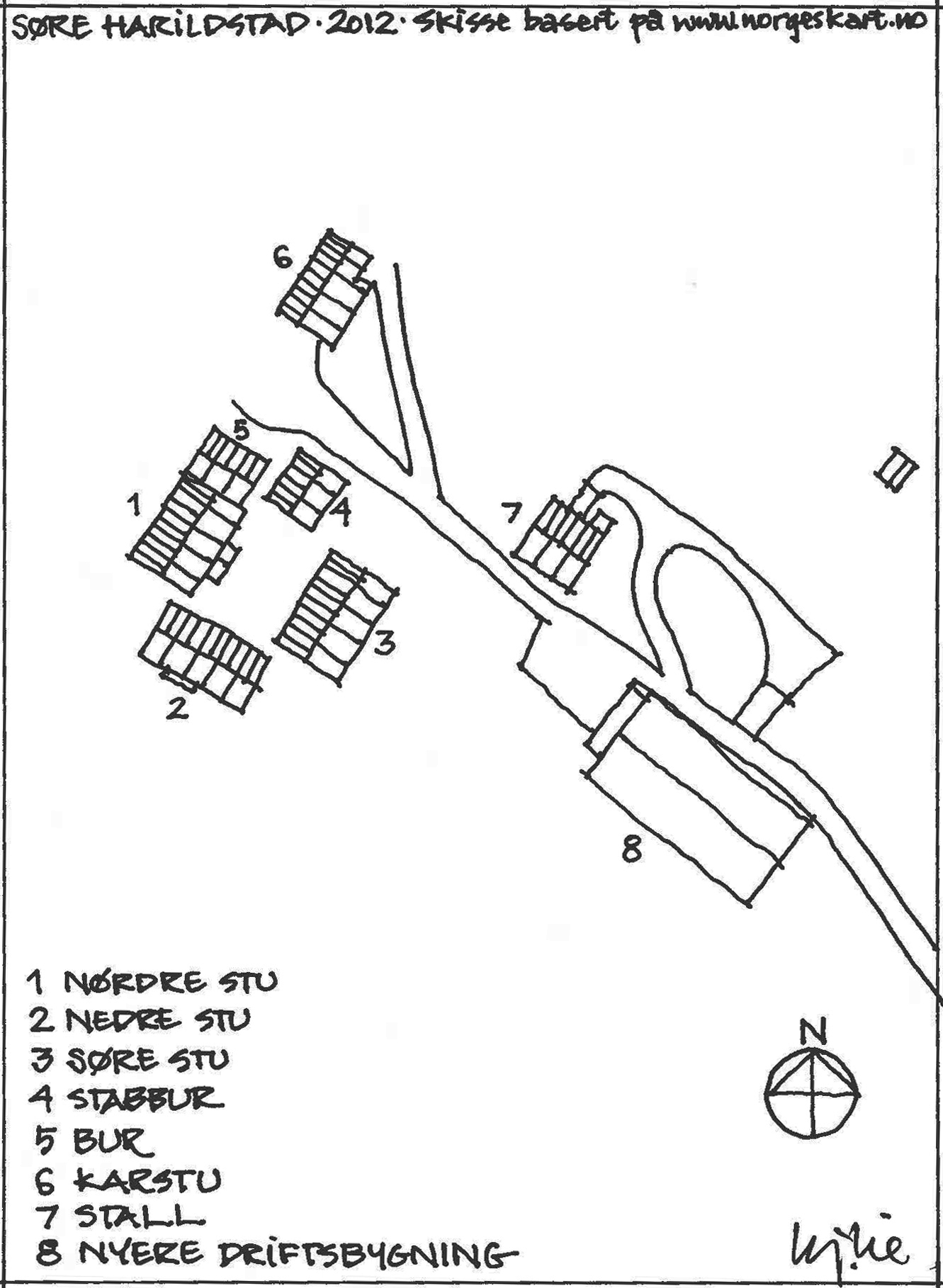
English: site plan sketch of the farm Søre Harildstad, Nedre Heidal, Norway, as it appeared in 2012. The plan shows where the listed buildings are situated
Norsk bokmål: Situasjonsplan-skisse av Søre Harildstad, Nedre Heidal, Sel kommune. Planen viser hvor de fredete bygningene er plassert
Deutsch: Søre Harildstad, Nedre Heidal, Norwegen, Situation 2012; Lageplan des Gutes - 1. Nördliches Wohnhaus, 2. Unteres Wohnhaus, 3. Südliches Wohnhaus, 4. Lebensmittelspeicher, 5. Schlafhaus / Gästeschlafplatz, 6. Ausgedingehaus, 7. Stall, 8. Neues Stallgebäude |
| Date | |
| Source | Own work - Kj. Lie, sketch based on map from http://norgeskart.no |
| Author | Kjersti Lie |
Licensing
[edit]
I, the copyright holder of this work, hereby publish it under the following licenses:
This file is licensed under the Creative Commons Attribution-Share Alike 3.0 Unported license.
- You are free:
- to share – to copy, distribute and transmit the work
- to remix – to adapt the work
- Under the following conditions:
- attribution – You must give appropriate credit, provide a link to the license, and indicate if changes were made. You may do so in any reasonable manner, but not in any way that suggests the licensor endorses you or your use.
- share alike – If you remix, transform, or build upon the material, you must distribute your contributions under the same or compatible license as the original.

|
Permission is granted to copy, distribute and/or modify this document under the terms of the GNU Free Documentation License, Version 1.2 or any later version published by the Free Software Foundation; with no Invariant Sections, no Front-Cover Texts, and no Back-Cover Texts. A copy of the license is included in the section entitled GNU Free Documentation License. |
You may select the license of your choice.
File history
Click on a date/time to view the file as it appeared at that time.
| Date/Time | Thumbnail | Dimensions | User | Comment | |
|---|---|---|---|---|---|
| current | 20:18, 31 October 2012 | | 1,331 × 1,818 (506 KB) | Kjersti Lie (talk | contribs) | {{Information |Description ={{en|1=site plan sketch of the farm Søre Harildstad, Nedre Heidal, Norway, as it appeared in 2012. The plan shows where the listed buildings are situated}} {{no|1=Situasjonsplan-skisse av Søre Harildstad, Nedre Heidal, ... |
You cannot overwrite this file.
File usage on Commons
There are no pages that use this file.
File usage on other wikis
The following other wikis use this file:
- Usage on de.wikipedia.org
- Usage on no.wikipedia.org