File:Russland BV043569922.jpg
Jump to navigation
Jump to search

Size of this preview: 795 × 600 pixels. Other resolutions: 318 × 240 pixels | 636 × 480 pixels | 1,018 × 768 pixels | 1,280 × 966 pixels | 1,879 × 1,418 pixels.
Original file (1,879 × 1,418 pixels, file size: 426 KB, MIME type: image/jpeg)
Captions
Captions
Add a one-line explanation of what this file represents
Summary
[edit]| Title |
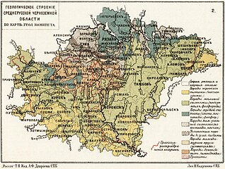
Geologičeskoe stroenīe srednerusskoj černozemnoj oblasti po kart Geol. Komiteta |
|||||||||||||||||||||||
| Description |
Deutsch: Russland, Zentralrussland, Geologie |
|||||||||||||||||||||||
| Date | ||||||||||||||||||||||||
| Source | Leibniz-Institut für Ost- und Südosteuropaforschung (IOS) GeoPortOst | |||||||||||||||||||||||
| Permission (Reusing this file) |
|
|||||||||||||||||||||||
| Geotemporal data | ||||||||||||||||||||||||
| Map location | Russland | |||||||||||||||||||||||
| Bounding box |
|
|||||||||||||||||||||||
| Georeferencing | ||||||||||||||||||||||||
| Bibliographic data | ||||||||||||||||||||||||
| Map sheet | 2. (nach S. 16) | |||||||||||||||||||||||
| Language | Russian | |||||||||||||||||||||||
| Archival data | ||||||||||||||||||||||||
| Collection |
|
|||||||||||||||||||||||
| Accession number |
BV043569922 |
|||||||||||||||||||||||

Licensing
[edit]
|
This work is in the public domain in its country of origin and other countries and areas where the copyright term is the author's life plus 70 years or fewer. | |
| This file has been identified as being free of known restrictions under copyright law, including all related and neighboring rights. | |
File history
Click on a date/time to view the file as it appeared at that time.
| Date/Time | Thumbnail | Dimensions | User | Comment | |
|---|---|---|---|---|---|
| current | 16:05, 22 November 2023 | | 1,879 × 1,418 (426 KB) | Enyavar (talk | contribs) | Cropped 27 % horizontally, 26 % vertically, rotated -0.2° using CropTool with precise mode. |
| 15:44, 19 February 2019 |  | 2,584 × 1,924 (543 KB) | H.bauer26 (talk | contribs) | pattypan 18.02 |
You cannot overwrite this file.
File usage on Commons
The following page uses this file: