File:Russia - DPLA - 5220a17f657dc58028d577c3d241509d.jpg
Jump to navigation
Jump to search
Size of this preview: 769 × 600 pixels. Other resolutions: 308 × 240 pixels | 616 × 480 pixels | 985 × 768 pixels | 1,280 × 998 pixels | 2,560 × 1,996 pixels | 3,278 × 2,556 pixels.
Original file (3,278 × 2,556 pixels, file size: 1.24 MB, MIME type: image/jpeg)
Captions
Captions
Add a one-line explanation of what this file represents
Summary
[edit]| Russia
( |
||||||||||||||
|---|---|---|---|---|---|---|---|---|---|---|---|---|---|---|
| Author |
Central Intelligence Agency |
|||||||||||||
| Creator | Central Intelligence Agency. 12/4/1981 | |||||||||||||
| Title |
Russia |
|||||||||||||
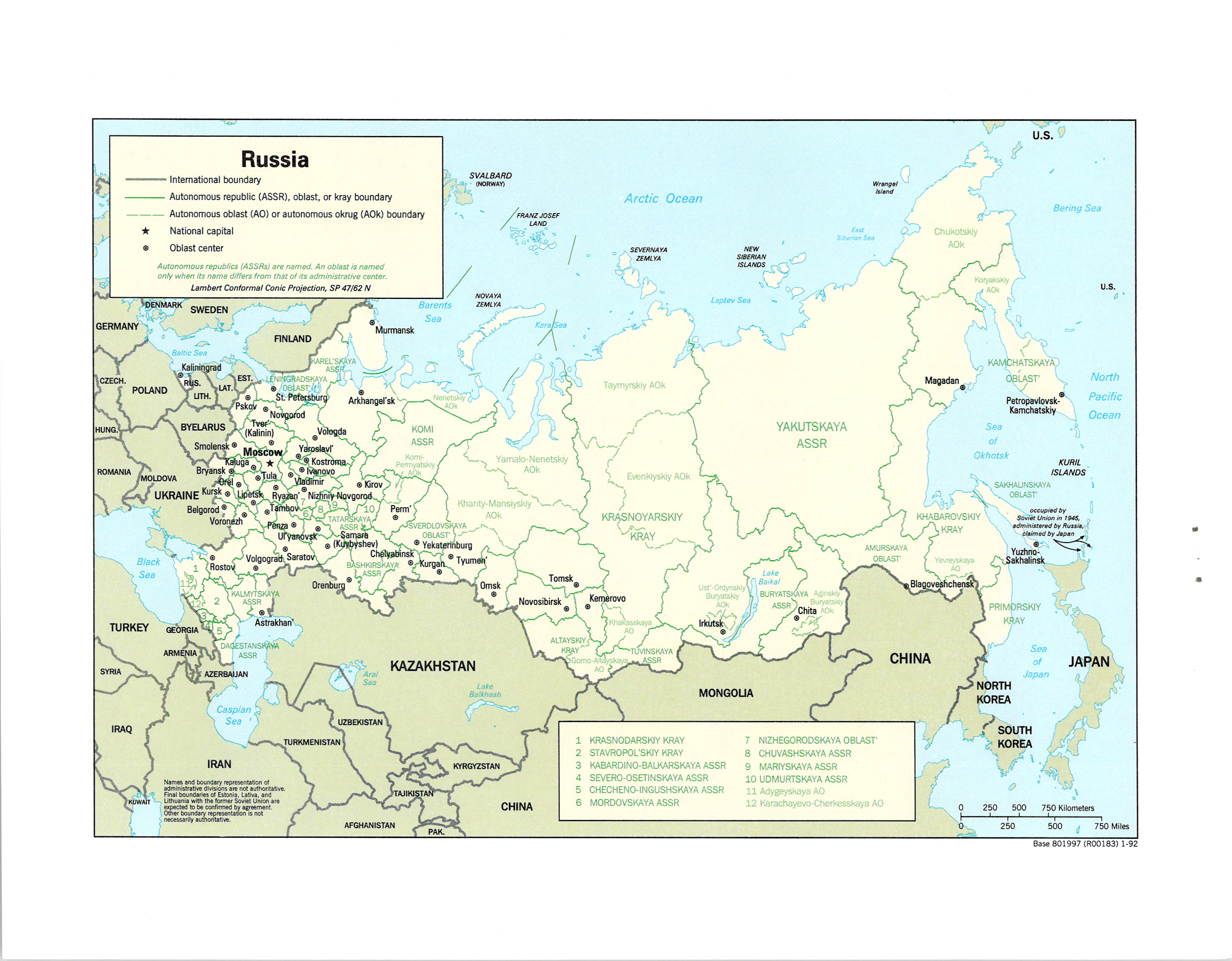
| Description |
Lambert Conformal Conic Projection, standard parallels 47N and 62N. Includes Kaliningrad, Novaya Zemlya, Franz Josef Land, Severnaya Zemlya, New Siberian Islands, Wrangel Island, Kuril Islands, Sakhalin Island, and islands occupied by Soviet Union in 1945, administered by Russia, claimed by Japan. Also includes Svalbard (Norway). |
|||||||||||||
| Collection |
|
|||||||||||||
| Source/Photographer |
|
|||||||||||||
| Permission (Reusing this file) |
|
|||||||||||||
| Standardized rights statement |
|
|||||||||||||

File history
Click on a date/time to view the file as it appeared at that time.
| Date/Time | Thumbnail | Dimensions | User | Comment | |
|---|---|---|---|---|---|
| current | 07:59, 8 March 2023 | | 3,278 × 2,556 (1.24 MB) | DPLA bot (talk | contribs) | Uploading DPLA ID dpla:5220a17f657dc58028d577c3d241509d |
You cannot overwrite this file.
File usage on Commons
The following page uses this file: