Category:US National Archives series: Published Maps, 1947 - 2015
Jump to navigation
Jump to search
This series consists of published maps of most countries and world regions. Included are base and briefing base maps; maps depicting terrain, sociological, transportation, political, and economic features; maps depicting administrative, military, and treaty boundaries; maps of urban areas; and maps showing ethnic distributions or narcotics trade routes. Also included are thematic maps, charts, graphs, and organization charts relating to various topics of the Cold War, including the Soviet Union, China, Cuba, and the Vietnam War.
From ca. 1967 to ca. 1990, maps in this series were produced or acquired by both the Map Service Center and the Directorate of Intelligence.
Media in category "US National Archives series: Published Maps, 1947 - 2015"
The following 200 files are in this category, out of 2,307 total.
(previous page) (next page)-
"South Tirol" Austrian Claims Against Italy - DPLA - 9778076732f0b65c465da8600bedefc8.jpg 6,856 × 4,802; 3.42 MB
-
(World) - DPLA - 5826e1c13685b03403bef8b5e601c674 (page 1).jpg 12,004 × 8,833; 9.83 MB
-
(World) - DPLA - 5826e1c13685b03403bef8b5e601c674 (page 10).jpg 12,001 × 8,829; 9.13 MB
-
(World) - DPLA - 5826e1c13685b03403bef8b5e601c674 (page 11).jpg 12,002 × 8,838; 8.59 MB
-
(World) - DPLA - 5826e1c13685b03403bef8b5e601c674 (page 12).jpg 11,997 × 8,833; 8.28 MB
-
(World) - DPLA - 5826e1c13685b03403bef8b5e601c674 (page 13).jpg 11,997 × 8,833; 9.22 MB
-
(World) - DPLA - 5826e1c13685b03403bef8b5e601c674 (page 14).jpg 11,998 × 8,833; 10.59 MB
-
(World) - DPLA - 5826e1c13685b03403bef8b5e601c674 (page 15).jpg 11,997 × 8,833; 10.05 MB
-
(World) - DPLA - 5826e1c13685b03403bef8b5e601c674 (page 16).jpg 12,001 × 8,833; 10.91 MB
-
(World) - DPLA - 5826e1c13685b03403bef8b5e601c674 (page 17).jpg 12,002 × 8,838; 9.5 MB
-
(World) - DPLA - 5826e1c13685b03403bef8b5e601c674 (page 18).jpg 11,994 × 8,833; 8.71 MB
-
(World) - DPLA - 5826e1c13685b03403bef8b5e601c674 (page 19).jpg 12,003 × 8,833; 9.34 MB
-
(World) - DPLA - 5826e1c13685b03403bef8b5e601c674 (page 2).jpg 12,008 × 8,833; 8.61 MB
-
(World) - DPLA - 5826e1c13685b03403bef8b5e601c674 (page 20).jpg 11,997 × 8,829; 8.6 MB
-
(World) - DPLA - 5826e1c13685b03403bef8b5e601c674 (page 21).jpg 12,004 × 8,829; 8.42 MB
-
(World) - DPLA - 5826e1c13685b03403bef8b5e601c674 (page 22).jpg 12,003 × 8,829; 8.51 MB
-
(World) - DPLA - 5826e1c13685b03403bef8b5e601c674 (page 23).jpg 11,998 × 8,833; 9.9 MB
-
(World) - DPLA - 5826e1c13685b03403bef8b5e601c674 (page 24).jpg 12,000 × 8,833; 9.66 MB
-
(World) - DPLA - 5826e1c13685b03403bef8b5e601c674 (page 25).jpg 12,001 × 8,838; 7 MB
-
(World) - DPLA - 5826e1c13685b03403bef8b5e601c674 (page 26).jpg 12,004 × 8,833; 9.46 MB
-
(World) - DPLA - 5826e1c13685b03403bef8b5e601c674 (page 27).jpg 12,001 × 8,838; 7.64 MB
-
(World) - DPLA - 5826e1c13685b03403bef8b5e601c674 (page 28).jpg 12,002 × 8,829; 7.53 MB
-
(World) - DPLA - 5826e1c13685b03403bef8b5e601c674 (page 29).jpg 12,001 × 8,829; 7.51 MB
-
(World) - DPLA - 5826e1c13685b03403bef8b5e601c674 (page 3).jpg 12,003 × 8,833; 10.53 MB
-
(World) - DPLA - 5826e1c13685b03403bef8b5e601c674 (page 30).jpg 11,997 × 8,833; 8.5 MB
-
(World) - DPLA - 5826e1c13685b03403bef8b5e601c674 (page 4).jpg 12,002 × 8,829; 7.95 MB
-
(World) - DPLA - 5826e1c13685b03403bef8b5e601c674 (page 5).jpg 12,006 × 8,833; 11.45 MB
-
(World) - DPLA - 5826e1c13685b03403bef8b5e601c674 (page 6).jpg 12,003 × 8,838; 9.63 MB
-
(World) - DPLA - 5826e1c13685b03403bef8b5e601c674 (page 7).jpg 11,998 × 8,838; 8.73 MB
-
(World) - DPLA - 5826e1c13685b03403bef8b5e601c674 (page 8).jpg 11,995 × 8,833; 12.5 MB
-
(World) - DPLA - 5826e1c13685b03403bef8b5e601c674 (page 9).jpg 12,004 × 8,829; 8.26 MB
-
17737 - North Vietnam Airfields - NARA - 74797469.jpg 7,584 × 3,616; 1.87 MB
-
20172 - North Vietnam Station Locations - NARA - 74797471.jpg 8,138 × 3,616; 3.33 MB
-
22475 - North Vietnam Water Resources- Surface Water - NARA - 74797473.jpg 5,184 × 6,444; 5.53 MB
-
22476 - North Vietnam Water Resources- Ground Water - NARA - 74797475.jpg 5,216 × 6,448; 3.65 MB
-
22477 - North Vietnam Soils - NARA - 74797477.jpg 5,184 × 6,441; 5.02 MB
-
22478 - North Vietnam Rock Types - NARA - 74797479.jpg 4,864 × 6,423; 4.78 MB
-
22479 - North Vietnam Vegetation - NARA - 74797481.jpg 5,184 × 6,446; 5.4 MB
-
22480 - North Vietnam State of Ground - NARA - 74797483.jpg 5,216 × 6,446; 5.67 MB
-
22481 - North Vietnam Cross-Country Movement Conditions - NARA - 74797485.jpg 4,884 × 6,400; 3.02 MB
-
22482 - North Vietnam Suitability for Airfields - NARA - 74797487.jpg 4,864 × 6,440; 4 MB
-
22483 - North Vietnam Suitability for Roads - NARA - 74797489.jpg 5,216 × 6,447; 4.95 MB
-
22484 - North Vietnam Suitability for Underground Installations - NARA - 74797491.jpg 5,216 × 6,448; 3.14 MB
-
29327 - North Vietnam Terrain and Transportation - NARA - 74797493.jpg 4,608 × 5,638; 2.22 MB
-
29461 - North Vietnam Map - NARA - 74797495.jpg 6,592 × 6,746; 3.03 MB
-
29461.1 - North Vietnam Map - NARA - 74797497.jpg 6,592 × 6,744; 4 MB
-
29462 - North Vietnam - NARA - 74797499.jpg 4,032 × 4,113; 1.21 MB
-
29525 - North Vietnam Main Wireline Circuits - NARA - 74797501.jpg 5,152 × 6,275; 3.61 MB
-
43722 - North Vietnam Ports and Naval Facilities - NARA - 74797503.jpg 3,729 × 4,832; 1.99 MB
-
500082 - North Vietnam - NARA - 74797505.jpg 12,023 × 7,520; 10.79 MB
-
500083 - North Vietnam - NARA - 74797507.jpg 5,088 × 5,901; 2.75 MB
-
501271 - North Vietnam - Northern Area - NARA - 74797509.jpg 5,843 × 4,448; 5.34 MB
-
501273 - North Vietnam - Panhandle Area - NARA - 74797511.jpg 4,814 × 6,304; 5.53 MB
-
501426 - North Vietnam - Northern Area - NARA - 74797513.jpg 6,021 × 4,352; 5.21 MB
-
54641 - North Vietnam Destruction of Bridges versus Repair - NARA - 74797515.jpg 3,264 × 3,189; 832 KB
-
55698 - North Vietnam Principal Petroleum Storage Terminals - NARA - 74797517.jpg 3,028 × 3,296; 1.27 MB
-
55699 - North Vietnam Dispersed Petroleum Storage Sites - Tanks - NARA - 74797519.jpg 3,532 × 3,328; 1.49 MB
-
56187 - North Vietnam - NARA - 74797521.jpg 4,832 × 3,168; 1.71 MB
-
Abreus (Cuba) - DPLA - f3f8c29deb042436b62aa3ff9c7e5c47.jpg 6,664 × 5,333; 3.44 MB
-
Afghanistan - DPLA - 37e68321cd458a37687f638ded9529e0.jpg 10,811 × 8,107; 9.94 MB
-
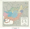
Afghanistan - DPLA - 5f61811742821adc5aa5b80176f394df.jpg 1,999 × 2,073; 5.32 MB
-
Afghanistan - DPLA - 6202a636c51d87c3472e6697361131a4.jpg 2,007 × 2,095; 6.47 MB
-
Afghanistan - DPLA - 8de25d3261ac446cb8feea5024f6ae04.jpg 10,815 × 8,103; 10.16 MB
-
Afghanistan - DPLA - 8ea114902f3ea0f8359fca5429305889.jpg 5,136 × 3,717; 1.41 MB
-
Afghanistan - DPLA - a3d2de20124bf707cec716739a86e833.jpg 2,001 × 2,081; 5.47 MB
-
Afghanistan - DPLA - d14a2421ffcbb4717521c942d51fc1de.jpg 1,999 × 2,083; 4.87 MB
-
Afghanistan - DPLA - fe5e3de26dc5cd233046534e594ce988.jpg 2,649 × 2,158; 924 KB
-
Afghanistan Mineral Resources - DPLA - a982bb69e64e77d42e7d7f8e0a1c5f33.jpg 5,144 × 4,974; 2.74 MB
-
Afghanistan Terrain, Transportation - DPLA - 7c466627809d16bd1eb2d52a89337a17.jpg 6,804 × 6,602; 6.11 MB
-
Afghanistan- Physiography - DPLA - 93d62877edb3e3e76c95a9dee290177d.jpg 3,268 × 2,552; 1.85 MB
-
Afghanistan-Pakistan Border - DPLA - 9e39ecc11a1d6af934e4080d0957d7d6.jpg 2,536 × 3,266; 6.6 MB
-
Africa - DPLA - 0433beede0e3b1bf440b0f3aa4e79c8d.jpg 2,152 × 2,615; 6.94 MB
-
Africa - DPLA - 0d5d3b9e36550eb258b8ab12bb66ab10.jpg 2,125 × 2,637; 7.72 MB
-
Africa - DPLA - 1b1195329aec7c191574d04b3b346c72 (page 1).jpg 2,146 × 2,638; 7.29 MB
-
Africa - DPLA - 1b1195329aec7c191574d04b3b346c72 (page 2).jpg 2,143 × 2,654; 7.21 MB
-
Africa - DPLA - 3ed52280b94eab9d475d06daafe1f5e2.jpg 2,145 × 2,626; 7.11 MB
-
Africa - DPLA - 4d09bdce057f47a4c10b1da417e2af7c.jpg 2,138 × 2,642; 7.32 MB
-
Africa - DPLA - 6ceba089406d5ce6ed2c70c783a0d0f9.jpg 2,151 × 2,645; 6.88 MB
-
Africa - DPLA - 6d193e0ce7e1cc62a3f2326589864bbb.jpg 2,159 × 2,648; 6.29 MB
-
Africa - DPLA - 6de10ba560f6dbae5bb106ef0f41e27e.jpg 2,004 × 2,437; 5.64 MB
-
Africa - DPLA - 81bd787a021c9ea33f45ff8933d11dac.jpg 2,152 × 2,629; 6.04 MB
-
Africa - DPLA - 997136e458f49e013de89a74119d1e50.jpg 2,145 × 2,632; 7.21 MB
-
Africa - DPLA - bbc9897bec2fa05e42444c1402131e48.jpg 2,148 × 2,651; 7.21 MB
-
Africa - DPLA - bfd25525cc1e9d29045735891905f033.jpg 2,134 × 2,632; 6.26 MB
-
Africa - DPLA - c1b1a12c19abc3ceaa63da1e6f7c0bd5.jpg 2,143 × 2,642; 7.73 MB
-
Agricultural Map of Ceylon - DPLA - 8344a0b3321eab305acc2ab8de83346f.jpg 2,819 × 4,355; 1.74 MB
-
Agricultural Regions (China) - DPLA - 85f74580327a588619a8956141c64a49.jpg 2,081 × 1,959; 2.4 MB
-
Aguada De Pasajeros (Cuba) - DPLA - a7fa0338f72df6e0d4bb7a46cf2960df.jpg 6,656 × 5,262; 4.04 MB
-
Airline Routes in Middle America, March 1949 - DPLA - d779114cdb338448496f00e71d092f7f.jpg 12,007 × 8,849; 11.91 MB
-
Airline Routes in South America, March,1949 - DPLA - 587ef873c1242698a31a8378f5cccb42.jpg 8,424 × 12,581; 10.42 MB
-
Alaska - DPLA - 23c1f96fec57f16b8efa44813cc097df.jpg 4,296 × 3,361; 1.5 MB
-
Alaska - DPLA - ce4aaf9b2d7a75850d2f12b8102590ca.jpg 4,232 × 3,332; 1.75 MB
-
Alaska - DPLA - d9c4e2ea1a135ce7dd13324bc1444e17.jpg 11,980 × 8,818; 8.59 MB
-
Alaska - DPLA - efccdba83b1cba9bd183d4775294196d.jpg 4,302 × 3,400; 1.79 MB
-
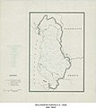
Albania - DPLA - 7a5b4d36fc505cd2b8cb7f5b4dd5fb87.jpg 2,029 × 2,516; 5.53 MB
-
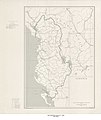
Albania - DPLA - 88175d1a59ae8d9bd38c3c20d47b98b7.jpg 2,001 × 2,486; 6.94 MB
-
Albania - DPLA - a4d65db7089fbac4bfeedf72f11b8a24.jpg 2,021 × 2,666; 5.75 MB
-
Albania - DPLA - c3b3a3750f860b3098be3b72820092f4.jpg 1,996 × 2,492; 5.74 MB
-
Albania - DPLA - ce8ef1218f14080cf6d5216d6a735703.jpg 3,816 × 4,284; 1.6 MB
-
Albania - DPLA - d58979284ffbaf7118585a408cec3c86.jpg 6,826 × 8,309; 3.57 MB
-
Albania - DPLA - e5654836b0af408bd21059176fb794f5.jpg 6,800 × 8,253; 3.92 MB
-
Albania - DPLA - e92b39d7da9a35071c49667b09494a83.jpg 7,567 × 9,002; 7.22 MB
-
Albania - DPLA - f08444171dd0d63a4a5eb8e71d96c981.jpg 2,552 × 3,274; 6.09 MB
-
Albania- Physiography - DPLA - 8a185f44ff744693e0b19dde2951f17d.jpg 2,552 × 3,270; 6.38 MB
-
Algeria - DPLA - 39dee831f7abe5e06535a29e429682ed.jpg 2,556 × 3,278; 6.74 MB
-
Algeria - DPLA - 3ad7b0f9b20c224900cb507566b7d4aa.jpg 5,502 × 4,615; 2.37 MB
-
Algeria - DPLA - 3eb8a4311c03aad45507a116df292a84.jpg 9,472 × 8,683; 8.43 MB
-
Algeria - DPLA - 69c68d6d69533a2a73d9b643316dac83.jpg 2,544 × 3,284; 6.6 MB
-
Algeria - DPLA - 809fee9034ff8a30b3a83947d139a8d1.jpg 9,480 × 8,698; 8.05 MB
-
Algeria - DPLA - bae5b90cd081b4948f5cd002163c3821.jpg 2,556 × 3,280; 5.03 MB
-
Algeria - DPLA - cbf01d0a21d1bf08e11d714f110a9b24.jpg 2,560 × 3,278; 4.85 MB
-
Algeria - DPLA - dcb25bf79354a2f636cd257113548d85.jpg 2,554 × 3,274; 5.95 MB
-
Algeria Administrative Divisions - DPLA - 162a0b52d2f1843c7f50c7c70eafa35a.jpg 2,554 × 3,272; 5.97 MB
-
Algerie - DPLA - 70876faec39bb871e41e93f2992e5feb.jpg 6,576 × 5,070; 2.75 MB
-
Allied Access Routes to West Berlin - DPLA - 58e9514df54c04c423c5829727d0ff08.jpg 2,396 × 3,118; 6.96 MB
-
Almirante (Cuba) - DPLA - 998bfe3dc3ec70c5ef5efcaf93b71307.jpg 6,774 × 5,758; 6.9 MB
-
Alonso Rojas (Cuba) - DPLA - cb3624a46585064883f084172af70c1b.jpg 7,968 × 7,294; 6.37 MB
-
Altayskiy Kray Map I - DPLA - da03dbfaa7780f997e1ab59a759da54d.jpg 11,320 × 7,704; 11.28 MB
-
Amami-Gunto - DPLA - fae10dd15e97eac989faa9001bc068f7.jpg 11,392 × 9,519; 10.23 MB
-
Amurskaya Oblast Map 2 - DPLA - 307fcc2d1761a3bd56701e01004b22b2.jpg 11,276 × 7,665; 10.05 MB
-
Andorra - DPLA - e3ecb753b871bb0dad016444cafbac18.jpg 2,556 × 3,278; 6.55 MB
-
Anglo-Egyptian Sudan - DPLA - 29439fea23b23b60ceaea37e2c012da2.jpg 8,412 × 12,633; 12.61 MB
-
Anglo-Egyptian Sudan - DPLA - 2b4e80f8c513c56063a76465eb459917.jpg 8,460 × 12,647; 10.93 MB
-
Anglo-Egyptian Sudan - DPLA - 2e951a5b52da8eb8f9e3ae282e00a7fa.jpg 3,072 × 4,182; 1.51 MB
-
Anglo-Egyptian Sudan - DPLA - 314db67fb67bacae0bb96035bd3d7373.jpg 8,392 × 12,590; 9.23 MB
-
Anglo-Egyptian Sudan - DPLA - 79974e18e37f4cf087ea69b01ed1a89a.jpg 3,095 × 4,142; 1.37 MB
-
Anglo-Egyptian Sudan - DPLA - 87511e57f7c4e4dbb9ccbed870b0f996.jpg 8,480 × 12,682; 11.47 MB
-
Angola - DPLA - 17f29cf3122f66b11d23086cf9794d97.jpg 2,392 × 3,118; 6.79 MB
-
Antarctic Region - DPLA - 00418d9ee5a71c9404cde2fb22835556.jpg 2,552 × 3,276; 5.6 MB
-
Antarctic Region - DPLA - 189a0b713d3fcf59ef9299f2c8abd28b.jpg 2,558 × 3,286; 5.43 MB
-
Antarctic Region - DPLA - 3000158a9de3bcd9818e60a2facc0785.jpg 2,554 × 3,274; 6.61 MB
-
Antarctic Region - DPLA - 63ae9e2e9bef388cb44ae12a6f79fe34.jpg 2,556 × 3,280; 6.04 MB
-
Antarctic Region - DPLA - ac67b1a543e8848b7e2f2700606ff0cc.jpg 2,550 × 3,274; 5.11 MB
-
Antarctic Region - DPLA - b2026379cf9f6569ed6768f6ac40e478.jpg 2,558 × 3,284; 6.22 MB
-
Antarctic Region - DPLA - b65e942327db52c2b23d90bb08dedb3a.jpg 2,554 × 3,282; 5.45 MB
-
Antarctic Region - DPLA - cec375069f279d9461b1faf4b0f82310.jpg 2,556 × 3,282; 6.19 MB
-
Antarctic Region - DPLA - d050326fbc52e78f6ad44250f711b6cf.jpg 2,556 × 3,280; 5.54 MB
-
Antarctic Region - DPLA - fc44ce6b8226eb88ee66b74177f126fb.jpg 2,554 × 3,280; 6.57 MB
-
Antarctica - DPLA - 2f38428d97dc544a8a1348b7d9e9e2d9.jpg 2,558 × 3,274; 6.54 MB
-
Antarctica - DPLA - 55c1ed72e1d086e7b726389a5deee177 (page 1).jpg 4,175 × 3,486; 2 MB
-
Antarctica - DPLA - 55c1ed72e1d086e7b726389a5deee177 (page 2).jpg 4,230 × 3,435; 1.46 MB
-
Antarctica - DPLA - 6cb7b65cf90690876aa604f84a481e2c.jpg 2,370 × 3,330; 974 KB
-
Antigua and Barbuda - DPLA - 39640ae921abf2b7a46a17d3a82a4926.jpg 2,552 × 3,276; 4.49 MB
-
Approaches to Berlin (Germany) - DPLA - 555730a5be729d035c73f613efaa79ec.jpg 2,714 × 3,448; 8.29 MB
-
Approximate Netherlands Claims Against Germany - DPLA - 45b46e815d169a953ab1b0b3f49a1e27.jpg 4,264 × 12,514; 3.2 MB
-
Approximate Netherlands Claims Against Germany - DPLA - 7fe74cb321f13f1d364147757b528373.jpg 4,829 × 9,918; 6.24 MB
-
Approximate Netherlands Claims Against Germany - DPLA - 88a7523aa6b3a7da9f9d2749dd789790.jpg 4,264 × 12,517; 3.15 MB
-
Arabian Peninsula Status of Boundaries - DPLA - 128890656127538b8e7fdd71081b48a3.jpg 4,240 × 3,956; 1.46 MB
-
Arabian Peninsula Telecommunications - DPLA - 6a41793c3aba4d2b016a21d7e260092a.jpg 4,376 × 3,659; 1.13 MB
-
Arctic Region - DPLA - 2fff94d45fb98da9db647949bf8bafec.jpg 2,560 × 3,274; 6.23 MB
-
Arctic Region - DPLA - 364ffb1d8b951e65239e0fa4c38247c0 (page 1).jpg 2,554 × 3,272; 5.94 MB
-
Arctic Region - DPLA - 364ffb1d8b951e65239e0fa4c38247c0 (page 2).jpg 2,556 × 3,274; 6.02 MB
-
Arctic Region - DPLA - 691ffe9cc25456e971a895cf1ab3316c.jpg 2,552 × 3,274; 5.72 MB
-
Arctic Region - DPLA - 6f8c018cda18f9c03afbe1ffeb83a95c.jpg 2,556 × 3,282; 5.75 MB
-
Arctic Region - DPLA - b59f71808678ff337cd1aaa1b2f1b7a4.jpg 2,556 × 3,270; 6.88 MB
-
Arctic Region - DPLA - e0a2023317d691b720342acda9873fff.jpg 2,554 × 3,284; 6.32 MB
-
Arctic Region - DPLA - ffbae5587caa12175945887cc1b0dbc4.jpg 2,556 × 3,276; 6.78 MB
-
Area between Caspian and Black Sea - DPLA - 886345784b30f97177d2fbc20d5430af.jpg 5,445 × 5,754; 1.46 MB
-
Argentina - DPLA - 2be86c4ede3c5ef90a6e93471695143f.jpg 2,568 × 3,284; 7.66 MB
-
Argentina - DPLA - 3d82e2ab17a2da8ec119044505bd2cc4.jpg 2,552 × 3,274; 5.4 MB
-
Argentina - DPLA - 54617fd07edcbb8a4c17ea7228233a15.jpg 5,496 × 9,336; 4.15 MB
-
Argentina - DPLA - 62d12f9e4f30d5bcf73dcdbb85cfba8b.jpg 4,824 × 5,570; 2.47 MB
-
Argentina - DPLA - 845bc153a188822c79db1aad00784e5b.jpg 2,552 × 3,274; 5.46 MB
-
Argentina - DPLA - 9323b77ef2a3dab6783527f4bbcafc13.jpg 8,400 × 11,591; 9.55 MB
-
Argentina - DPLA - bf310557a62b6e87d2e072406d777133.jpg 2,402 × 3,124; 6.39 MB
-
Argentina - DPLA - e1f57324870b06664cce7a0818c5f99b.jpg 8,268 × 11,605; 8.11 MB
-
Argentina - DPLA - ebcf6de29e14c8750967f6d658b13487.jpg 3,606 × 6,432; 2.25 MB
-
Argentina - DPLA - f24ea164f07f603dd6fcaddc1d9f0ee0.jpg 4,821 × 5,554; 2.33 MB
-
Argentina Civil Divisions - DPLA - e9a296f50ce71d4f9be03d40a4f47046.jpg 5,760 × 7,898; 4.94 MB
-
Argentina Population Density - DPLA - a7de6e3645db0d87e3b081c69f9de9a6.jpg 4,174 × 6,496; 2.53 MB
-
Argentina Radio Facilities - DPLA - 1d4f87e35b9c067a9c0f7dbf0df9cad5.jpg 2,695 × 3,942; 1.3 MB
-
Argentina Topographic Map Coverage - DPLA - 9909db5a86402fb8f53e9a5b4131486f.jpg 3,898 × 7,521; 3.27 MB
-
Arkhangel'Skaya Oblast - DPLA - 173a5167e278a979ddd87a63251e61bb.jpg 9,504 × 7,567; 9.17 MB
-
Armenia - DPLA - 279c88f5ad192a98759fe5d05d79e77b.jpg 2,556 × 3,284; 5.66 MB
-
Armenia - DPLA - 29e287a16a8e11e6fa85eaf63352e8ce.jpg 2,546 × 3,270; 4.28 MB
-
Armenia - DPLA - f3cf1e79ab230d44ebbcf094b576b50f.jpg 2,558 × 3,278; 4.87 MB
-
Armyanskaya Ssr - DPLA - 0e59ee7c2be671e156fa206d54d25cdb.jpg 7,130 × 9,970; 9.67 MB
-
Arroyo Blanco (Cuba) - DPLA - 98147f3b29fc16c299e438a4abe28b9b.jpg 6,744 × 5,758; 6.3 MB
-
Artemisa (Cuba) - DPLA - 2f6d6854ec1fb0b1008e7bbf0c263f48.jpg 6,684 × 5,310; 4.99 MB
-
Asia - DPLA - 03ea181a9f6783d9097ce44c4deba202.jpg 2,552 × 3,274; 7.28 MB
-
Asia - DPLA - 0cbc7867dffcff2dd30b989b4bd80730.jpg 2,556 × 3,280; 7.99 MB
-
Asia - DPLA - 53fcbc07cfbe0ca64d7d3c223a3435b0.jpg 2,550 × 3,278; 7.59 MB
-
Asia - DPLA - 640719a9e98ffca1ecee0166e5470a32.jpg 2,552 × 3,288; 6.93 MB
-
Asia - DPLA - bb72805dbd38622ec9ce427715dc4d77.jpg 2,550 × 3,278; 6.56 MB
-
Asia - DPLA - db2a0fb3499adef08045030571854d69.jpg 2,554 × 3,274; 7.25 MB
-
Asia - DPLA - e82f73103a92edda213284c0140d1b4c.jpg 2,554 × 3,274; 8.6 MB
-
Asia - DPLA - f6e73d004a59854b500346098ce63d94.jpg 2,560 × 3,280; 7.46 MB


