File:Romenay Gemeindeschema Plan.svg
Jump to navigation
Jump to search

Size of this PNG preview of this SVG file: 705 × 381 pixels. Other resolutions: 320 × 173 pixels | 640 × 346 pixels | 1,024 × 553 pixels | 1,280 × 692 pixels | 2,560 × 1,383 pixels.
Original file (SVG file, nominally 705 × 381 pixels, file size: 2.56 MB)
Captions
Captions
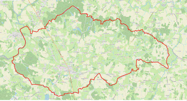
Map of municipality of Romenay with its limits
Summary
[edit]
| Description |
Deutsch: Karte der Gemeinde Romenay mit ihren Grenzen |
| Date | |
| Source | openstreetmap.org |
| Author | OpenStreetMap contributors, H.p.frei |
Licensing
[edit]
| This work contains information from OpenStreetMap, which is made available under the Open Database License (ODbL).
The ODbL does not require any particular license for maps produced from ODbL data. Prior to 1 August 2020, map tiles produced by the OpenStreetMap Foundation were licensed under the CC-BY-SA-2.0 license. Maps produced by other people may be subject to other licences. |

|
The copyright holder of this file allows anyone to use it for any purpose, provided that the copyright holder is properly attributed. Redistribution, derivative work, commercial use, and all other use is permitted. |
|
|
File history
Click on a date/time to view the file as it appeared at that time.
| Date/Time | Thumbnail | Dimensions | User | Comment | |
|---|---|---|---|---|---|
| current | 22:00, 25 January 2024 | | 705 × 381 (2.56 MB) | H.p.frei (talk | contribs) | Uploaded own work with UploadWizard |
You cannot overwrite this file.
File usage on Commons
There are no pages that use this file.