File:Roman Empire map.ogv
Jump to navigation
Jump to search
Size of this JPG preview of this OGG file: 631 × 599 pixels. Other resolutions: 253 × 240 pixels | 505 × 480 pixels.
Original file (Ogg Theora video file, length 39 s, 800 × 760 pixels, 43 kbps, file size: 203 KB)
Captions
Captions
Add a one-line explanation of what this file represents
Summary
[edit]| Description |
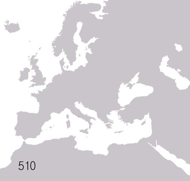
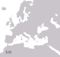
English: Map showing how the Roman Empire grew. Years shown: 510BC, 320BC, 300BC, 270BC, 220BC, 190BC, 140BC, 70BC, 40BC, 20AD, 70AD, 140AD, 230AD, 300AD, 360AD, 405AD, 420AD, 450AD, 480AD, 530AD, 560AD, 600AD, 630AD, 650AD, 740AD, 867AD, 1025AD, 1095AD, 1170AD, 1200AD, 1204AD, 1280AD, 1360AD, 1400AD, 1430AD, 1453AD Français : Carte de l'évolution territoriale de l'Empire romain. Années affichées : -510, -320, -300, -270, -220, -190, -140, -70, -40, 20, 70, 140, 230, 300, 360, 405, 420, 450, 480, 530, 560, 600, 630, 650, 740, 867, 1025, 1095, 1170, 1200, 1204, 1280, 1360, 1400, 1430, 1453 |
| Date | (UTC) |
| Source |
|
| Author |
|
| Camera location | | View this and other nearby images on: OpenStreetMap |
|---|
Licensing
[edit]I, the copyright holder of this work, hereby publish it under the following licenses:
| This file is licensed under the Creative Commons Attribution-Share Alike 3.0 Unported license. | ||
| ||
| This licensing tag was added to this file as part of the GFDL licensing update. |

|
Permission is granted to copy, distribute and/or modify this document under the terms of the GNU Free Documentation License, Version 1.2 or any later version published by the Free Software Foundation; with no Invariant Sections, no Front-Cover Texts, and no Back-Cover Texts. A copy of the license is included in the section entitled GNU Free Documentation License. |
You may select the license of your choice.
Original upload log
[edit]This image is a derivative work of the following images:
- File:Roman_Empire_map.gif licensed with Cc-by-sa-3.0-migrated, GFDL
Uploaded with derivativeFX
File history
Click on a date/time to view the file as it appeared at that time.
| Date/Time | Thumbnail | Dimensions | User | Comment | |
|---|---|---|---|---|---|
| current | 17:24, 30 July 2011 | 39 s, 800 × 760 (203 KB) | Sémhur (talk | contribs) | {{Information |Description=This is a map of the Roman Empire based on Image:BlankMap-Europe-v3.pngThis is a map showing how the Roman empire grew. Years shown: 510BC, 320BC, 300BC, 270BC, 220BC, 190BC, 140BC, 70BC, 40BC, 20AD, 70AD, 140AD, 230AD, 300AD, |
You cannot overwrite this file.
File usage on Commons
The following page uses this file:
Transcode status
Update transcode statusFile usage on other wikis
The following other wikis use this file:
- Usage on en.wikipedia.org
- Usage on fr.wikipedia.org
- Usage on it.wikipedia.org
- Usage on oc.wikipedia.org
- Usage on ro.wikipedia.org
- Usage on ta.wikipedia.org