File:Rivierverbetering bij Maastricht, bestek 1892.jpg
Jump to navigation
Jump to search
Size of this preview: 800 × 415 pixels. Other resolutions: 320 × 166 pixels | 640 × 332 pixels | 1,024 × 531 pixels | 1,280 × 664 pixels | 2,560 × 1,328 pixels | 4,196 × 2,177 pixels.
Original file (4,196 × 2,177 pixels, file size: 4.67 MB, MIME type: image/jpeg)
Captions
Captions
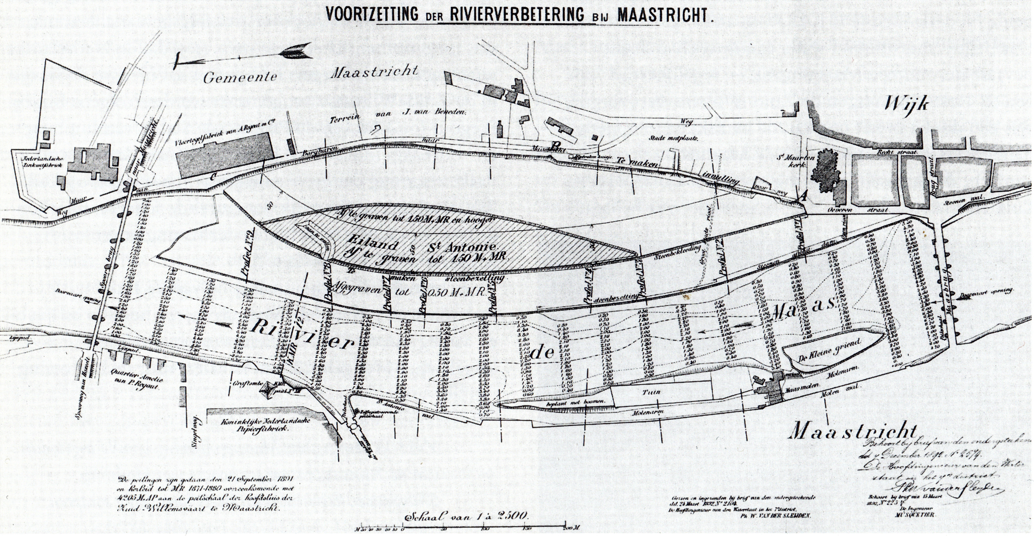
Map outling the works to adjust the course of the river Meuse in Maastricht, the Netherlands, in 1892.
Summary
[edit]
| Description |
Nederlands: Bestek van Waterstaat: Voortzetting der rivierverbetering bij Maastricht, 1892. Het plan was toen al enige tijd in uitvoering en werd in 1895 afgerond. Het behelsde onder meer het afgraven van het grootste deel van het Sint-Antoniuseiland in de Maas en het dichtgooien van de geul tussen het eiland en de bestaande oever. |
| Date | |
| Source | M. Martin (2000): Opkomst van de moderne stad. Ruimtelijke veranderingen in Maastricht 1660-1905, page 140. Waanders Uitgevers, Zwolle. Rijksdienst voor de Monumentenzorg, Zeist. ISBN 90-400-9323-7 |
| Author | ir. Musquetier (cartographer) |
Licensing
[edit]
|
This work is in the public domain in its country of origin and other countries and areas where the copyright term is the author's life plus 70 years or fewer. | |
| This file has been identified as being free of known restrictions under copyright law, including all related and neighboring rights. | |
File history
Click on a date/time to view the file as it appeared at that time.
| Date/Time | Thumbnail | Dimensions | User | Comment | |
|---|---|---|---|---|---|
| current | 19:25, 17 November 2020 | | 4,196 × 2,177 (4.67 MB) | Kleon3 (talk | contribs) | Uploaded a work by ir. Musquetier (cartographer) from {{aut|M. Martin}} (2000): ''Opkomst van de moderne stad. Ruimtelijke veranderingen in Maastricht 1660-1905'', page 140. Waanders Uitgevers, Zwolle. Rijksdienst voor de Monumentenzorg, Zeist. {{ISBN|90-400-9323-7}} with UploadWizard |
You cannot overwrite this file.
File usage on Commons
There are no pages that use this file.
File usage on other wikis
The following other wikis use this file:
- Usage on nl.wikipedia.org