File:Relief Map of Baltic Sea.png
Jump to navigation
Jump to search
Size of this preview: 501 × 599 pixels. Other resolutions: 201 × 240 pixels | 401 × 480 pixels | 869 × 1,039 pixels.
Original file (869 × 1,039 pixels, file size: 1.14 MB, MIME type: image/png)
Captions
Captions
Add a one-line explanation of what this file represents
Summary
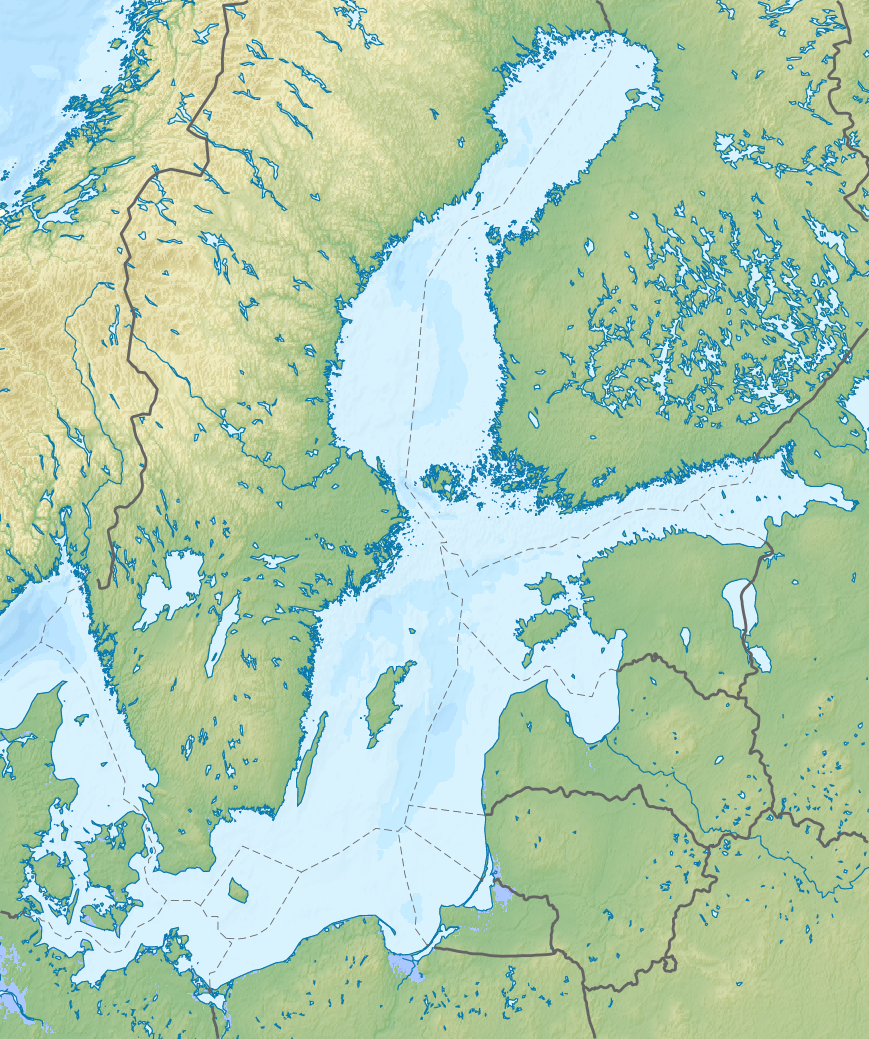
[edit]| Description |
Русский: Физическая карта Балтийского моря с национальными границами.
English: Relief map of the Baltic Sea with national borders added
Equirectangular projection, N/S stretching 200 %. Geographic limits of the map:
|
| Date | |
| Source |
|
| Author | Nzeemin, NordNordWest |
| Other versions |
|

Licensing
[edit]
I, the copyright holder of this work, hereby publish it under the following license:
This file is licensed under the Creative Commons Attribution-Share Alike 3.0 Unported license.
- You are free:
- to share – to copy, distribute and transmit the work
- to remix – to adapt the work
- Under the following conditions:
- attribution – You must give appropriate credit, provide a link to the license, and indicate if changes were made. You may do so in any reasonable manner, but not in any way that suggests the licensor endorses you or your use.
- share alike – If you remix, transform, or build upon the material, you must distribute your contributions under the same or compatible license as the original.
File history
Click on a date/time to view the file as it appeared at that time.
| Date/Time | Thumbnail | Dimensions | User | Comment | |
|---|---|---|---|---|---|
| current | 11:22, 28 August 2012 | | 869 × 1,039 (1.14 MB) | Nzeemin (talk | contribs) | User created page with UploadWizard |
You cannot overwrite this file.
File usage on Commons
The following 11 pages use this file:
- Baltic Sea
- Category:Baltic Sea
- Category:Bays of the Baltic Sea
- Category:Geography of the Baltic Sea
- Category:Islands of the Baltic Sea
- Category:Lighthouses in the Baltic Sea
- Category:Maps of the Baltic Sea
- Category:Offshore wind farms in the Baltic Sea
- Category:Ships named after the Baltic Sea
- Category:Shipwrecks in the Baltic Sea
- Category:Tributaries of the Baltic Sea
File usage on other wikis
The following other wikis use this file:
- Usage on ab.wikipedia.org
- Usage on ar.wikipedia.org
- Usage on azb.wikipedia.org
- Usage on az.wikipedia.org
- Usage on ba.wikipedia.org
- Usage on be.wikipedia.org
- Usage on bg.wikipedia.org
- Usage on bn.wikipedia.org
- Usage on ca.wikipedia.org
- Usage on ceb.wikipedia.org
- Usage on ce.wikipedia.org
- Usage on de.wikipedia.org
- Finnischer Meerbusen
- Bottnischer Meerbusen
- Danziger Bucht
- Gotlandtief
- Seeschlacht bei Hanko
- Bottenwiek
- Kolberger Heide
- Vorlage:Positionskarte Ostsee
- Seeschlacht bei Grönham
- Kriegers Flak
- Gefecht bei Hummelshof
- Schlacht bei Erastfer
- Schlacht von Gemauerthof
- Gefecht bei Saladen
- Schlacht bei Jakobstadt
- Gefechte bei Rauge
View more global usage of this file.