File:RRBP-Recreation-Map-web.jpg
Jump to navigation
Jump to search
Size of this preview: 800 × 537 pixels. Other resolutions: 320 × 215 pixels | 640 × 430 pixels | 1,024 × 688 pixels | 1,280 × 860 pixels | 3,000 × 2,015 pixels.
Original file (3,000 × 2,015 pixels, file size: 782 KB, MIME type: image/jpeg)
Captions
Captions
Add a one-line explanation of what this file represents
Summary
[edit]
| Description |
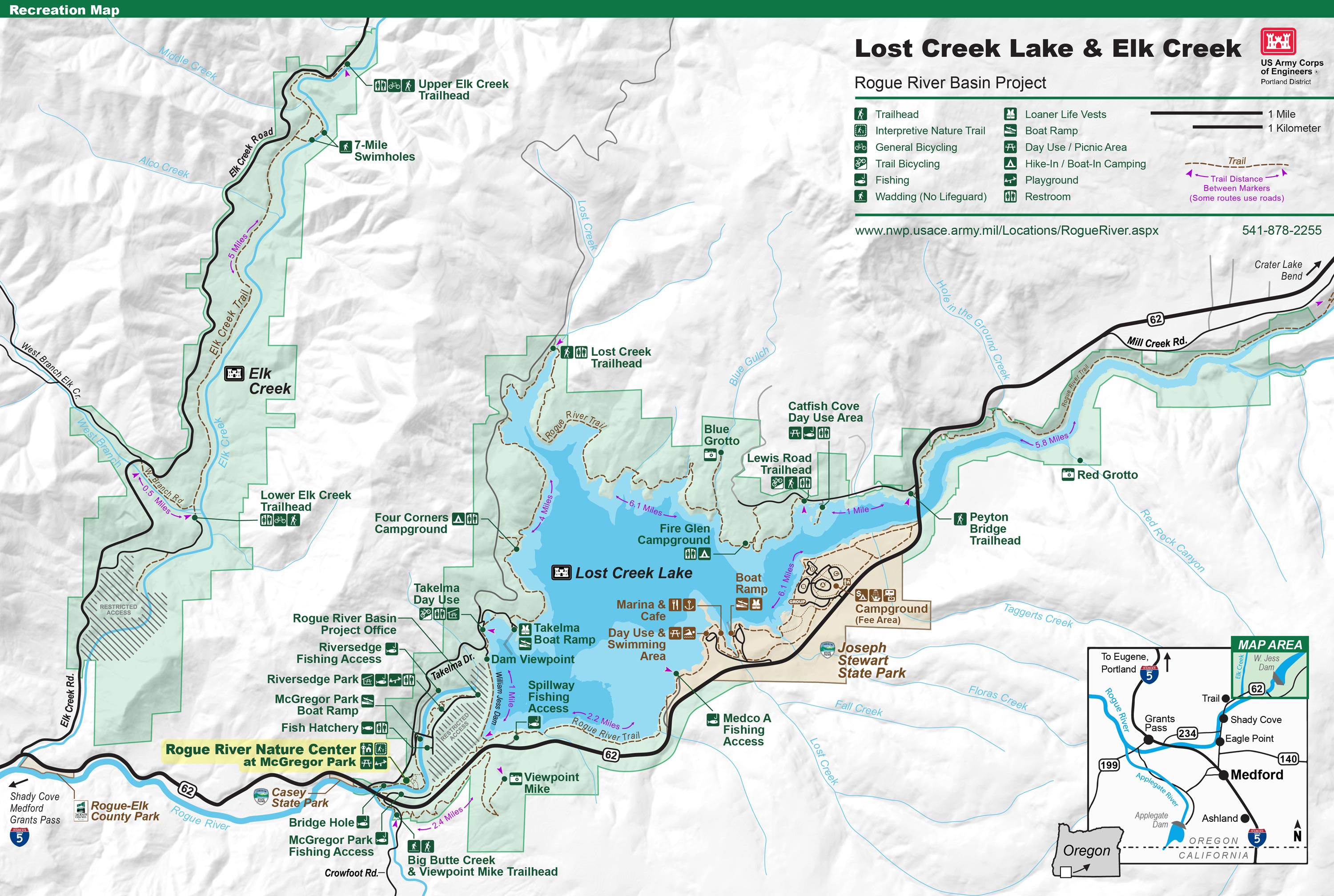
English: Recreation Map of Elk Creek and Lost Creek Lake areas. |
| Date | |
| Source | U.S. Army Corps of Engineers. Created by employee David Hays in 2016. |
| Author | United States Army Corps of Engineers |
Licensing
[edit]
This image or file is a work of a U.S. Army Corps of Engineers soldier or employee, taken or made as part of that person's official duties. As a work of the U.S. federal government, the image is in the public domain.
|
File history
Click on a date/time to view the file as it appeared at that time.
| Date/Time | Thumbnail | Dimensions | User | Comment | |
|---|---|---|---|---|---|
| current | 00:14, 14 January 2016 | | 3,000 × 2,015 (782 KB) | Rangerdavid (talk | contribs) | Cross-wiki upload from en.wikipedia.org |
You cannot overwrite this file.
File usage on Commons
There are no pages that use this file.