Category:Maps of Oregon bodies of water
Appearance
English: Maps of Oregon bodies of water.
Subcategories
This category has only the following subcategory.
M
Media in category "Maps of Oregon bodies of water"
The following 9 files are in this category, out of 9 total.
-
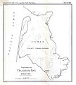
FMIB 33376 Fisheries of Tillamook Bay, Oregon.jpeg 1,094 × 1,214; 144 KB
-
Klamath Project Mapic.jpg 1,688 × 1,036; 345 KB
-
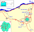
Map mount hood vicinity.png 564 × 526; 13 KB
-
Netarts Bay Research Areas.pdf 1,275 × 1,650; 1.21 MB
-
RRBP-Recreation-Map-web.jpg 3,000 × 2,015; 782 KB
-
USGS Central Oregon Coast.png 346 × 399; 34 KB
-
USGS Oregon Northern Coast Range.png 406 × 523; 44 KB
-
Waldo Lake map.gif 520 × 685; 180 KB
-
Warm Springs Reservoir Map.png 1,075 × 2,262; 801 KB


