File:Quivira refuge map.pdf
Jump to navigation
Jump to search

Size of this JPG preview of this PDF file: 463 × 599 pixels. Other resolutions: 185 × 240 pixels | 371 × 480 pixels | 594 × 768 pixels | 1,272 × 1,645 pixels.
Original file (1,272 × 1,645 pixels, file size: 777 KB, MIME type: application/pdf)
Captions
Captions
Add a one-line explanation of what this file represents
Summary
[edit]| Description | |
| Date | Unknown date |
| Source | U.S. Fish and Wildlife Service |
| Author | U.S. Fish and Wildlife Service |
Licensing
[edit]This image or recording is the work of a U.S. Fish and Wildlife Service employee, taken or made as part of that person's official duties. As a work of the U.S. federal government, the image is in the public domain. For more information, see the Fish and Wildlife Service copyright policy.
|
 |
File history
Click on a date/time to view the file as it appeared at that time.
| Date/Time | Thumbnail | Dimensions | User | Comment | |
|---|---|---|---|---|---|
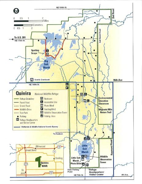
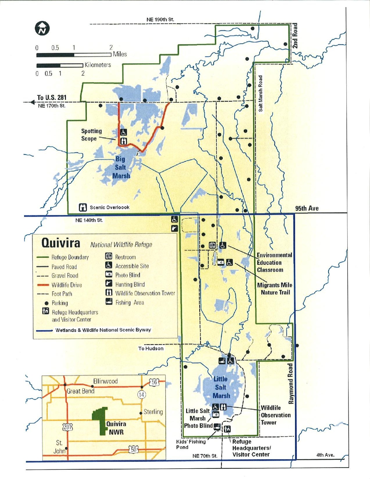
| current | 21:56, 4 March 2011 |  | 1,272 × 1,645 (777 KB) | Smallchief (talk | contribs) | {{Information |Description ={{en|1=A map of Quivira National Wildlife Refuge in Kansas }} |Source =U.S. Fish and Wildlife Service |Author =U.S. Fish and Wildlife Service |Date =? |Permission = |other_versions = }} |
You cannot overwrite this file.
File usage on Commons
There are no pages that use this file.
File usage on other wikis
The following other wikis use this file:
- Usage on en.wikipedia.org