File:Provincia de Tacna, Chile (1884-1925).svg
Jump to navigation
Jump to search

Size of this PNG preview of this SVG file: 492 × 600 pixels. Other resolutions: 197 × 240 pixels | 394 × 480 pixels | 630 × 768 pixels | 840 × 1,024 pixels | 1,680 × 2,048 pixels | 2,268 × 2,764 pixels.
Original file (SVG file, nominally 2,268 × 2,764 pixels, file size: 285 KB)
Captions
Captions
Add a one-line explanation of what this file represents
Summary
[edit].svg&action=edit§ion=1)
| Description |
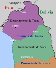
Español: Mapa de la antigua Provincia chilena de Tacna (1884-1925).
|
| Date | |
| Source |
Own work |
| Author | Janitoalevic |
| Other versions | File:Tacna province (1884-1929) Chile location map.svg |
.png&action=edit&redlink=1)
_Chile_location_map.svg)
Licensing
[edit].svg&action=edit§ion=2)
I, the copyright holder of this work, hereby publish it under the following license:
This file is licensed under the Creative Commons Attribution-Share Alike 4.0 International license.
- You are free:
- to share – to copy, distribute and transmit the work
- to remix – to adapt the work
- Under the following conditions:
- attribution – You must give appropriate credit, provide a link to the license, and indicate if changes were made. You may do so in any reasonable manner, but not in any way that suggests the licensor endorses you or your use.
- share alike – If you remix, transform, or build upon the material, you must distribute your contributions under the same or compatible license as the original.
File history
Click on a date/time to view the file as it appeared at that time.
| Date/Time | Thumbnail | Dimensions | User | Comment | |
|---|---|---|---|---|---|
| current | 21:42, 29 December 2022 | | 2,268 × 2,764 (285 KB) | Janitoalevic (talk | contribs) | . |
| 21:37, 29 December 2022 |  | 2,268 × 2,764 (356 KB) | Janitoalevic (talk | contribs) | Río Ticalaco como límite. | |
| 22:31, 15 April 2018 |  | 2,268 × 2,764 (193 KB) | Janitoalevic (talk | contribs) | . | |
| 22:17, 15 April 2018 |  | 2,268 × 2,764 (193 KB) | Janitoalevic (talk | contribs) | . | |
| 18:46, 27 May 2017 |  | 2,268 × 2,764 (190 KB) | Janitoalevic (talk | contribs) | . | |
| 15:38, 27 May 2017 |  | 2,268 × 2,764 (220 KB) | Janitoalevic (talk | contribs) | User created page with UploadWizard |
You cannot overwrite this file.
File usage on Commons
The following 10 pages use this file:
- User:Janitoalevic/Gallery/Maps
- User:Magog the Ogre/Maps of conflicts/2017 May
- User:Magog the Ogre/Maps of conflicts/2018 April
- User:Magog the Ogre/Maps of conflicts/2022 December
- User:Magog the Ogre/Multilingual legend/2022 December 21-31
- Commons:Deletion requests/Archive/2018/08/30
- Commons:Deletion requests/File:Provincia de Tacna, Chile (1884-1929).png
- File:Provincia de Tacna, Chile (1884-1929).svg (file redirect)
.png)
.svg&redirect=no)
File usage on other wikis
The following other wikis use this file:
- Usage on es.wikipedia.org
- Usage on ru.wikipedia.org
- Usage on www.wikidata.org
.svg&oldid=820431106)