File:Powiat świebodziński location map.png
Jump to navigation
Jump to search

Size of this preview: 800 × 474 pixels. Other resolutions: 320 × 190 pixels | 640 × 379 pixels | 1,187 × 703 pixels.
Original file (1,187 × 703 pixels, file size: 145 KB, MIME type: image/png)
Captions
Captions
Add a one-line explanation of what this file represents
| Description |
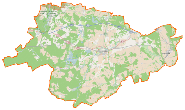
Polski: Mapa powiatu świebodzińskiego, Polska
English: Map of Powiat świebodziński, Poland |
|||||||||
| Date | ||||||||||
| Source | You may find a page on the OpenStreetMap wiki page for Powiat świebodziński | |||||||||
| Creator |
OpenStreetMap contributors OpenStreetMap contributors |
|||||||||
| Permission (Reusing this file) |
OpenStreetMap data is available under the Open Database License (details). Map tiles are licensed under the Creative Commons Attribution-ShareAlike 2.0 license (CC-BY-SA 2.0).
This file is licensed under the Creative Commons Attribution-Share Alike 2.0 Generic license.
|
|||||||||
| Geotemporal data | ||||||||||
| Bounding box |
|
|||||||||
| Georeferencing | If inappropriate please set warp_status = skip to hide. | |||||||||
File history
Click on a date/time to view the file as it appeared at that time.
| Date/Time | Thumbnail | Dimensions | User | Comment | |
|---|---|---|---|---|---|
| current | 12:57, 21 April 2015 | | 1,187 × 703 (145 KB) | VanWiel (talk | contribs) | {{OpenStreetMap | name = Powiat świebodziński | location = Powiat świebodziński | description = {{pl|Mapa powiatu świebodzińskiego, Polska}} {{en|Map of Powiat świebodziński, Poland}} | top = 52.386... |
You cannot overwrite this file.
File usage on Commons
There are no pages that use this file.
File usage on other wikis
The following other wikis use this file:
- Usage on pl.wikipedia.org
- Cibórz (województwo lubuskie)
- Świebodzin
- Łagów (powiat świebodziński)
- Powiat świebodziński
- Jordanowo (województwo lubuskie)
- Niesłysz
- Zbąszynek
- Jezioro Łagowskie
- Ołobok (województwo lubuskie)
- Ciecz (jezioro)
- Lubrza (województwo lubuskie)
- Kosieczyn
- Rezerwat przyrody Kręcki Łęg
- Boryszyn
- Chlastawa
- Chociule
- Darnawa
- Dąbrówka Wielkopolska
- Glińsk
- Jemiołów (wieś)
- Kępsko (województwo lubuskie)
- Kręcko
- Kupienino
- Kiełcze
- Kosobudz
- Lubinicko
- Lubogóra
- Łagówek
- Myszęcin
- Niekarzyn
- Niesulice
- Ojerzyce
- Opalewo
- Pałck
- Podła Góra
- Poźrzadło (województwo lubuskie)
- Przełazy
- Przetocznica
- Radoszyn
- Rogoziniec
- Romanówek (Lubrza)
- Rosin
- Rudgerzowice
- Rozłogi (województwo lubuskie)
- Szczaniec
- Wilenko
- Wolimirzyce
- Węgrzynice
- Zawisze
- Błonie (województwo lubuskie)
View more global usage of this file.