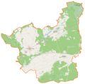
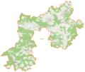
Category:Location maps of powiats in Lubusz Voivodeship
Jump to navigation
Jump to search
Media in category "Location maps of powiats in Lubusz Voivodeship"
The following 11 files are in this category, out of 11 total.
-
Powiat gorzowski location map.png 1,544 × 827; 156 KB
-
Powiat krośnieński (województwo lubuskie) location map.png 1,089 × 1,090; 174 KB
-
Powiat międzyrzecki location map.png 961 × 1,071; 169 KB
-
Powiat strzelecko-drezdenecki location map.png 1,074 × 1,052; 136 KB
-
Powiat sulęciński location map.png 1,195 × 1,094; 147 KB
-
Powiat słubicki location map.png 774 × 1,241; 232 KB
-
Powiat wschowski location map.png 887 × 807; 122 KB
-
Powiat zielonogórski location map.png 1,376 × 1,158; 181 KB
-
Powiat świebodziński location map.png 1,187 × 703; 145 KB
-
Powiat żagański location map.png 1,290 × 899; 133 KB
-
Powiat żarski location map.png 944 × 1,276; 177 KB


