File:Poland (1975–1991) location map.svg
Jump to navigation
Jump to search

Size of this PNG preview of this SVG file: 617 × 600 pixels. Other resolutions: 247 × 240 pixels | 494 × 480 pixels | 790 × 768 pixels | 1,053 × 1,024 pixels | 2,106 × 2,048 pixels | 1,993 × 1,938 pixels.
Original file (SVG file, nominally 1,993 × 1,938 pixels, file size: 484 KB)
Captions
Captions
Add a one-line explanation of what this file represents
| Description |
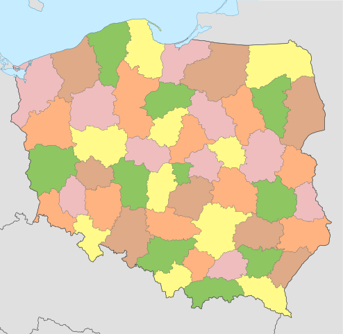
English: Location map of Poland (1975 – 1991) Equirectangular projection, N/S stretching 160 %. Geographic limits of the map: * N: 55.2° N * S: 48.7° N * W: 13.8° E * E: 24.5° E Deutsch: Positionskarte von Polen (1975 – 1991) Quadratische Plattkarte, N-S-Streckung 160 %. Geographische Begrenzung der Karte: * N: 55.2° N * S: 48.7° N * W: 13.8° O * O: 24.5° O |
| Date | (UTC) |
| Source | |
| Author |
|
_location_map.png)
| This is a retouched picture, which means that it has been digitally altered from its original version. Modifications: Zwektoryzowano. The original can be viewed here: Poland (1975–1991) location map.png:
|
I, the copyright holder of this work, hereby publish it under the following licenses:
This file is licensed under the Creative Commons Attribution-Share Alike 3.0 Unported, 2.5 Generic, 2.0 Generic and 1.0 Generic license.
- You are free:
- to share – to copy, distribute and transmit the work
- to remix – to adapt the work
- Under the following conditions:
- attribution – You must give appropriate credit, provide a link to the license, and indicate if changes were made. You may do so in any reasonable manner, but not in any way that suggests the licensor endorses you or your use.
- share alike – If you remix, transform, or build upon the material, you must distribute your contributions under the same or compatible license as the original.

|
Permission is granted to copy, distribute and/or modify this document under the terms of the GNU Free Documentation License, Version 1.2 or any later version published by the Free Software Foundation; with no Invariant Sections, no Front-Cover Texts, and no Back-Cover Texts. A copy of the license is included in the section entitled GNU Free Documentation License. |
You may select the license of your choice.
Original upload log
[edit]_location_map.svg&action=edit§ion=1)
This image is a derivative work of the following images:
- File:Poland_(1975–1991)_location_map.png licensed with Cc-by-sa-3.0,2.5,2.0,1.0, GFDL
- 2011-04-30T11:02:03Z Lukasb1992 1993x1938 (494639 Bytes) minor change – gmina Brzeszcze
- 2011-04-29T21:46:11Z Lukasb1992 2000x1944 (497062 Bytes) {{Information |Description ={{en|1=Location map of [[:en:Poland|Poland]] (1975 – 1991) Equirectangular projection, N/S stretching 160 %. Geographic limits of the map: * N: 55.2° N * S: 48.7° N * W: 13.8° E * E: 24.5°
Uploaded with derivativeFX
File history
Click on a date/time to view the file as it appeared at that time.
| Date/Time | Thumbnail | Dimensions | User | Comment | |
|---|---|---|---|---|---|
| current | 17:04, 1 June 2011 | | 1,993 × 1,938 (484 KB) | Malyszkz (talk | contribs) | {{Information |Description={{en|1=Location map of Poland (1975 – 1991) Equirectangular projection, N/S stretching 160 %. Geographic limits of the map: * N: 55.2° N * S: 48.7° N * W: 13.8° E * E: 24.5° E}} {{de|1=Positionskarte von [[: |
You cannot overwrite this file.
File usage on Commons
The following page uses this file:
_location_map.svg&oldid=619903652)