File:Plat of part of the estate of the late William East, deceased - in squares nos. 10, 11, 12, s. of 12, 62 & 63, with the wharfs fronting along said property - (Washington D.C.) LOC 87695761.tif
Jump to navigation
Jump to search

Size of this JPG preview of this TIF file: 800 × 576 pixels. Other resolutions: 320 × 230 pixels | 640 × 461 pixels | 1,024 × 737 pixels | 1,280 × 921 pixels | 2,560 × 1,843 pixels | 7,823 × 5,631 pixels.
Original file (7,823 × 5,631 pixels, file size: 126.03 MB, MIME type: image/tiff)
Captions
Captions
Add a one-line explanation of what this file represents
Summary
[edit]| Description |
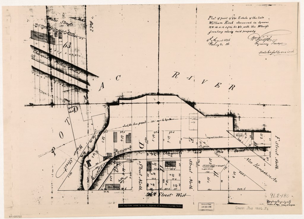
English: Cadastral map showing block and lot numbers, lot boundaries, dimensions, and buildings. "4th August 1856, Washington D.C." Covers area bounded by 26th St. N.W., F St. N.W., and Potomac River. Oriented with north to the right. Photocopy of ms. map. "From negative loaned by Mr. W. Hayward of National Capital Parks." Includes inset. Available also through the Library of Congress Web site as a raster image. DCP |
||
| Title | Plat of part of the estate of the late William East, deceased : in squares nos. 10, 11, 12, s. of 12, 62 & 63, with the wharfs fronting along said property : [Washington D.C.] | ||
| Shelf ID | G3851.P55 1856 .F6 | ||
| Date | |||
| Source | https://www.loc.gov/item/87695761/ | ||
| Author | Forsyth, William; East, William | ||
| Permission (Reusing this file) |
|
||
| Other versions |
|
||
| Location | United States · Washington D.C. · District Of Columbia · Washington | ||
| Part of | American Memory · Cities And Towns · Catalog · Geography And Map Division | ||
| Subject | Washington (D.C.) · Wharves · Washington · Waterfronts · United States · Maps · District Of Columbia · Real Property |

_LOC_87695761.jpg)
Licensing
[edit]|
This is a faithful photographic reproduction of a two-dimensional, public domain work of art. The work of art itself is in the public domain for the following reason:
The official position taken by the Wikimedia Foundation is that "faithful reproductions of two-dimensional public domain works of art are public domain".
This photographic reproduction is therefore also considered to be in the public domain in the United States. In other jurisdictions, re-use of this content may be restricted; see Reuse of PD-Art photographs for details. | ||||
File history
Click on a date/time to view the file as it appeared at that time.
| Date/Time | Thumbnail | Dimensions | User | Comment | |
|---|---|---|---|---|---|
| current | 02:14, 4 June 2018 |  | 7,823 × 5,631 (126.03 MB) | Fæ (talk | contribs) | LOC Maps https://www.loc.gov/item/87695761/ #4051 |
You cannot overwrite this file.
File usage on Commons
The following page uses this file: