File:Plan du campement des Armées du Roy autour de Maestricht, pendant le siège, en 1748.jpg
Jump to navigation
Jump to search

Size of this preview: 764 × 599 pixels. Other resolutions: 306 × 240 pixels | 612 × 480 pixels | 979 × 768 pixels | 1,239 × 972 pixels.
Original file (1,239 × 972 pixels, file size: 333 KB, MIME type: image/jpeg)
Captions
Captions
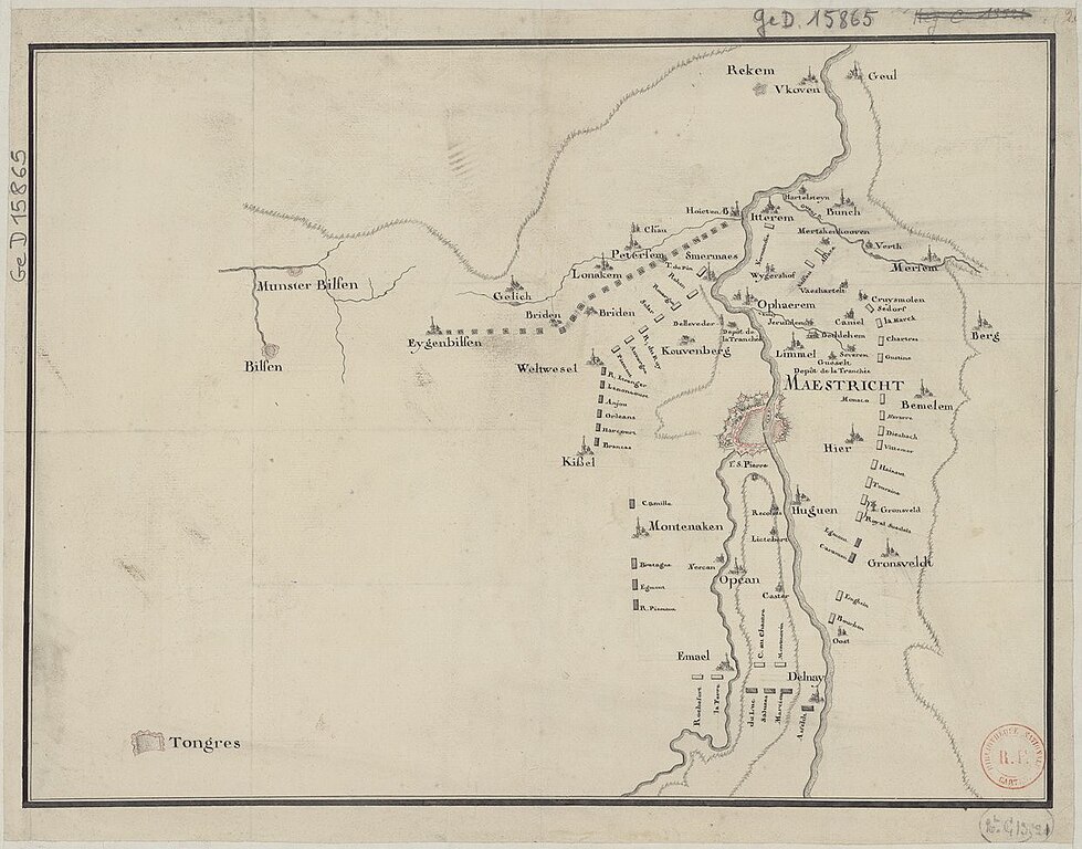
French map of the area around Maastricht, the Netherlands, during the siege of 1748 (1673 erroneously mentioned in the source).
Summary
[edit]| Description |
Nederlands: Franse kaart van het Beleg van Maastricht van 1748. De bron, de website van de Bibliothèque National de France, vermeld abusievelijk 1673 (beleg door Lodewijk XIV). De aanwezigheid van het Fort Sint-Pieter spreekt dat tegen. Bovendien komen de namen van legerleiders overeen met het beleg van 1748 (door Lodewijk XV). |
| Date | circa 1673 |
| Source | https://gallica.bnf.fr/ark:/12148/btv1b8493673f/f1.item.r=Maestricht.zoom# |
| Author | unknown cartographer |
| Other versions |

Licensing
[edit]
|
This work is in the public domain in its country of origin and other countries and areas where the copyright term is the author's life plus 70 years or fewer. This work is in the public domain in the United States because it was published (or registered with the U.S. Copyright Office) before January 1, 1929. | |
| This file has been identified as being free of known restrictions under copyright law, including all related and neighboring rights. | |
File history
Click on a date/time to view the file as it appeared at that time.
| Date/Time | Thumbnail | Dimensions | User | Comment | |
|---|---|---|---|---|---|
| current | 10:07, 25 October 2021 | | 1,239 × 972 (333 KB) | Kleon3 (talk | contribs) | Uploaded a work by unknown cartographer from https://gallica.bnf.fr/ark:/12148/btv1b8493673f/f1.item.r=Maestricht.zoom# with UploadWizard |
You cannot overwrite this file.
File usage on Commons
The following 2 pages use this file: