File:Plan SPB 1833.jpg
Jump to navigation
Jump to search

Size of this preview: 776 × 599 pixels. Other resolutions: 311 × 240 pixels | 622 × 480 pixels | 995 × 768 pixels | 1,280 × 989 pixels | 2,560 × 1,977 pixels | 7,575 × 5,850 pixels.
Original file (7,575 × 5,850 pixels, file size: 15.72 MB, MIME type: image/jpeg)
Captions
Captions
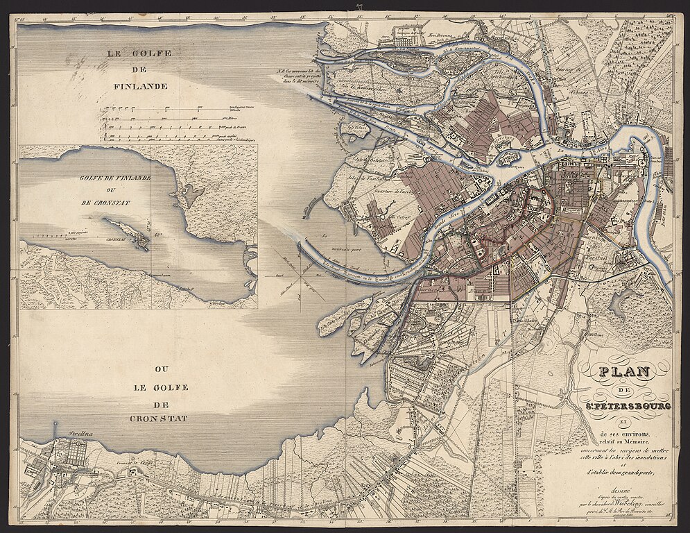
Plan of Saint Petersburg and its surroundings (in French)
Summary
[edit]
| Description |
Русский: План Санкт-Петербурга и его окрестностей на французском языке, относящийся к мемуарам, о средствах защиты сего города от наводнений и об устроении двух больших портов
English: Plan of Saint Petersburg and its surroundings (in French) |
|||||||||
| Date | ||||||||||
| Source | https://q-map.ru/%d0%ba%d0%b0%d1%80%d1%82%d0%b0-%d1%81%d0%b0%d0%bd%d0%ba%d1%82-%d0%bf%d0%b5%d1%82%d0%b5%d1%80%d0%b1%d1%83%d1%80%d0%b3%d0%b0-%d0%b8-%d0%b5%d0%b3%d0%be-%d0%be%d0%ba%d1%80%d0%b5%d1%81%d1%82%d0%bd%d0%be/ | |||||||||
| Creator | ||||||||||
| Geotemporal data | ||||||||||
| Bounding box |
|
|||||||||
| Georeferencing | ||||||||||
Licensing
[edit]
|
This work is in the public domain in its country of origin and other countries and areas where the copyright term is the author's life plus 100 years or fewer. | |
| This file has been identified as being free of known restrictions under copyright law, including all related and neighboring rights. | |
This work is in the public domain in the United States because it was published (or registered with the U.S. Copyright Office) before January 1, 1929.
Public domain works must be out of copyright in both the United States and in the source country of the work in order to be hosted on the Commons. If the work is not a U.S. work, the file must have an additional copyright tag indicating the copyright status in the source country.
Note: This tag should not be used for sound recordings. |
File history
Click on a date/time to view the file as it appeared at that time.
| Date/Time | Thumbnail | Dimensions | User | Comment | |
|---|---|---|---|---|---|
| current | 22:16, 20 June 2024 | | 7,575 × 5,850 (15.72 MB) | AndyVolykhov (talk | contribs) | Uploaded a work by Carl Friedrich Wiebeking from https://q-map.ru/%d0%ba%d0%b0%d1%80%d1%82%d0%b0-%d1%81%d0%b0%d0%bd%d0%ba%d1%82-%d0%bf%d0%b5%d1%82%d0%b5%d1%80%d0%b1%d1%83%d1%80%d0%b3%d0%b0-%d0%b8-%d0%b5%d0%b3%d0%be-%d0%be%d0%ba%d1%80%d0%b5%d1%81%d1%82%d0%bd%d0%be/ with UploadWizard |
You cannot overwrite this file.
File usage on Commons
The following page uses this file: