File:Peru - HDI by region or department (2005).svg
Jump to navigation
Jump to search

Size of this PNG preview of this SVG file: 492 × 600 pixels. Other resolutions: 197 × 240 pixels | 394 × 480 pixels | 630 × 768 pixels | 840 × 1,024 pixels | 1,679 × 2,048 pixels | 820 × 1,000 pixels.
Original file (SVG file, nominally 820 × 1,000 pixels, file size: 1 MB)
Captions
Captions
Add a one-line explanation of what this file represents
| Description |
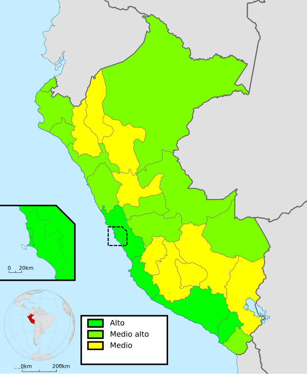
English: Political map of Peru coloured by HDI at 2005 (2006 Inform). Español: Mapa de las regiones y departamentos del Perú según IDH al 2005 (Informe 2006). |
| Date | (UTC) |
| Source | |
| Author |
|
.svg)
| This is a retouched picture, which means that it has been digitally altered from its original version. The original can be viewed here: Peru - (Template).svg:
|
I, the copyright holder of this work, hereby publish it under the following license:
This file is licensed under the Creative Commons Attribution-Share Alike 3.0 Unported license.
- You are free:
- to share – to copy, distribute and transmit the work
- to remix – to adapt the work
- Under the following conditions:
- attribution – You must give appropriate credit, provide a link to the license, and indicate if changes were made. You may do so in any reasonable manner, but not in any way that suggests the licensor endorses you or your use.
- share alike – If you remix, transform, or build upon the material, you must distribute your contributions under the same or compatible license as the original.
Original upload log
[edit].svg&action=edit§ion=1)
This image is a derivative work of the following images:
- File:Peru_-_(Template).svg licensed with Cc-by-sa-3.0
- 2009-07-21T07:54:54Z Huhsunqu 820x1000 (1674312 Bytes) detail map
- 2009-07-15T06:39:44Z Huhsunqu 820x1000 (1396540 Bytes) ANCHOS
- 2009-07-06T05:07:34Z Huhsunqu 820x1000 (1398457 Bytes) {{Information |Description={{en|1=Blank political map of Perú}} {{es|1=Mapa plantilla de las regiones y departamentos del Perú.}} |Source=trabajo propio (own work) |Author=[[User:Huhsunqu|Huhsunqu]] |Date=2009-07-05 |Permis
Uploaded with derivativeFX
File history
Click on a date/time to view the file as it appeared at that time.
| Date/Time | Thumbnail | Dimensions | User | Comment | |
|---|---|---|---|---|---|
| current | 06:38, 9 November 2010 | | 820 × 1,000 (1 MB) | Huhsunqu (talk | contribs) | {{Information |Description={{en|1=Political map of Peru coloured by HDI at 2005 (2006 Inform).}} {{es|1=Mapa de las regiones y departamentos del Perú según IDH al 2005 (Informe 2006).}} |Source=*File:Peru_-_(Template).svg |Date=2010-11-09 06:36 (U |
You cannot overwrite this file.
File usage on Commons
There are no pages that use this file.
.svg&oldid=493647194)