Category:HDI maps of Peru
Jump to navigation
Jump to search
Media in category "HDI maps of Peru"
The following 21 files are in this category, out of 21 total.
-
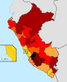
 Departamentos del Perú por IDH - 2021.png 530 × 720; 79 KB
-
 Departamentos del Perú por IDH 2021 - Cuartiles.png 6,600 × 6,600; 1.6 MB
-
 DepartmentsofPeruHDI2020.png 7,030 × 3,542; 830 KB
-
 Distritos de la Provincia de Lima por IDH - Cuartiles.png 850 × 1,119; 207 KB
-
 HDI Location Peru.png 809 × 977; 263 KB
-
 IDH peru 2013.svg 820 × 1,000; 606 KB
-
 IDH Perú cuartiles.png 834 × 1,118; 294 KB
-
 IDH Perú por cuartiles.png 4,630 × 6,117; 851 KB
-
 Mapa del Perú por IDH 2021 - Cuartiles.png 6,600 × 6,600; 1.59 MB
-
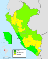
 Mapa IDH Perú por Tramos.png 775 × 1,138; 109 KB
-
 Peru - HDI by region or department (2005).svg 820 × 1,000; 1 MB
-
 PeruDepartmentsHDI2020.jpg 2,237 × 3,395; 475 KB
-
 PeruHDIMap2.jpg 3,765 × 5,939; 1 MB
-
 PeruHDIMap2020.png 6,600 × 6,502; 1.45 MB
-
 PeruRegionsHDIMap2020.png 7,030 × 3,542; 838 KB
-
 Peruvian departments by HDI (2017).svg 512 × 728; 89 KB
-
 PeruvianDepartmentHDI.jpg 3,813 × 5,939; 1.01 MB
-
 PeruvianRegionsHDI2020.jpg 2,280 × 3,542; 475 KB
-
 Perú - IDH Departamental - Distribución por tramos.png 792 × 1,067; 269 KB
-
 Perú - IDH Departamental por Tramos.png 4,630 × 6,117; 804 KB
-
 Perú Departamentos IDH.jpg 2,520 × 3,578; 681 KB


.svg)


.svg)


