File:Peloponnese-Landsat7 WW Ausz.jpg
Jump to navigation
Jump to search
No higher resolution available.
Peloponnese-Landsat7_WW_Ausz.jpg (800 × 502 pixels, file size: 683 KB, MIME type: image/jpeg)
Captions
Captions
Add a one-line explanation of what this file represents
| Description |
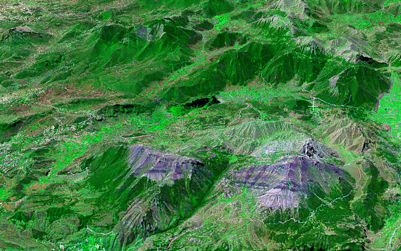
Deutsch: Stymfalia (Ökosystem) Geologie Gut erkennbar: Tektonischer Lift und Neigung des Ziria-Massiv’s formte Stymfalia-Senke
English: Image detail: Lake, Mount Ziria (2374m), north to south, altitude: 20 km; Landsat7, GeoCover 2000, res. 15m/pix with snow caps Complete image: Peloponnese-Landsat7_WW.jpg |
| Date | |
| Source | Public domain WWW Worldwind |
| Author | ulrichstill |
| This image is in the public domain because it is a screenshot from NASA’s globe software World Wind using a public domain layer, such as Blue Marble, MODIS, Landsat, SRTM, USGS or GLOBE.
|
 |
File history
Click on a date/time to view the file as it appeared at that time.
| Date/Time | Thumbnail | Dimensions | User | Comment | |
|---|---|---|---|---|---|
| current | 17:02, 11 September 2006 | | 800 × 502 (683 KB) | Ulrichstill (talk | contribs) | {{Information| |Description = de:Stymfalia_(Ecosystem), image-detail: See / lake, Mount Ziria (2374m). north==>south, altitude: 20 km; Landsat7, GeoCover 2000, res. 15m/pix<br> Complete image: Image:Peloponnese-Landsat7_WW.jpg<br> Geologie. Gut |
You cannot overwrite this file.
File usage on Commons
There are no pages that use this file.
File usage on other wikis
The following other wikis use this file:
- Usage on de.wikipedia.org