Category:Maps of the Peloponnese
Jump to navigation
Jump to search
Use the appropriate category for maps showing all or a large part of the Peloponnese. See subcategories for smaller areas:
| If the map shows | Category to use |
|---|---|
| the Peloponnese on a recently created map | Category:Maps of the Peloponnese or its subcategories |
| the Peloponnese on a map created more than 70 years ago | Category:Old maps of the Peloponnese or its subcategories |
| the history of the Peloponnese on a recently created map | Category:Maps of the history of the Peloponnese or its subcategories |
| the history of the Peloponnese on a map created more than 70 years ago | Category:Old maps of the history of the Peloponnese or its subcategories |
Subcategories
This category has the following 42 subcategories, out of 42 total.
- Maps of Aigialeia (13 F)
- Maps of Andravida-Kyllini (10 F)
- Maps of Andritsaina-Krestena (4 F)
- Maps of Evrotas (12 F)
- Maps of Ilida (4 F)
- Maps of Nafplion (3 F)
- Maps of Pyrgos (11 F)
- Maps of Sikyona (9 F)
- Maps of Spetses (10 F)
- Maps of Trifylia (15 F)
- Maps of Troizinia-Methana (5 F)
- Maps of Voreia Kynouria (3 F)
- Maps of Zacharo (4 F)
L
M
O
T
Media in category "Maps of the Peloponnese"
The following 55 files are in this category, out of 55 total.
-
 Admiralty Chart No 712 Harbours and Anchorages on the South-East Coast of Greece, Published 1966.jpg 16,173 × 11,105; 41.82 MB
-
 Admiralty Chart No 719 Harbours and Anchorages on the South-West Coast of Greece, Published 1964.jpg 11,016 × 8,246; 18.95 MB
-
 Alfeios map.jpg 473 × 368; 39 KB
-
 Alfios.png 1,200 × 940; 1.15 MB
-
 Argolic gulf.jpg 906 × 574; 109 KB
-
 Diakopto-Kalavrita-Chelmos-Landsat7 WW texted.jpg 1,600 × 1,162; 2 MB
-
 Elis topographic map blank.svg 650 × 700; 728 KB
-
 Ethnic distribution of settlements of the Peloponnese (1460-63).png 6,794 × 6,101; 19.92 MB
-
 Evrotas river valley 1770 Le Roy.jpg 654 × 1,021; 482 KB
-
 Greece Mani Peninsula labeled.gif 200 × 208; 6 KB
-
 Kap Malea.png 366 × 392; 61 KB
-
 Kardaritsi-Arcadias-Map.png 390 × 233; 152 KB
-
 Karte Peloponnes2.jpg 1,106 × 959; 309 KB
-
 LocationPeloponnese-HEL-1-z.PNG 500 × 400; 6 KB
-
 Mani - administrative map.jpg 901 × 765; 433 KB
-
 Mani 2000.png 380 × 450; 147 KB
-
 ManiAntik.png 377 × 451; 149 KB
-
 ManiVen.png 380 × 451; 146 KB
-
 Map of ancient Pylos-en.svg 304 × 304; 637 KB
-
 Map of Peloponisos with Thespiae.jpg 1,110 × 984; 116 KB
-
 Map-Kardaritsi-Arcadias.png 370 × 221; 117 KB
-
 MapofGR-kardaritsiArcadias.png 360 × 221; 110 KB
-
 Navarino Bay in Peloponnese.jpg 657 × 600; 225 KB
-
 Orohydrography NE-Peloponnese detail.jpg 1,354 × 1,800; 979 KB
-
 Orohydrography NE-Peloponnese.jpg 1,354 × 1,800; 926 KB
-
 PeloponesoNoroeste.svg 425 × 581; 5.85 MB
-
 Peloponess.jpg 2,449 × 2,837; 1.08 MB
-
 Peloponisos-b.png 1,111 × 1,000; 1.56 MB
-
 Peloponnes.png 200 × 204; 16 KB
-
 Peloponnes1.jpg 829 × 762; 89 KB
-
 Peloponnes3.png 1,044 × 816; 370 KB
-
 Peloponnesbea2a.png 1,044 × 816; 346 KB
-
 Peloponnesbea2aar.png 1,044 × 816; 313 KB
-
 Peloponnese map shaded relief-blank.svg 2,611 × 2,044; 2.84 MB
-
 Peloponnese map.png 326 × 285; 17 KB
-
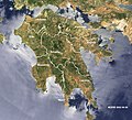
 Peloponnese modis hu.png 900 × 1,062; 1.36 MB
-
 Peloponnese municipalities1.svg 832 × 875; 350 KB
-
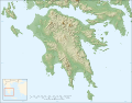 Peloponnese relief map-blank.svg 2,611 × 2,044; 1.97 MB
-
 Peloponnese relief map-de.png 2,000 × 1,566; 3.06 MB
-
 Peloponnese relief map2de.png 2,000 × 1,566; 1.15 MB
-
 Peloponnese-Landsat7 WW Ausz.jpg 800 × 502; 683 KB
-
 Peloponnese-Landsat7 WW.jpg 1,600 × 1,162; 2.01 MB
-
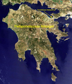
 Peloponnese-Map satview BlueMarbleProject.jpg 1,200 × 1,095; 1.23 MB
-
 Peloponneso1750000.png 692 × 664; 122 KB
-
 Peloponnesos Map.png 808 × 852; 234 KB
-
 PeloponnesosMap.png 330 × 653; 67 KB
-
 Peloponnisos-b2.png 1,180 × 962; 1.51 MB
-
 Periphery peloponnese municipalities1.svg 832 × 875; 253 KB
-
 PosPeloponnisosGeo.png 976 × 827; 137 KB
-
 Pub Fleuron T067047-8.png 1,707 × 831; 53 KB
-

-
 Stymfalia-Landsat7 WW texted.jpg 1,517 × 894; 2.14 MB
-
 Stymfalia-Landsat7 WW.jpg 1,517 × 894; 1.98 MB
-
 Taygetos relief map-de.png 1,274 × 848; 1.14 MB
-
 ÉlipeMapaTopográfico.svg 414 × 471; 5.85 MB


.png)


.png)


