File:Pagecgd112 il.pdf
Jump to navigation
Jump to search

Size of this JPG preview of this PDF file: 776 × 600 pixels. Other resolutions: 311 × 240 pixels | 621 × 480 pixels | 994 × 768 pixels | 1,280 × 989 pixels | 1,650 × 1,275 pixels.
Original file (1,650 × 1,275 pixels, file size: 757 KB, MIME type: application/pdf)
Captions
Captions
Add a one-line explanation of what this file represents
Summary
[edit]| Description |
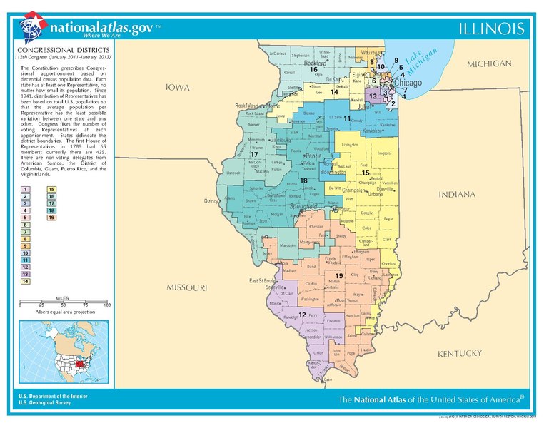
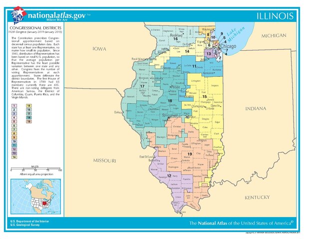
English: Illinois congressional districts map |
| Date | I think 2003 |
| Source | The National Atlas of the United States |
| Author | The U.S. govt. |
Licensing
[edit]This map was obtained from an edition of the National Atlas of the United States. Like almost all works of the U.S. federal government, works from the National Atlas are in the public domain in the United States.
Online access: NationalAtlas.gov | 1970 print edition: Library of Congress, Perry-Castañeda Library
|
File history
Click on a date/time to view the file as it appeared at that time.
| Date/Time | Thumbnail | Dimensions | User | Comment | |
|---|---|---|---|---|---|
| current | 07:37, 29 July 2012 |  | 1,650 × 1,275 (757 KB) | Futurist110 (talk | contribs) | {{Information |Description ={{en|1=Illinois congressional districts map}} |Source =The National Atlas of the United States |Author =The U.S. govt. |Date =I think 2003 |Permission = |other_versions = }} |
You cannot overwrite this file.
File usage on Commons
There are no pages that use this file.