File:Oxia Palus Region - PIA00171.tiff
Jump to navigation
Jump to search

Size of this JPG preview of this TIF file: 800 × 557 pixels. Other resolutions: 320 × 223 pixels | 640 × 446 pixels | 1,024 × 713 pixels | 1,280 × 891 pixels | 2,560 × 1,782 pixels | 7,170 × 4,991 pixels.
Original file (7,170 × 4,991 pixels, file size: 66.7 MB, MIME type: image/tiff)
Captions
Captions
Add a one-line explanation of what this file represents
Summary
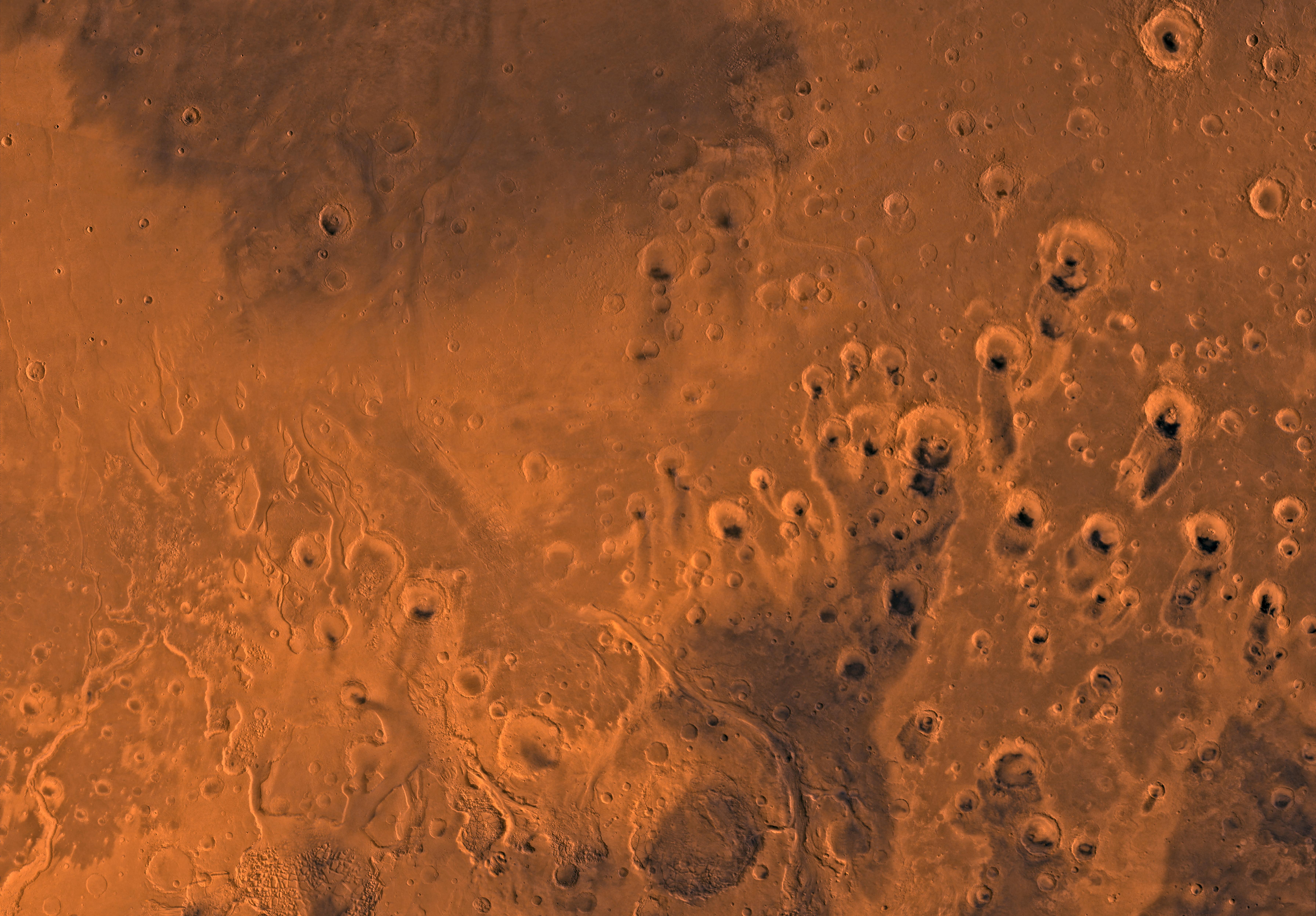
[edit]| Description | Mars digital-image mosaic merged with color of the MC-11 quadrangle, Oxia Palus region of Mars. Heavily cratered highlands of the southeastern two-thirds are cut by several large outflow channels. These channels terminate at the dark large depression, Chryse basin, which contain relatively smooth plains in the northwestern part. Latitude range 0 to 30 degrees, longitude range 0 to 45 degrees. |
| Date | (published) |
| Source | Catalog page · Full-res (JPEG · TIFF) |
| Author | NASA/JPL/USGS |
This image or video was catalogued by Jet Propulsion Laboratory of the United States National Aeronautics and Space Administration (NASA) under Photo ID: PIA00171. This tag does not indicate the copyright status of the attached work. A normal copyright tag is still required. See Commons:Licensing. Other languages:
|
| This media is a product of the Viking Credit and attribution belongs to the mission team, if not already specified in the "author" row |
Licensing
[edit]| This file is in the public domain in the United States because it was solely created by NASA. NASA copyright policy states that "NASA material is not protected by copyright unless noted". (See Template:PD-USGov, NASA copyright policy page or JPL Image Use Policy.) | ||
 |
Warnings:
|
File history
Click on a date/time to view the file as it appeared at that time.
| Date/Time | Thumbnail | Dimensions | User | Comment | |
|---|---|---|---|---|---|
| current | 14:27, 22 January 2020 |  | 7,170 × 4,991 (66.7 MB) | Junior Jumper (talk | contribs) | {{NASA Photojournal |catalog = PIA00171 |image = yes |video = |animation = |mission = Viking |instrument = |caption = Mars digital-image mosaic merged with color of the MC-11 quadrangle, Oxia Palus region of Mars. Heavily cratered highlands of the southeastern two-thirds are cut by several large outflow channels. These channels terminate at the dark large depression, Chryse basin, which contain relatively smooth plains in the northwestern part. Latitude range 0 to 30 degrees, longit... |
You cannot overwrite this file.
File usage on Commons
The following page uses this file: