File:Oostende 1905.jpg
Jump to navigation
Jump to search
Size of this preview: 800 × 531 pixels. Other resolutions: 320 × 212 pixels | 640 × 425 pixels | 1,024 × 679 pixels | 1,280 × 849 pixels | 2,560 × 1,699 pixels | 3,436 × 2,280 pixels.
Original file (3,436 × 2,280 pixels, file size: 2.3 MB, MIME type: image/jpeg)
Captions
Captions
Add a one-line explanation of what this file represents
Summary
[edit]
| Description |
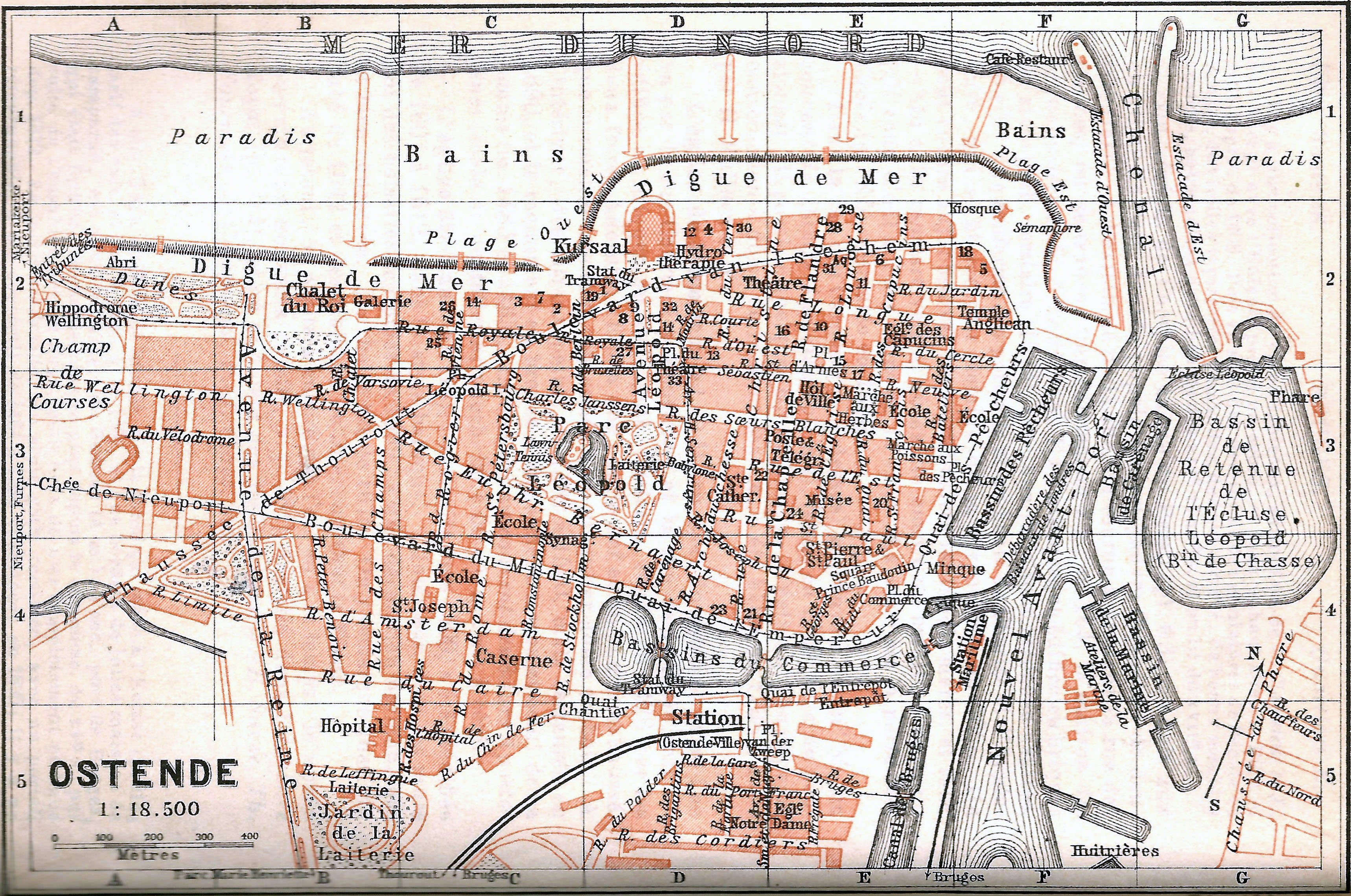
Nederlands: Baedeker kaart van Oostende van 1905
Français : Ostende (Belgique - Province de Flandre-Occidentale) — Plan du Guide Baedeker 1905 |
| Date | |
| Source | Guide Baedeker Belgique et Hollande 1905, page 199 |
| Author | Anstalt von Wagner & Debes, Leipzig |
| Object location | | View this and other nearby images on: OpenStreetMap |
|---|
Licensing
[edit]
|
This work is in the public domain in its country of origin and other countries and areas where the copyright term is the author's life plus 70 years or fewer. This work is in the public domain in the United States because it was published (or registered with the U.S. Copyright Office) before January 1, 1929. | |
| This file has been identified as being free of known restrictions under copyright law, including all related and neighboring rights. | |
Compagny work
File history
Click on a date/time to view the file as it appeared at that time.
| Date/Time | Thumbnail | Dimensions | User | Comment | |
|---|---|---|---|---|---|
| current | 09:54, 30 October 2013 | | 3,436 × 2,280 (2.3 MB) | Smiley.toerist (talk | contribs) | User created page with UploadWizard |
You cannot overwrite this file.
File usage on Commons
There are no pages that use this file.