Category:Old maps of Ostend
Jump to navigation
Jump to search
Subcategories
This category has the following 2 subcategories, out of 2 total.
Media in category "Old maps of Ostend"
The following 33 files are in this category, out of 33 total.
-

-

-
 Oostende 1865-1914 1.jpg 6,355 × 3,455; 7.14 MB
-
 Oostende 1865-1914 2.jpg 2,585 × 2,206; 1.6 MB
-

-
 32 631353F.png 1,768 × 2,362; 830 KB
-

-
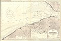
 Admiralty Chart No 1872 Calais to the R. Schelde entrance, Published 1881.jpg 16,319 × 11,294; 48.9 MB
-
 Admiralty Chart No 1872 Calais to the River Schelde entrance, Published 1881.jpg 16,519 × 11,329; 53.23 MB
-
 Admiralty Chart No 325 West Schelde Ostend to Westkapelle, Published 1928.jpg 16,452 × 11,278; 63.28 MB
-
 Admiralty Chart No 3371 Dunkerque to Hook of Holland, Published 1949.jpg 15,956 × 12,472; 41.77 MB
-
 Anoniem 006.JPG 2,246 × 1,364; 1.3 MB
-
 Beleg van Oostende gevechten en ontploffingen onder de bolwerken, 1604, RP-P-OB-80.674.jpg 4,274 × 5,548; 6.29 MB
-
 Beleg.Oostende(01).jpg 968 × 728; 455 KB
-

-
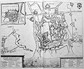
 Kaart van Oostende, 1604, RP-P-OB-78.784-320.jpg 5,652 × 4,284; 6.04 MB
-
 Map of Ostend - 18th century.JPG 1,371 × 1,719; 772 KB
-
 Old map of Ostend by Heins, Balthasar, Florentius.jpg 605 × 810; 555 KB
-
 Oostende - Sanderus 1641.jpg 3,055 × 2,490; 4.43 MB
-
 Oostende 1647.png 1,168 × 936; 1.19 MB
-
 Oostende 1729.jpg 2,256 × 779; 404 KB
-
 Oostende 1778.jpg 2,029 × 1,396; 772 KB
-
 Oostende 1905.jpg 3,436 × 2,280; 2.3 MB
-
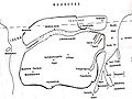
 Oostende beleg.png 685 × 541; 382 KB
-
 Oostende.1601.JPG 1,914 × 1,348; 759 KB
-
 Oostende.17de eeuw.JPG 1,494 × 1,255; 439 KB
-
 Ostend, Belgium ; Ferraris Map.jpg 652 × 564; 41 KB
-
 Ostend, Map by Priorato.JPG 476 × 358; 44 KB
-
 Ostenda obsessa et capta.jpg 2,200 × 1,713; 1.38 MB
-
 Stadsplan, Gent, Brugge, Aalst, Oostende, Pieter Mortier.jpg 3,000 × 2,406; 4 MB
-
 Stadsplan, Gent, Brugge, Aalst, Oostende, Pieter Van Der Aa.jpg 2,634 × 1,937; 3.62 MB
-
 Testerep kopie.jpg 720 × 540; 95 KB
-
 Карта к статье «Остенде». Военная энциклопедия Сытина (Санкт-Петербург, 1911-1915).jpg 4,025 × 3,283; 2.15 MB
%27_(11216389566).jpg)
%27_(11166386965).jpg)


_(With_maps.))%27_(11092126176).jpg)


.jpg)
.jpg)


.jpg)