File:Nya Sverige detaljkarta.jpg
Jump to navigation
Jump to search

Size of this preview: 267 × 599 pixels. Other resolutions: 107 × 240 pixels | 214 × 480 pixels | 342 × 768 pixels | 456 × 1,024 pixels | 1,625 × 3,645 pixels.
Original file (1,625 × 3,645 pixels, file size: 711 KB, MIME type: image/jpeg)
Captions
Captions
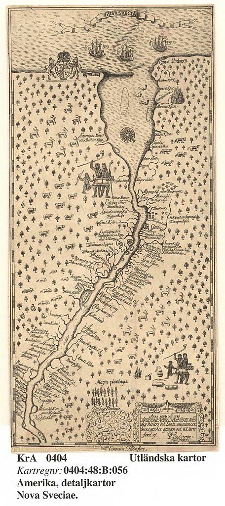
Printed map of New Sweden by Pedher Linheström
Summary
[edit]| Description |
Svenska: Ur: Kort beskrifning om provincien Nya Swerige uti America, som nu förtjden af the engelske kallas Pensylvania. Af lärde och trowärdige mäns skrifter och berättelser ihopaletad och sammanskrefwen, samt med åthskillige figurer utzirad af Thomas Campanius Holm [1] |
|||||||||||||||||||||||||||||
| Date | ||||||||||||||||||||||||||||||
| Source |
https://sok.riksarkivet.se/arkiv/zMH0mwdhpAVBK4IJZfuFO6
|
|||||||||||||||||||||||||||||
| Author | Pedher Lindheström | |||||||||||||||||||||||||||||


Licensing
[edit]
|
This work is in the public domain in its country of origin and other countries and areas where the copyright term is the author's life plus 70 years or fewer. | |
| This file has been identified as being free of known restrictions under copyright law, including all related and neighboring rights. | |
This work is in the public domain in the United States because it meets three requirements:
For background information, see the explanations on Non-U.S. copyrights.
Note: This tag should not be used for sound recordings. |
File history
Click on a date/time to view the file as it appeared at that time.
| Date/Time | Thumbnail | Dimensions | User | Comment | |
|---|---|---|---|---|---|
| current | 07:07, 1 September 2022 | | 1,625 × 3,645 (711 KB) | Oscar Rüdeberg (Riksarkivet Sverige) (talk | contribs) | Uploaded a work by Pedher Lindheström from https://sok.riksarkivet.se/arkiv/zMH0mwdhpAVBK4IJZfuFO6 with UploadWizard |
You cannot overwrite this file.
File usage on Commons
The following page uses this file:
File usage on other wikis
The following other wikis use this file:
- Usage on sv.wikipedia.org
- Usage on www.wikidata.org