File:Nova Hospoda COSK-01.jpg
Jump to navigation
Jump to search

Size of this preview: 600 × 600 pixels. Other resolutions: 240 × 240 pixels | 480 × 480 pixels | 768 × 768 pixels | 1,024 × 1,024 pixels | 2,048 × 2,048 pixels | 4,000 × 4,000 pixels.
Original file (4,000 × 4,000 pixels, file size: 3.57 MB, MIME type: image/jpeg)
Captions
Captions
Add a one-line explanation of what this file represents
Summary
[edit]| Description |
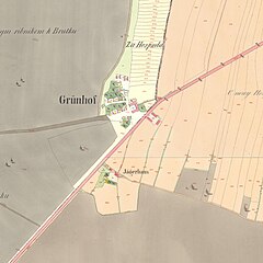
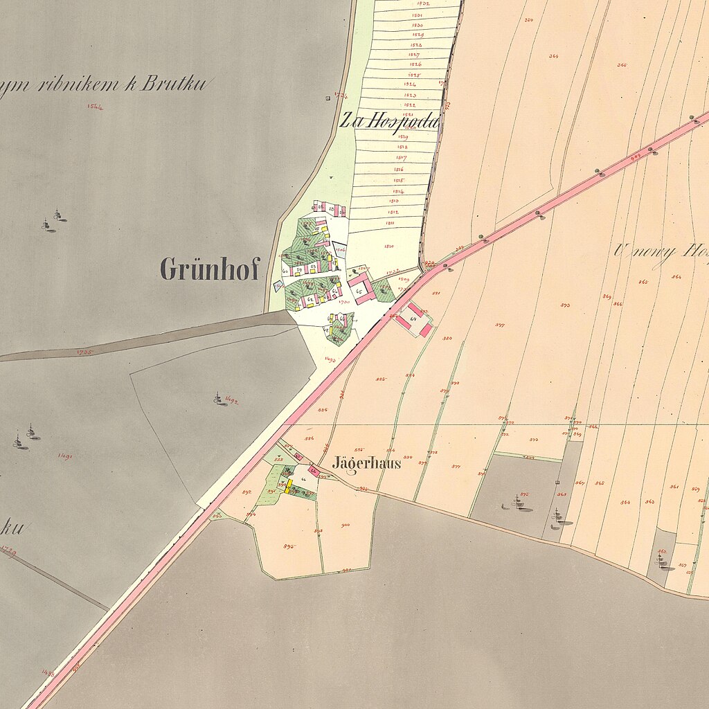
Čeština: Území Nové Hospody na císařských otiscích map stabilního katastru z roku 1839, složeno z částí mapových listů: katastrální území Vejprnice - dříve Weiprnitz (Wegprnic) und Ortschaft Grünhof, 1839, mapový list 3 a katastrální území Skvrňany - dříve Skurnian (Skurnanj), 1839, mapové listy 4 a 6. |
| Date | |
| Source | https://ags.cuzk.cz/archiv/ |
| Author | Offices of the Austrian Empire |


|
This file was created on the basis of data provided by the Central Archives of Surveying and Land Register (State Administration of Land Surveying and Cadastre).
|
Licensing
[edit]
|
This work is in the public domain in its country of origin and other countries and areas where the copyright term is the author's life plus 70 years or fewer. This work is in the public domain in the United States because it was published (or registered with the U.S. Copyright Office) before January 1, 1929. | |
| This file has been identified as being free of known restrictions under copyright law, including all related and neighboring rights. | |
File history
Click on a date/time to view the file as it appeared at that time.
| Date/Time | Thumbnail | Dimensions | User | Comment | |
|---|---|---|---|---|---|
| current | 15:52, 11 January 2024 | | 4,000 × 4,000 (3.57 MB) | Gampe (talk | contribs) | Uploaded a work by Offices of the Austrian Empire from https://ags.cuzk.cz/archiv/ with UploadWizard |
You cannot overwrite this file.
File usage on Commons
The following page uses this file:
File usage on other wikis
The following other wikis use this file:
- Usage on cs.wikipedia.org