File:Norway-CIA WFB Map.png
Jump to navigation
Jump to search
Size of this preview: 276 × 600 pixels. Other resolutions: 110 × 240 pixels | 328 × 713 pixels.
Original file (328 × 713 pixels, file size: 22 KB, MIME type: image/png)
Captions
Captions
Add a one-line explanation of what this file represents
| Description |
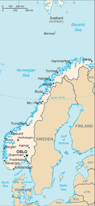
English: A map of Norway, showing major cities. |
|||
| Date | published 2004 | |||
| Source | CIA, The World Factbook, 2004. | |||
| Author | unknown cartographer | |||
| Permission (Reusing this file) |
|

File history
Click on a date/time to view the file as it appeared at that time.
| Date/Time | Thumbnail | Dimensions | User | Comment | |
|---|---|---|---|---|---|
| current | 09:17, 27 March 2005 | | 328 × 713 (22 KB) | Wolfman~commonswiki (talk | contribs) | {{CIA-map}} |
You cannot overwrite this file.
File usage on Commons
There are no pages that use this file.
File usage on other wikis
The following other wikis use this file:
- Usage on en.wikipedia.org
- Usage on en.wikisource.org
- Usage on fa.wikipedia.org
- Usage on gom.wikipedia.org
- Usage on ilo.wikipedia.org
- Usage on lt.wiktionary.org
- Usage on nn.wikipedia.org
- Usage on se.wikipedia.org
- Usage on th.wikipedia.org
- Usage on tum.wikipedia.org
- Fredrikstad
- Drammen
- Kristiansand
- Larvik
- Hamar
- Sandefjord
- Tønsberg
- Halden
- Porsgrunn
- Agder
- Arendal (town)
- Farsund (town)
- Grimstad (town)
- Flekkefjord (town)
- Farsund
- Flekkefjord
- Grimstad
- Mandal, Norway
- Mandal (municipality)
- Risør (town)
- Risør
- Innlandet
- Gjøvik (town)
- Kongsvinger (town)
- Kongsvinger
- Hamar Municipality
- Gjøvik
- Lillehammer (town)
- Møre og Romsdal
- Kristiansund (town)
- Molde (town)
- Ålesund (town)
- Nordland
- Bodø (town)
- Svolvær
- Narvik
- Vågan
- Narvik (town)
- Rogaland
View more global usage of this file.